Saint-Viaud | |
|---|---|
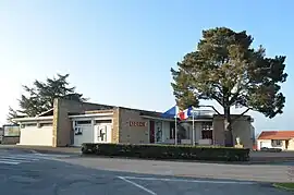 The town hall in Saint-Viaud | |
.svg.png.webp) Coat of arms | |
Location of Saint-Viaud | |
 Saint-Viaud 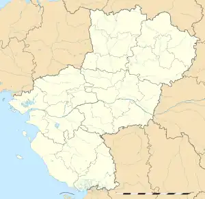 Saint-Viaud | |
| Coordinates: 47°15′22″N 2°01′06″W / 47.2561°N 2.0183°W | |
| Country | France |
| Region | Pays de la Loire |
| Department | Loire-Atlantique |
| Arrondissement | Saint-Nazaire |
| Canton | Saint-Brevin-les-Pins |
| Intercommunality | Sud-Estuaire |
| Government | |
| • Mayor (2020–2026) | Roch Chéraud[1] |
| Area 1 | 32.63 km2 (12.60 sq mi) |
| Population | 2,764 |
| • Density | 85/km2 (220/sq mi) |
| Time zone | UTC+01:00 (CET) |
| • Summer (DST) | UTC+02:00 (CEST) |
| INSEE/Postal code | 44192 /44320 |
| Elevation | 0–51 m (0–167 ft) (avg. 30 m or 98 ft) |
| 1 French Land Register data, which excludes lakes, ponds, glaciers > 1 km2 (0.386 sq mi or 247 acres) and river estuaries. | |
Saint-Viaud (French pronunciation: [sɛ̃ vjo] ⓘ; Breton: Sant-Widel-Skovrid) is a commune in the Loire-Atlantique department in western France.[3]
Population
| Year | Pop. | ±% p.a. |
|---|---|---|
| 1968 | 1,508 | — |
| 1975 | 1,359 | −1.48% |
| 1982 | 1,576 | +2.14% |
| 1990 | 1,713 | +1.05% |
| 1999 | 1,837 | +0.78% |
| 2007 | 2,076 | +1.54% |
| 2012 | 2,264 | +1.75% |
| 2017 | 2,510 | +2.08% |
| Source: INSEE[4] | ||
See also
References
- ↑ "Répertoire national des élus: les maires" (in French). data.gouv.fr, Plateforme ouverte des données publiques françaises. 4 May 2022.
- ↑ "Populations légales 2021". The National Institute of Statistics and Economic Studies. 28 December 2023.
- ↑ INSEE commune file
- ↑ Population en historique depuis 1968, INSEE
Wikimedia Commons has media related to Saint-Viaud.
This article is issued from Wikipedia. The text is licensed under Creative Commons - Attribution - Sharealike. Additional terms may apply for the media files.