Issé
| |
|---|---|
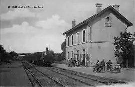 Old train station in the early 20th century | |
 Coat of arms | |
Location of Issé | |
 Issé 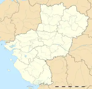 Issé | |
| Coordinates: 47°37′29″N 1°27′00″W / 47.6247°N 1.45°W | |
| Country | France |
| Region | Pays de la Loire |
| Department | Loire-Atlantique |
| Arrondissement | Châteaubriant-Ancenis |
| Canton | Châteaubriant |
| Intercommunality | Châteaubriant-Derval |
| Government | |
| • Mayor (2020–2026) | Jean-Marc Lalloué[1] |
| Area 1 | 38.66 km2 (14.93 sq mi) |
| Population | 1,794 |
| • Density | 46/km2 (120/sq mi) |
| Time zone | UTC+01:00 (CET) |
| • Summer (DST) | UTC+02:00 (CEST) |
| INSEE/Postal code | 44075 /44520 |
| Elevation | 22–76 m (72–249 ft) |
| Website | www |
| 1 French Land Register data, which excludes lakes, ponds, glaciers > 1 km2 (0.386 sq mi or 247 acres) and river estuaries. | |
Issé (French pronunciation: [ise] ⓘ; Gallo: Isae, Breton: Izeg) is a commune on the banks of the river Don in the Loire-Atlantique department in western France. It is situated 10 km southeast of Châteaubriant.
Population
| Year | Pop. | ±% p.a. |
|---|---|---|
| 1968 | 1,898 | — |
| 1975 | 1,909 | +0.08% |
| 1982 | 1,896 | −0.10% |
| 1990 | 1,821 | −0.50% |
| 1999 | 1,776 | −0.28% |
| 2007 | 1,815 | +0.27% |
| 2012 | 1,846 | +0.34% |
| 2017 | 1,833 | −0.14% |
| Source: INSEE[3] | ||
Transport
The train station reopened in 2014, serving tram-trains from the Pays de la Loire.
See also
References
- ↑ "Répertoire national des élus: les maires" (in French). data.gouv.fr, Plateforme ouverte des données publiques françaises. 13 September 2022.
- ↑ "Populations légales 2021". The National Institute of Statistics and Economic Studies. 28 December 2023.
- ↑ Population en historique depuis 1968, INSEE
Wikimedia Commons has media related to Issé.
This article is issued from Wikipedia. The text is licensed under Creative Commons - Attribution - Sharealike. Additional terms may apply for the media files.