Verjon | |
|---|---|
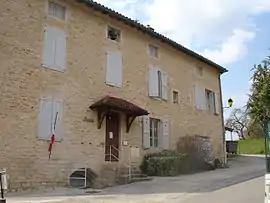 Town hall | |
.svg.png.webp) Coat of arms | |
Location of Verjon | |
 Verjon 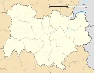 Verjon | |
| Coordinates: 46°20′45″N 5°21′05″E / 46.3458°N 5.3514°E | |
| Country | France |
| Region | Auvergne-Rhône-Alpes |
| Department | Ain |
| Arrondissement | Bourg-en-Bresse |
| Canton | Saint-Étienne-du-Bois |
| Intercommunality | CA Bassin de Bourg-en-Bresse |
| Government | |
| • Mayor (2020–2026) | Philippe Jamme[1] |
| Area 1 | 5.11 km2 (1.97 sq mi) |
| Population | 339 |
| • Density | 66/km2 (170/sq mi) |
| Time zone | UTC+01:00 (CET) |
| • Summer (DST) | UTC+02:00 (CEST) |
| INSEE/Postal code | 01432 /01270 |
| Elevation | 210–496 m (689–1,627 ft) (avg. 243 m or 797 ft) |
| 1 French Land Register data, which excludes lakes, ponds, glaciers > 1 km2 (0.386 sq mi or 247 acres) and river estuaries. | |
Verjon (French pronunciation: [vɛʁʒɔ̃]; Arpitan: Vrejon) is a commune in the Ain department in eastern France.
Geography
The Solnan has its source in the commune and forms part of its southwestern border.
Population
| Year | Pop. | ±% p.a. |
|---|---|---|
| 1968 | 205 | — |
| 1975 | 187 | −1.30% |
| 1982 | 209 | +1.60% |
| 1990 | 235 | +1.48% |
| 1999 | 192 | −2.22% |
| 2009 | 248 | +2.59% |
| 2014 | 261 | +1.03% |
| 2020 | 333 | +4.14% |
| Source: INSEE[3] | ||
See also
References
- ↑ "Répertoire national des élus: les maires" (in French). data.gouv.fr, Plateforme ouverte des données publiques françaises. 13 September 2022.
- ↑ "Populations légales 2021". The National Institute of Statistics and Economic Studies. 28 December 2023.
- ↑ Population en historique depuis 1968, INSEE
Wikimedia Commons has media related to Verjon.
This article is issued from Wikipedia. The text is licensed under Creative Commons - Attribution - Sharealike. Additional terms may apply for the media files.