Saint-Laurent-sur-Saône | |
|---|---|
Commune | |
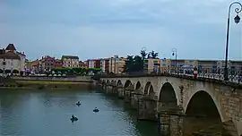 Saint-Laurent bridge | |
.svg.png.webp) Coat of arms | |
Location of Saint-Laurent-sur-Saône | |
 Saint-Laurent-sur-Saône 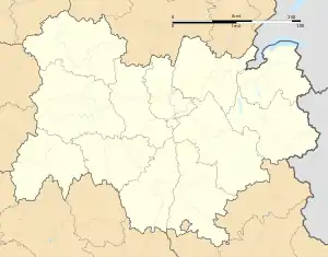 Saint-Laurent-sur-Saône | |
| Coordinates: 46°18′19″N 4°50′21″E / 46.3052°N 4.8391°E | |
| Country | France |
| Region | Auvergne-Rhône-Alpes |
| Department | Ain |
| Arrondissement | Bourg-en-Bresse |
| Canton | Vonnas |
| Intercommunality | Mâconnais Beaujolais Agglomération |
| Government | |
| • Mayor (2020–2026) | Jacques Doussot[1] |
| Area 1 | 0.53 km2 (0.20 sq mi) |
| Population | 1,659 |
| • Density | 3,100/km2 (8,100/sq mi) |
| Time zone | UTC+01:00 (CET) |
| • Summer (DST) | UTC+02:00 (CEST) |
| INSEE/Postal code | 01370 /01750 |
| Elevation | 167–174 m (548–571 ft) |
| 1 French Land Register data, which excludes lakes, ponds, glaciers > 1 km2 (0.386 sq mi or 247 acres) and river estuaries. | |
Saint-Laurent-sur-Saône (French pronunciation: [sɛ̃ loʁɑ̃ syʁ son], literally Saint-Laurent on Saône) is a commune in the Ain department in eastern France. It lies on the left bank of the Saône, across from the city of Mâcon.
Population
| Year | Pop. | ±% p.a. |
|---|---|---|
| 1968 | 2,041 | — |
| 1975 | 1,967 | −0.53% |
| 1982 | 1,813 | −1.16% |
| 1990 | 1,710 | −0.73% |
| 1999 | 1,655 | −0.36% |
| 2009 | 1,737 | +0.48% |
| 2014 | 1,783 | +0.52% |
| 2020 | 1,674 | −1.05% |
| Source: INSEE[3] | ||
See also
References
- ↑ "Répertoire national des élus: les maires". data.gouv.fr, Plateforme ouverte des données publiques françaises (in French). 2 December 2020.
- ↑ "Populations légales 2021". The National Institute of Statistics and Economic Studies. 28 December 2023.
- ↑ Population en historique depuis 1968, INSEE
Wikimedia Commons has media related to Saint-Laurent-sur-Saône.
This article is issued from Wikipedia. The text is licensed under Creative Commons - Attribution - Sharealike. Additional terms may apply for the media files.