Secourt | |
|---|---|
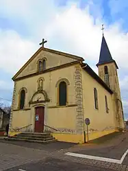 The church in Secourt | |
 Coat of arms | |
Location of Secourt | |
 Secourt  Secourt | |
| Coordinates: 48°56′53″N 6°17′08″E / 48.9481°N 6.2856°E | |
| Country | France |
| Region | Grand Est |
| Department | Moselle |
| Arrondissement | Metz |
| Canton | Le Saulnois |
| Intercommunality | Sud Messin |
| Government | |
| • Mayor (2020–2026) | Denis Veiss[1] |
| Area 1 | 7.31 km2 (2.82 sq mi) |
| Population | 200 |
| • Density | 27/km2 (71/sq mi) |
| Time zone | UTC+01:00 (CET) |
| • Summer (DST) | UTC+02:00 (CEST) |
| INSEE/Postal code | 57643 /57420 |
| Elevation | 227–281 m (745–922 ft) (avg. 262 m or 860 ft) |
| 1 French Land Register data, which excludes lakes, ponds, glaciers > 1 km2 (0.386 sq mi or 247 acres) and river estuaries. | |
Secourt (French pronunciation: [səkuʁ]; German: Unterhofen) is a commune in the Moselle department in Grand Est in north-eastern France.
It is located 20 km south east of Montigny-lès-Metz, 26 km south of Metz, 35 km north of Nancy. its neighbouring villages are Sailly-Achâtel, Vigny and Solgne.
See also
References
- ↑ "Répertoire national des élus: les maires". data.gouv.fr, Plateforme ouverte des données publiques françaises (in French). 2 December 2020.
- ↑ "Populations légales 2021". The National Institute of Statistics and Economic Studies. 28 December 2023.
External links
 Media related to Secourt at Wikimedia Commons
This article is issued from Wikipedia. The text is licensed under Creative Commons - Attribution - Sharealike. Additional terms may apply for the media files.