Buhl-Lorraine | |
|---|---|
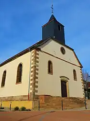 The church in Buhl-Lorraine | |
.svg.png.webp) Coat of arms | |
Location of Buhl-Lorraine | |
 Buhl-Lorraine  Buhl-Lorraine | |
| Coordinates: 48°43′31″N 7°05′07″E / 48.7253°N 7.0853°E | |
| Country | France |
| Region | Grand Est |
| Department | Moselle |
| Arrondissement | Sarrebourg-Château-Salins |
| Canton | Sarrebourg |
| Government | |
| • Mayor (2020–2026) | Franck Klein[1] |
| Area 1 | 11.2 km2 (4.3 sq mi) |
| Population | 1,196 |
| • Density | 110/km2 (280/sq mi) |
| Time zone | UTC+01:00 (CET) |
| • Summer (DST) | UTC+02:00 (CEST) |
| INSEE/Postal code | 57119 /57400 |
| Elevation | 248–325 m (814–1,066 ft) |
| 1 French Land Register data, which excludes lakes, ponds, glaciers > 1 km2 (0.386 sq mi or 247 acres) and river estuaries. | |
Buhl-Lorraine (French pronunciation: [byl lɔʁɛn]; German: Bühl am Kanal) is a commune in the Moselle department in Grand Est in northeastern France.
Geography
The village is located in Lorraine, as its name suggests, more specifically in South Moselle.
Buhl-Lorraine is located 3 miles from Sarrebourg. Its elevation is about 260 meters.
The municipality is crossed by the Bièvre, tributary of the Saar.
Population
| Year | Pop. | ±% p.a. |
|---|---|---|
| 1968 | 652 | — |
| 1975 | 768 | +2.37% |
| 1982 | 786 | +0.33% |
| 1990 | 817 | +0.48% |
| 1999 | 1,037 | +2.68% |
| 2007 | 1,118 | +0.94% |
| 2012 | 1,239 | +2.08% |
| 2017 | 1,214 | −0.41% |
| Source: INSEE[3] | ||
Toponymy
The name of the village come from the germanic word, bühel or bühl, which means "hill"[4].
Ancient names:[5] Büle during the 15th, Buhel in 1525, Bill in 1526, Biel in 1751, Biel or Bihle in 1779, Bilh in 1790, Bille in 1793, Bühl between 1871-1918, Buhl-Lorraine in 1920, Bühl am Kanal between 1940-1944.
See also
References
- ↑ "Répertoire national des élus: les maires". data.gouv.fr, Plateforme ouverte des données publiques françaises (in French). 2 December 2020.
- ↑ "Populations légales 2021". The National Institute of Statistics and Economic Studies. 28 December 2023.
- ↑ Population en historique depuis 1968, INSEE
- ↑ Nègre, Ernest (1996). Toponymie générale de la France / 2. Formations non-romanes, formations dialectales (2. tirage ed.). Genève: Droz. ISBN 2-600-00133-6. OCLC 174640771.
- ↑ Lepage, Henri (1862). Dictionnaire topographique du département de la Meurthe (in French). Paris: Imprimerie impériale.
External links
 Media related to Buhl-Lorraine at Wikimedia Commons
This article is issued from Wikipedia. The text is licensed under Creative Commons - Attribution - Sharealike. Additional terms may apply for the media files.