Hartzviller | |
|---|---|
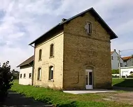 The old railway station in Hartzviller | |
.svg.png.webp) Coat of arms | |
Location of Hartzviller | |
 Hartzviller  Hartzviller | |
| Coordinates: 48°40′13″N 7°05′14″E / 48.6703°N 7.0872°E | |
| Country | France |
| Region | Grand Est |
| Department | Moselle |
| Arrondissement | Sarrebourg-Château-Salins |
| Canton | Phalsbourg |
| Intercommunality | CC Sarrebourg Moselle Sud |
| Government | |
| • Mayor (2020–2026) | Laurent Chevrier[1] |
| Area 1 | 4.14 km2 (1.60 sq mi) |
| Population | 937 |
| • Density | 230/km2 (590/sq mi) |
| Time zone | UTC+01:00 (CET) |
| • Summer (DST) | UTC+02:00 (CEST) |
| INSEE/Postal code | 57299 /57870 |
| Elevation | 275–376 m (902–1,234 ft) (avg. 300 m or 980 ft) |
| 1 French Land Register data, which excludes lakes, ponds, glaciers > 1 km2 (0.386 sq mi or 247 acres) and river estuaries. | |
Hartzviller (German: Harzweiler) is a commune in the Moselle department in Grand Est in north-eastern France.
Geography
It is located about ten kilometres south of Sarrebourg. It has less than 1,000 inhabitants since the beginning of the 21st century but forms a small agglomeration with the communes of Troisfontaines and Walscheid, frequently referred to as the "Bièvre Valley", with 4,000 inhabitants.
This commune is located in the historic region of Lorraine.
The Bièvre river crosses the village.
The Hartzviller train station is nowadays closed.
See also
References
- ↑ "Répertoire national des élus: les maires". data.gouv.fr, Plateforme ouverte des données publiques françaises (in French). 2 December 2020.
- ↑ "Populations légales 2021". The National Institute of Statistics and Economic Studies. 28 December 2023.
External links
 Media related to Hartzviller at Wikimedia Commons
This article is issued from Wikipedia. The text is licensed under Creative Commons - Attribution - Sharealike. Additional terms may apply for the media files.