Saint-Loup-sur-Semouse | |
|---|---|
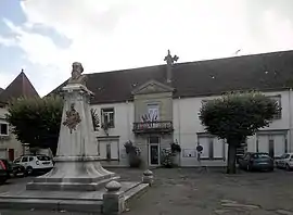 The town hall and war memorial in Saint-Loup-sur-Semouse | |
 Coat of arms | |
Location of Saint-Loup-sur-Semouse | |
 Saint-Loup-sur-Semouse 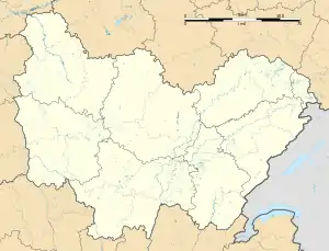 Saint-Loup-sur-Semouse | |
| Coordinates: 47°53′08″N 6°16′27″E / 47.8856°N 6.2742°E | |
| Country | France |
| Region | Bourgogne-Franche-Comté |
| Department | Haute-Saône |
| Arrondissement | Lure |
| Canton | Saint-Loup-sur-Semouse |
| Government | |
| • Mayor (2020–2026) | Thierry Bordot[1] |
| Area 1 | 16.54 km2 (6.39 sq mi) |
| Population | 2,944 |
| • Density | 180/km2 (460/sq mi) |
| Time zone | UTC+01:00 (CET) |
| • Summer (DST) | UTC+02:00 (CEST) |
| INSEE/Postal code | 70467 /70800 |
| Elevation | 231–315 m (758–1,033 ft) |
| 1 French Land Register data, which excludes lakes, ponds, glaciers > 1 km2 (0.386 sq mi or 247 acres) and river estuaries. | |
Saint-Loup-sur-Semouse (French pronunciation: [sɛ̃ lu syʁ səmuz]) is a commune in the Haute-Saône department in the region of Bourgogne-Franche-Comté in eastern France.
Population
| Year | Pop. | ±% p.a. |
|---|---|---|
| 1968 | 3,468 | — |
| 1975 | 4,692 | +4.41% |
| 1982 | 4,907 | +0.64% |
| 1990 | 4,677 | −0.60% |
| 1999 | 4,291 | −0.95% |
| 2007 | 3,714 | −1.79% |
| 2012 | 3,314 | −2.25% |
| 2017 | 3,221 | −0.57% |
| Source: INSEE[3] | ||
See also
References
- ↑ "Répertoire national des élus: les maires" (in French). data.gouv.fr, Plateforme ouverte des données publiques françaises. 13 September 2022.
- ↑ "Populations légales 2021". The National Institute of Statistics and Economic Studies. 28 December 2023.
- ↑ Population en historique depuis 1968, INSEE
Wikimedia Commons has media related to Saint-Loup-sur-Semouse.
This article is issued from Wikipedia. The text is licensed under Creative Commons - Attribution - Sharealike. Additional terms may apply for the media files.