Raddon-et-Chapendu | |
|---|---|
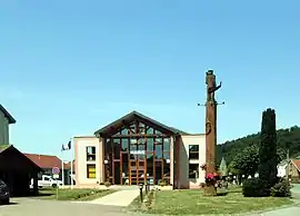 The town hall in Raddon-et-Chapendu | |
 Coat of arms | |
Location of Raddon-et-Chapendu | |
 Raddon-et-Chapendu 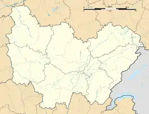 Raddon-et-Chapendu | |
| Coordinates: 47°50′33″N 6°28′19″E / 47.8425°N 6.4719°E | |
| Country | France |
| Region | Bourgogne-Franche-Comté |
| Department | Haute-Saône |
| Arrondissement | Lure |
| Canton | Mélisey |
| Intercommunality | Pays de Luxeuil |
| Government | |
| • Mayor (2020–2026) | Joël Brice[1] |
| Area 1 | 12.50 km2 (4.83 sq mi) |
| Population | 844 |
| • Density | 68/km2 (170/sq mi) |
| Time zone | UTC+01:00 (CET) |
| • Summer (DST) | UTC+02:00 (CEST) |
| INSEE/Postal code | 70435 /70280 |
| Elevation | 319–497 m (1,047–1,631 ft) |
| 1 French Land Register data, which excludes lakes, ponds, glaciers > 1 km2 (0.386 sq mi or 247 acres) and river estuaries. | |
Raddon-et-Chapendu (French pronunciation: [ʁadɔ̃ e ʃapɑ̃dy]) is a commune in the Haute-Saône department in the region of Bourgogne-Franche-Comté in eastern France.
Population
| Year | Pop. | ±% p.a. |
|---|---|---|
| 1968 | 822 | — |
| 1975 | 798 | −0.42% |
| 1982 | 779 | −0.34% |
| 1990 | 791 | +0.19% |
| 1999 | 835 | +0.60% |
| 2007 | 890 | +0.80% |
| 2012 | 953 | +1.38% |
| 2017 | 861 | −2.01% |
| Source: INSEE[3] | ||
See also
References
- ↑ "Répertoire national des élus: les maires". data.gouv.fr, Plateforme ouverte des données publiques françaises (in French). 2 December 2020.
- ↑ "Populations légales 2021". The National Institute of Statistics and Economic Studies. 28 December 2023.
- ↑ Population en historique depuis 1968, INSEE
Wikimedia Commons has media related to Raddon-et-Chapendu.
This article is issued from Wikipedia. The text is licensed under Creative Commons - Attribution - Sharealike. Additional terms may apply for the media files.