| Mount Herard | |
|---|---|
 Mount Herard as seen from the Great Sand Dunes | |
| Highest point | |
| Elevation | 13,345 ft (4,068 m)[1][2] |
| Prominence | 2,040 ft (622 m)[2] |
| Isolation | 4.63 mi (7.45 km)[2] |
| Listing | |
| Coordinates | 37°50′57″N 105°29′40″W / 37.8491666°N 105.4945°W[3] |
| Geography | |
 Mount Herard | |
| Location | Great Sand Dunes National Park and Preserve, Saguache County, Colorado, United States[3] |
| Parent range | Sangre de Cristo Range[2] |
| Topo map | USGS 7.5' topographic map Medano Pass, Colorado[3] |
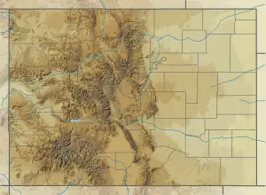
Mount Herard is a high and prominent mountain summit in the Sangre de Cristo Range of the Rocky Mountains of North America. The 13,345-foot (4,068 m) thirteener is located in the Sangre de Cristo Wilderness of Great Sand Dunes National Preserve, 15.0 miles (24.1 km) southeast (bearing 132°) of the Town of Crestone in Saguache County, Colorado, United States.[1][2][3]
Mountain
Originally called Medano Peak, the mountain with seven separate summits was renamed Mount Seven at the request of the Colorado Mountain Club in 1970.[3] In 1984 the mountain's name was changed to honor Ulysses Herard who homesteaded on its slopes in 1876.[3]
Historical names
See also
References
- 1 2 The elevation of Mount Herard includes an adjustment of +1.640 m (+5.38 ft) from NGVD 29 to NAVD 88.
- 1 2 3 4 5 "Mount Herard, Colorado". Peakbagger.com. Retrieved October 20, 2014.
- 1 2 3 4 5 6 7 8 9 "Mount Herard". Geographic Names Information System. United States Geological Survey, United States Department of the Interior. Retrieved October 20, 2014.
External links
This article is issued from Wikipedia. The text is licensed under Creative Commons - Attribution - Sharealike. Additional terms may apply for the media files.