| Anthracite Range | |
|---|---|
 Anthracite Range | |
| Highest point | |
| Peak | Anthracite Range High Point |
| Elevation | 12,394 ft (3,778 m)[1][2] |
| Prominence | 2,105 ft (642 m)[2] |
| Coordinates | 38°48′52″N 107°08′40″W / 38.814526°N 107.144505°W[2] |
| Geography | |
 Anthracite Range | |
| Country | United States |
| State | Colorado |
| County | Gunnison |
| Parent range | West Elk Mountains, Rocky Mountains |
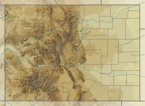
The Anthracite Range is a mountain range in the West Elk Mountains, a sub-range of the Rocky Mountains of North America. The range is located in Gunnison County of western Colorado and lies within the West Elk Wilderness of the Gunnison National Forest. The Anthracite Range is one of several prominent laccoliths found in the West Elk Mountains.[3][4]
Geology
The Anthracite Range is a laccolith, formed when magma intruded into sedimentary strata of the Mesaverde Formation approximately 30 million years ago. Subsequent erosion has removed the softer, overlying sedimentary rock thereby exposing the more resistant igneous rock that characterizes the mountain today. The range is composed of quartz monzonite porphyry and granodiorite porphyry. The Anthracite Range was glaciated, and the most prominent glacial cirques are located on the north and east sides of the range.[4][5]
The range is named after anthracite, a high-quality, metamorphized coal found in the sedimentary rock of the Mesaverde Formation at the base of this and nearby laccoliths.[4]
Summits
The Anthracite Range is an east-west oriented ridge less than 5 miles (8 km) in length, but there are several summits of interest to mountaineers and peakbaggers. From west to east, these summits include: the Anthracite Range High Point (elevation 12,385 ft (3,775 m)), prominence 2,125 ft (648 m)); Unnamed Peak 12,300 (elevation 12,300 ft (3,700 m)); Ohio Peak (elevation 12,271 ft (3,740 m)); and Unnamed Peak 11,555 (elevation 11,555 ft (3,522 m)). These summits are most often accessed from Ohio Pass where a climber's trail enters the wilderness area, traverses southwest across talus slopes then up through a cirque to the ridge just west of Unnamed Peak 11,555. From there, the summits are reached by hiking along the ridge.[6][7]
Gallery
 Anthracite Range from the southeast
 Ohio Peak, the only officially named summit in the Anthracite Range
 Geologic cross section of the Anthracite Range
See also
References
- ↑ "Anthracite". NGS Data Sheet. National Geodetic Survey, National Oceanic and Atmospheric Administration, United States Department of Commerce. Retrieved 22 Nov 2020.
- 1 2 3 "Anthracite Range, Colorado". Peakbagger.com. Retrieved 22 Nov 2020.
- ↑ "Anthracite Range". Geographic Names Information System. United States Geological Survey, United States Department of the Interior. Retrieved 22 Nov 2020.
- 1 2 3 Prather, Thomas (1999). Geology of the Gunnison Country (2nd ed.). Gunnison, Colorado: B&B Printers. LCCN 82-177244.
- ↑ Gaskill, D. L.; DeLong, J. E.; Cochran, D. M. (1987). Geologic map of the Mount Axtell quadrangle, Gunnison County, Colorado. Reston, Virginia: U.S. Geological Survey. Retrieved 22 November 2020.
- ↑ "List of Peaks". Lists of John. Retrieved 16 December 2020. The following Anthracite Range summits are included: Anthracite Range High Point, Unnamed Peak 12,300; Ohio Peak; and Unnamed Peak 11,555.
- ↑ Tarr, Mary Anne (2007). Timber, Talus & Tundra: Hiking Trails & Mountain Peaks of the Gunnison Basin...and a bit beyond (2nd ed.). Gunnison, Colorado: Uncompahgre Books. ISBN 978-0-9650842-1-5.
External links
 Media related to Anthracite Range at Wikimedia Commons
- Anthracite Range High Point on listsofjohn.com
- Anthracite Range on peakbagger.com
- Anthracite Range/Ohio Peak on summitpost.com