This article is a list of historic places in the Edmonton Metropolitan Region entered on the Canadian Register of Historic Places, whether they are federal, provincial, or municipal.
List


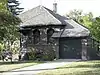
.JPG.webp)
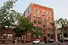
.JPG.webp)


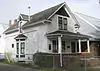
.JPG.webp)
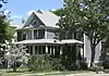

.JPG.webp)
.JPG.webp)
.jpg.webp)
.JPG.webp)


.JPG.webp)

_School_2012-09-07_20-21-20.jpg.webp)
.JPG.webp)
.JPG.webp)
.JPG.webp)
.JPG.webp)


.JPG.webp)

.JPG.webp)

.JPG.webp)
.JPG.webp)

.JPG.webp)
.JPG.webp)


.jpg.webp)
.JPG.webp)

.JPG.webp)
.JPG.webp)
.JPG.webp)


.JPG.webp)

.JPG.webp)


%252C_Edmonton.JPG.webp)

.JPG.webp)
.JPG.webp)
See also
Wikimedia Commons has media related to Cultural heritage monuments in Edmonton.
This article is issued from Wikipedia. The text is licensed under Creative Commons - Attribution - Sharealike. Additional terms may apply for the media files.