The State Register of Heritage Places is maintained by the Heritage Council of Western Australia. As of 2023, 1,032 places are heritage-listed in the City of Perth,[1][note 1] of which 226 are on the State Register of Heritage Places.[2][note 2]

List

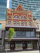
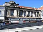
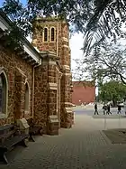
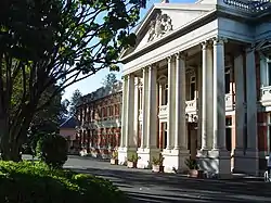
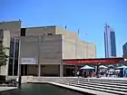
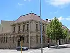
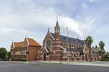
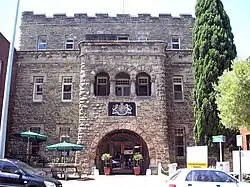
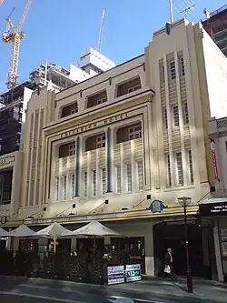
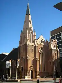
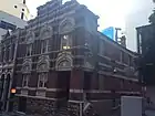
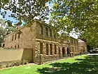
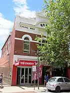
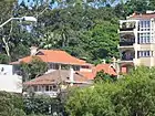
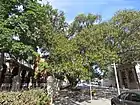
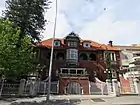
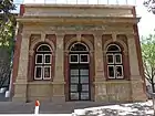
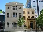
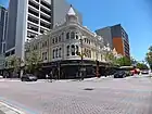
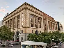
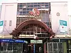
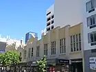
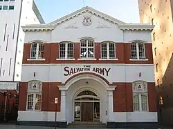
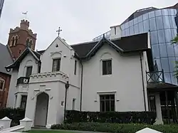
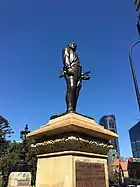
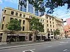
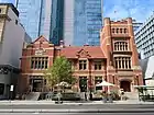
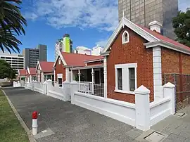
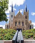
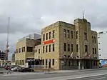
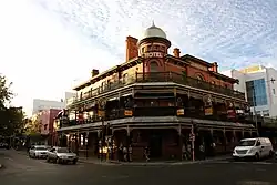
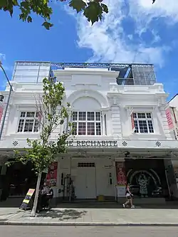
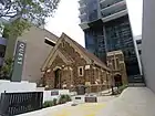
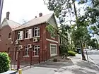
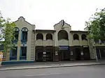
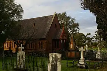
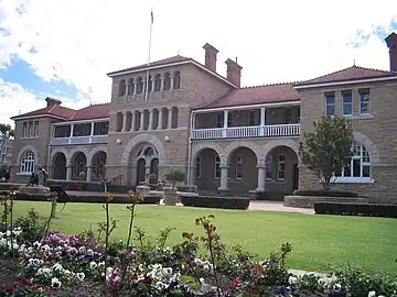
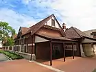
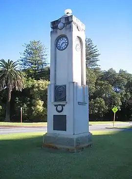
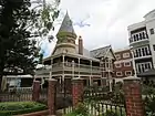
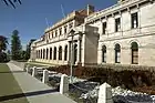
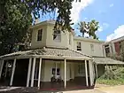
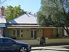
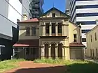
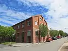
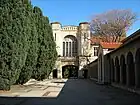
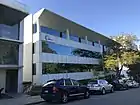
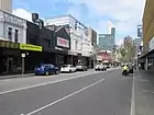
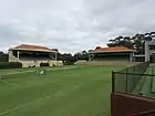
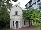
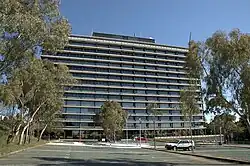
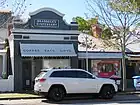
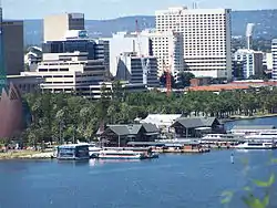
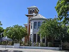
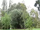
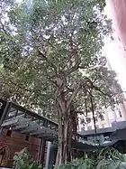
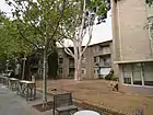
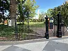
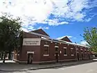
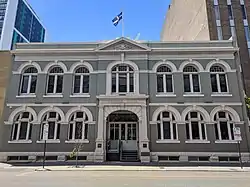
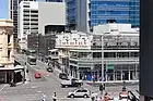
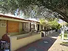
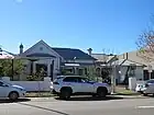
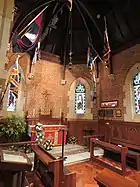
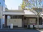
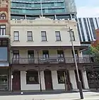
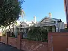
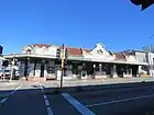
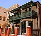
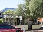
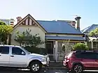
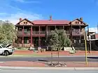
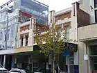
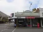
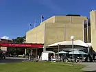
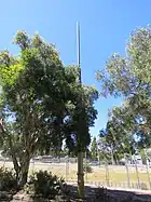
The Western Australian State Register of Heritage Places, as of 2023, lists the following 226 state registered places within the City of Perth:

Place name Place # Street number Street name Co-ordinates Suburb or town Notes & former names Photo
Commercial Building 1178132William Street31°57′07″S 115°51′29″E / 31.952055°S 115.857934°E / -31.952055; 115.857934 (Commercial Building)PerthDemolished in 2004
W D & H O Wills Warehouse (former)1330464–468Murray Street31°57′01″S 115°51′07″E / 31.950274°S 115.852024°E / -31.950274; 115.852024 (W D & H O Wills Warehouse)Perth
Bairds Building (former)1627491–493Wellington Street31°57′06″S 115°51′31″E / 31.951753°S 115.858664°E / -31.951753; 115.858664 (Bairds Building)PerthLevi Green's, Green's, Bairds Arcade, Myers, Commercial Building 491–493 Wellington Street
Saunders Building 1628499Wellington Street[?]PerthDemolished in 2004
Mitchells Building 1784140William Street31°57′06″S 115°51′29″E / 31.951763°S 115.858072°E / -31.951763; 115.858072 (Mitchells Building)Perth
Nedlands Park Masonic Hall18288BroadwayCrawley31°58′39″S 115°48′51″E / 31.977593°S 115.814261°E / -31.977593; 115.814261 (Nedlands Park Masonic Hall)
Commercial Building 1857507Wellington Street[?]Perth
St John's Lutheran Church194316Aberdeen Street31°56′52″S 115°51′44″E / 31.947848°S 115.862232°E / -31.947848; 115.862232 (St John's Lutheran Church)Perth
Supreme Court Buildings and Gardens, Old Court House, Stirling Gardens19472, 4 & 33Barrack Street31°57′28″S 115°51′36″E / 31.957835°S 115.859959°E / -31.957835; 115.859959 (Supreme Court Buildings)PerthWashington Palm Trees, The Supreme Court Building
Old Court House1948Supreme Court Gardens, Barrack Street31°57′27″S 115°51′38″E / 31.9576°S 115.8605°E / -31.9576; 115.8605 (Old Court House)PerthOld Court House Law Museum, Francis Burt Law Centre/Legal Education Centre, Law Society Building
Orchestral Shell 1949Supreme Court Gardens, Barrack Street[?]PerthDemolished in 1999
The Weld Club19503Barrack Street31°57′24″S 115°51′32″E / 31.95678°S 115.859°E / -31.95678; 115.859 (The Weld Club)Perth
Perth Town Hall1953601Hay Street31°57′18″S 115°51′38″E / 31.95492°S 115.860478°E / -31.95492; 115.860478 (Perth Town Hall)PerthHMAS Perth Memorial
Bon Marché Arcade195474–84Barrack Street31°57′15″S 115°51′39″E / 31.95424°S 115.860797°E / -31.95424; 115.860797 (Bon Marché Arcade)PerthBrookman's Buildings, Bon Marche Arcade Buildings
Railway Hotel (remains of facade & balcony) 1959138Barrack Street31°57′10″S 115°51′40″E / 31.952899°S 115.861063°E / -31.952899; 115.861063 (Railway Hotel)PerthCommercial Hotel, Romayne's Hotel
Phineas Seeligson's (former), Perth1961143Barrack Street31°57′09″S 115°51′40″E / 31.952552°S 115.861°E / -31.952552; 115.861 (Phineas Seeligson's)PerthCommercial Building, City Loans Office
Art Gallery & Museum Buildings19625Francis Street31°56′59″S 115°51′43″E / 31.949753°S 115.862003°E / -31.949753; 115.862003 (Art Gallery & Museum Buildings)PerthWestern Australian Museum Complex, comprises Victoria Jubilee Institute, Victoria Public Library, Jubilee Building, Government Geologist's Building
Perth Court of Petty Sessions1963James Street Mall31°57′03″S 115°51′41″E / 31.950944°S 115.8615°E / -31.950944; 115.8615 (Perth Court of Petty Sessions)PerthCentenary Gallery
Old Court House & Gaol19655Francis Street31°56′59″S 115°51′43″E / 31.949675°S 115.861906°E / -31.949675; 115.861906 (Old Court House & Gaol)PerthArt Gallery (east wing)
Protestant Hall (former), Perth1969160–162Beaufort Street31°56′53″S 115°51′51″E / 31.947967°S 115.864133°E / -31.947967; 115.864133 (Protestant Hall (former), Perth)Northbridge
Central Government Offices197328Barrack Street31°57′20″S 115°51′38″E / 31.95544°S 115.860448°E / -31.95544; 115.860448 (Central Government Offices)Perth
Atlas Building19758–10The Esplanade31°57′23″S 115°51′29″E / 31.956401°S 115.857989°E / -31.956401; 115.857989 (Atlas Building)PerthPhoenix Building
St Brigid's Convent (former)197660John Street31°56′40″S 115°51′09″E / 31.944384°S 115.852552°E / -31.944384; 115.852552 (St Brigid's Convent)Northbridge
St Brigid's Church1977CornerFitzgerald & Aberdeen Streets31°56′39″S 115°51′11″E / 31.9441°S 115.853°E / -31.9441; 115.853 (St Brigid's Church)Northbridge
St Brigid's High School1978Fitzgerald Street31°56′40″S 115°51′11″E / 31.94444°S 115.853156°E / -31.94444; 115.853156 (St Brigid's High School)Northbridge
Perth General Post Office19793Forrest Place31°57′08″S 115°51′32″E / 31.952215°S 115.858855°E / -31.952215; 115.858855 (Perth General Post Office)PerthPerth GPO
Swan Barracks19802Francis Street31°56′56″S 115°51′44″E / 31.948832°S 115.862255°E / -31.948832; 115.862255 (Swan Barracks)PerthFormer Drill Hall
St George's Hall Portico and Facade, Perth1985500Hay Street31°57′20″S 115°51′48″E / 31.955455°S 115.863214°E / -31.955455; 115.863214 (St George's Hall Portico and Facade, Perth)PerthSt. George's Theatre (former)
Cremorne Arcade1988572–578Hay Street31°57′17″S 115°51′41″E / 31.954669°S 115.861394°E / -31.954669; 115.861394 (Cremorne Arcade)Perth
Criterion Hotel1989560Hay Street31°57′18″S 115°51′42″E / 31.955°S 115.8617°E / -31.955; 115.8617 (Criterion Hotel)PerthRegatta Hotel, Bugatti's Bar
McNess Royal Arcade1990613–619Hay Street31°57′17″S 115°51′36″E / 31.954772°S 115.859952°E / -31.954772; 115.859952 (McNess Royal Arcade)Perth
Connor Quinlan Building1991612–616Hay Street31°57′16″S 115°51′37″E / 31.954451°S 115.860142°E / -31.954451; 115.860142 (Connor Quinlan Building)PerthSharpes Tobacconists, Swan Chambers, Quinlan Swan Building
Theatre Royal & Metropole Hotel (former)1993637–645Hay Street31°57′17″S 115°51′33″E / 31.95462°S 115.859299°E / -31.95462; 115.859299 (Theatre Royal & Metropole Hotel)PerthSussan House, Theatre Royale
London Court1998647–653Hay Street Mall31°57′17″S 115°51′32″E / 31.954693°S 115.858989°E / -31.954693; 115.858989 (London Court)Perth
Devon House2000729Hay Street31°57′14″S 115°51′26″E / 31.953811°S 115.857252°E / -31.953811; 115.857252 (Devon House)Perth
Gledden Building2002731Hay Street Mall31°57′17″S 115°51′37″E / 31.954827°S 115.860351°E / -31.954827; 115.860351 (Gledden Building)Perth
Wesley Church200375William Street31°57′12″S 115°51′25″E / 31.9533°S 115.857°E / -31.9533; 115.857 (Wesley Church)Perth
Melbourne Hotel (former)2005942Hay Street31°57′05″S 115°51′05″E / 31.951501°S 115.851484°E / -31.951501; 115.851484 (Melbourne Hotel)PerthOld Melbourne
His Majesty's Theatre2006825–839Hay Street31°57′11″S 115°51′16″E / 31.953078°S 115.854439°E / -31.953078; 115.854439 (His Majesty's Theatre)PerthHer Majesty's Hotel & Theatre
Harper's Buildings2007810–820Hay Street31°57′10″S 115°51′19″E / 31.952731°S 115.855202°E / -31.952731; 115.855202 (Harper's Buildings)Perth
18 & 20 Howard Street202318 & 20Howard Street31°57′20″S 115°51′27″E / 31.955596°S 115.857379°E / -31.955596; 115.857379 (18 & 20 Howard Street)PerthPhoenix Chambers (20 Howard St), Traders Building (former)
Commercial Building202421Howard Street31°57′20″S 115°51′26″E / 31.955458°S 115.857143°E / -31.955458; 115.857143 (Commercial Building)PerthDowning & Downing, 21 Howard Street, Parker & Parker Bldg, WA Turf Club fmr
Art Gallery Administration Building2025James Street Mall31°57′01″S 115°51′41″E / 31.950184°S 115.861299°E / -31.950184; 115.861299 (Art Gallery Administration Building)PerthPolice Barracks (former), Police Headquarters and CIB Administration
Hackett Hall2026Perth Cultural Centre31°56′59″S 115°51′41″E / 31.949592°S 115.8613°E / -31.949592; 115.8613 (Hackett Hall)NorthbridgePerth Public Library, State Reference Library (former)
Chung Wah Association Hall2027128James Street31°56′53″S 115°51′27″E / 31.947945°S 115.857523°E / -31.947945; 115.857523 (Chung Wah Association Hall)Northbridgeincludes Chung Wah Banner
PICA & Arts House2028James Street Mall31°56′59″S 115°51′37″E / 31.9498°S 115.86018°E / -31.9498; 115.86018 (PICA & Arts House)PerthPerth Institute of Contemporary Arts, Girls &, Infants School, Perth Boys School, Perth Tech
St Brigids Parish Hall (former)202960John Street31°56′41″S 115°51′11″E / 31.944664°S 115.853016°E / -31.944664; 115.853016 (St Brigids Parish Hall)Northbridge
St Brigid's Group, Perth2030John, Fitzgerald & Aberdeen Streets31°56′39″S 115°51′10″E / 31.944247°S 115.85275°E / -31.944247; 115.85275 (St Brigid's Group, Perth)NorthbridgeComprising Church, Parish Hall, Convent, Convent School, Presbytery
The Terraces204363Mount Street31°57′19″S 115°50′47″E / 31.9553°S 115.846503°E / -31.9553; 115.846503 (The Terraces)PerthLefroy House
Moreton Bay Fig Tree, Royal Perth Hospital2047Murray Street31°57′17″S 115°51′53″E / 31.954802°S 115.864659°E / -31.954802; 115.864659 (Moreton Bay Fig Tree, Royal Perth Hospital)Perth
Royal Perth Hospital Administration Building204851Victoria Square31°57′16″S 115°51′55″E / 31.954568°S 115.865169°E / -31.954568; 115.865169 (Royal Perth Hospital Administration Building)PerthNurses Home (former)
Royal Perth Hospital (Kirkman House)204951Victoria Square31°57′16″S 115°51′53″E / 31.954581°S 115.864728°E / -31.954581; 115.864728 (Royal Perth Hospital (Kirkman House))Perth& Moreton Bay Fig Tree
Perth Chest Clinic205015–17Murray Street31°57′18″S 115°51′53″E / 31.95508°S 115.864674°E / -31.95508; 115.864674 (Perth Chest Clinic)PerthHibernian Hall, Cathedral Hall
No 1 Fire Station (former)205125Murray Street31°57′17″S 115°51′50″E / 31.9548°S 115.864°E / -31.9548; 115.864 (No 1 Fire Station)PerthCentral Fire Station, Perth City Fire Station, Western Australian Fire Brigade Museum
Young Australia League and House205245 & 55Murray Street31°57′17″S 115°51′50″E / 31.95477°S 115.863788°E / -31.95477; 115.863788 (Young Australia League and House)PerthYAL and residence
Chief Secretary/Public Health Department (former)205357Murray Street31°57′17″S 115°51′48″E / 31.954723°S 115.863465°E / -31.954723; 115.863465 (Chief Secretary/Public Health Department)PerthPerth Medical and Health Department, Colonial, Chief Inspector of Factories and Early Closin
Perth Government Stores (former)205670–74Murray Street31°57′15″S 115°51′49″E / 31.954056°S 115.863622°E / -31.954056; 115.863622 (Perth Government Stores)PerthMurray House, Department of Mines
Queens Buildings205897–107William Street31°57′09″S 115°51′25″E / 31.952523°S 115.857028°E / -31.952523; 115.857028 (Queens Buildings)Perth
Commonwealth Bank Building2064242Murray Street31°57′09″S 115°51′31″E / 31.952583°S 115.858683°E / -31.952583; 115.858683 (Commonwealth Bank Building)Perth
Piccadilly Theatre and Arcade2065700–704Hay Street31°57′12″S 115°51′30″E / 31.953352°S 115.858261°E / -31.953352; 115.858261 (Piccadilly Theatre and Arcade)Perth
Methodist Mission (former)206697William Street31°57′09″S 115°51′25″E / 31.952523°S 115.857028°E / -31.952523; 115.857028 (Methodist Mission)Perth
Wentworth Plaza Hotel2067300Murray Street31°57′08″S 115°51′26″E / 31.952101°S 115.857264°E / -31.952101; 115.857264 (Wentworth Plaza Hotel)Perthpart of Raine Square complex, Commercial Building
No.2 Substation, Murray Street2072325Murray Street31°57′07″S 115°51′20″E / 31.952042°S 115.855598°E / -31.952042; 115.855598 (No.2 Substation, Murray Street)PerthElectric Light Substation, State Electricity Commission Sub Station
1 Museum Street20811Museum Street, 25 Aberdeen Street31°56′53″S 115°51′41″E / 31.948179°S 115.861517°E / -31.948179; 115.861517 (1 Museum Street)NorthbridgeTwo Houses, 27 & 29 Museum Street
Salvation Army Headquarters & Congress Hall (former)208448–54Pier Streetreet & 69 Murray Street31°57′17″S 115°51′46″E / 31.954666°S 115.862779°E / -31.954666; 115.862779 (Salvation Army Headquarters & Congress Hall)PerthSalvation Army Citadel, Salvation Army Peoples Palace
Lieut. General Sir J.J. Talbot Hobbs Memorial2089Riverside Drive31°57′28″S 115°51′32″E / 31.957847°S 115.858892°E / -31.957847; 115.858892 (Lieut. General Sir J.J. Talbot Hobbs Memorial)PerthSir Talbot Hobbs Statue
West Australian Rowing Club2090Riverside Drive31°57′35″S 115°51′35″E / 31.959584°S 115.859772°E / -31.959584; 115.859772 (West Australian Rowing Club)Perth
Lawson Flats2092Sherwood Crescent31°57′23″S 115°51′30″E / 31.956464°S 115.858288°E / -31.956464; 115.858288 (Lawson Flats)Perth
Bishop's House2093235St Georges Terrace31°57′16″S 115°51′04″E / 31.954569°S 115.851208°E / -31.954569; 115.851208 (Bishop's House)PerthBishop's See
St George's House2094235–237St Georges Terrace31°57′12″S 115°51′05″E / 31.953307°S 115.851266°E / -31.953307; 115.851266 (St George's House)PerthThe Terrace Hotel, Cardigan House, Bishops Grove, Ingle Hall
Government House and Grounds209513St Georges Terrace31°57′28″S 115°51′44″E / 31.957808°S 115.862221°E / -31.957808; 115.862221 (Government House and Grounds)PerthThe Domain, Government House including gardens
Government House Ballroom209613St Georges Terrace31°57′26″S 115°51′42″E / 31.957331°S 115.861744°E / -31.957331; 115.861744 (Government House Ballroom)Perth
Council House, Perth209727–29St Georges Terrace31°57′25″S 115°51′38″E / 31.957002°S 115.860647°E / -31.957002; 115.860647 (Council House, Perth)Perth
St Andrew's Church209936St Georges Terrace31°57′22″S 115°51′44″E / 31.956134°S 115.862111°E / -31.956134; 115.862111 (St Andrew's Church)PerthSt Andrews Presbyterian Church, St Andrews Uniting Church
The Deanery2100CornerSt Georges Terrace & Pier Street31°57′22″S 115°51′43″E / 31.9561°S 115.862°E / -31.9561; 115.862 (The Deanery)Perth
Burt Memorial Hall210138ASt Georges Terrace31°57′22″S 115°51′41″E / 31.956064°S 115.861331°E / -31.956064; 115.861331 (Burt Memorial Hall)Perth
St George's Cathedral2102CornerSt Georges Terrace & Cathedral Avenue31°57′21″S 115°51′40″E / 31.9557°S 115.861°E / -31.9557; 115.861 (St George's Cathedral)PerthPort Jackson Fig Tree
Alexander Forrest Statue2103CornerSt Georges Terrace & Barrack Street31°57′21″S 115°51′35″E / 31.955947°S 115.859792°E / -31.955947; 115.859792 (Alexander Forrest Statue)Perth
Trinity Uniting Church Group2105671–681Hay Street Mall31°57′18″S 115°51′29″E / 31.9549°S 115.858°E / -31.9549; 115.858 (Trinity Uniting Church Group)Perth
Western Australian Club2110101–103St Georges Terrace31°57′19″S 115°51′25″E / 31.955268°S 115.856979°E / -31.955268; 115.856979 (Western Australian Club)PerthEnglish, Scottish & Australian Bank, Rural & Industrial Bank, Australian Provident Mutual Society, Royal Bank of Australia
Newspaper House2111123–125St Georges Terrace31°57′16″S 115°51′20″E / 31.954581°S 115.855434°E / -31.954581; 115.855434 (Newspaper House)Perth
Newspaper House Group2112125St Georges Terrace31°57′17″S 115°51′19″E / 31.95466°S 115.855278°E / -31.95466; 115.855278 (Newspaper House Group)Perth
W.A. Trustee Co & Royal Insurance Co Building2113131–135St Georges Terrace31°57′16″S 115°51′19″E / 31.954536°S 115.855166°E / -31.954536; 115.855166 (W.A. Trustee Co & Royal Insurance Co Building)PerthWA Trust Executor & Agency Company Ltd
Palace Hotel (former)2114108St Georges Terrace31°57′18″S 115°51′25″E / 31.955°S 115.857°E / -31.955; 115.857 (Palace Hotel)PerthBankwest
Perth Technical College2116137St Georges Terrace31°57′16″S 115°51′17″E / 31.95441°S 115.85483°E / -31.95441; 115.85483 (Perth Technical College)Perth
Old Perth Boys School and Perth Technical College2117125–139St Georges Terrace31°57′16″S 115°51′16″E / 31.954337°S 115.854566°E / -31.954337; 115.854566 (Old Perth Boys School and Perth Technical College)PerthOld Perth Boys School
The Cloisters2119200St Georges Terrace31°57′12″S 115°51′11″E / 31.953345°S 115.853135°E / -31.953345; 115.853135 (The Cloisters)PerthPerth Church of England Collegiate School
Barracks Arch2120JunctionSt Georges Terrace, Malcolm & Elder Streets31°57′08″S 115°50′56″E / 31.9522°S 115.849°E / -31.9522; 115.849 (Barracks Arch)Perth
Victoria Square Cottages212123–29Victoria Square31°57′19″S 115°51′56″E / 31.955311°S 115.865423°E / -31.955311; 115.865423 (Victoria Square Cottages)PerthWelfare Bur, Social Apostolate, Catholic Missions/Immigration Centre, Family
St Mary's Roman Catholic Cathedral212441Victoria Square31°57′19″S 115°51′59″E / 31.955368°S 115.866437°E / -31.955368; 115.866437 (St Mary's Roman Catholic Cathedral)PerthCathedral of the Immaculate Conception
Archbishop's Palace212617Victoria Square31°57′22″S 115°51′56″E / 31.956005°S 115.86563°E / -31.956005; 115.86563 (Archbishop's Palace)PerthCatholic Church Office, Roman Catholic Presbytery
St John's Pro-Cathedral213018Victoria Avenue31°57′23″S 115°51′58″E / 31.956291°S 115.866199°E / -31.956291; 115.866199 (St John's Pro-Cathedral)Perth
Perth Dental Hospital Main Block2131189Wellington Street31°57′17″S 115°52′05″E / 31.954751°S 115.868066°E / -31.954751; 115.868066 (Perth Dental Hospital Main Block)PerthPerth Dental School, WA College of Dental Science, UWA
St John's Ambulance Building2132298–300Wellington Street31°57′10″S 115°51′51″E / 31.952863°S 115.86418°E / -31.952863; 115.86418 (St John's Ambulance Building)PerthPerth City YHA, Perth City Youth Hostel Association
Perth Railway Precinct2133Wellington Street31°57′05″S 115°51′36″E / 31.951284°S 115.859897°E / -31.951284; 115.859897 (Perth Railway Precinct)PerthPerth Train Station, Perth Railway Station
Wellington Buildings2140150–160William Street31°57′06″S 115°51′29″E / 31.951547°S 115.858187°E / -31.951547; 115.858187 (Wellington Buildings)PerthHigham's Buildings
Wesfarmers Building (former)2143569Wellington Street31°57′04″S 115°51′22″E / 31.950992°S 115.856237°E / -31.950992; 115.856237 (Wesfarmers Building)PerthWills Building Apartments, Westralian Farmers Building (former)
Railways Institute Building (former)2146605Wellington Street31°57′02″S 115°51′18″E / 31.950478°S 115.855046°E / -31.950478; 115.855046 (Railways Institute Building)PerthChief Mechanical Engineering WAGR Building (former)
Royal Hotel2148300Murray Street31°57′05″S 115°51′28″E / 31.9513°S 115.8579°E / -31.9513; 115.8579 (Royal Hotel)PerthWentworth Plaza/Raine Square/Royal Hotel, Complex
Maclaren's Chambers 2151144–148William Street[?]PerthDemolished in 2004
Horseshoe Bridge2153William Street31°57′02″S 115°51′32″E / 31.950688°S 115.85892°E / -31.950688; 115.85892 (Horseshoe Bridge)Perth
Brass Monkey2154209William Street31°56′56″S 115°51′33″E / 31.94879°S 115.859174°E / -31.94879; 115.859174 (Brass Monkey)NorthbridgeGreat Western Hotel (former)
Rechabite Hall2155224William Street31°56′55″S 115°51′36″E / 31.948658°S 115.859864°E / -31.948658; 115.859864 (Rechabite Hall)PerthCommonwealth Trading Bank Store, Independent Order of Rechabites Hall (former)
The New Church (former)2158176Adelaide Terrace31°57′33″S 115°52′15″E / 31.959088°S 115.870857°E / -31.959088; 115.870857 (The New Church)East PerthIndonesian Mission Baptist Church
Perth Girls' Orphanage (former)2159108Adelaide Terrace31°57′37″S 115°52′26″E / 31.960161°S 115.874013°E / -31.960161; 115.874013 (Perth Girls' Orphanage)East PerthHeritage Council of Western Australia, Fisheries & Wildlife Department
Carlton Hotel2161248–260Hay Street31°57′28″S 115°52′16″E / 31.957912°S 115.871213°E / -31.957912; 115.871213 (Carlton Hotel)East Perth
East Perth Cemeteries21642Bronte Street31°57′21″S 115°52′43″E / 31.95582°S 115.878656°E / -31.95582; 115.878656 (East Perth Cemeteries)East PerthEast Perth Cemeteries, East Perth Cemetery & St Bartholomews Church
The Perth Mint2166310Hay Street31°57′26″S 115°52′09″E / 31.957128°S 115.869252°E / -31.957128; 115.869252 (The Perth Mint)Perth
Gloucester Park2170569Nelson Crescent31°57′26″S 115°52′54″E / 31.957187°S 115.881665°E / -31.957187; 115.881665 (Gloucester Park)East PerthPerth Trotting Course, Brennan Park
Peter Pan Statue, Queen's Gardens217270Hay Street31°57′33″S 115°52′37″E / 31.9591°S 115.876817°E / -31.9591; 115.876817 (Peter Pan Statue, Queen's Gardens)East Perth
Perth Girls School (former)21732Wellington Street31°57′23″S 115°52′33″E / 31.956284°S 115.875897°E / -31.956284; 115.875897 (Perth Girls School)East PerthPolice Traffic Department, Police Traffic Branch
East Perth Primary School (former)217476Wittenoom St31°57′10″S 115°52′25″E / 31.952843°S 115.873542°E / -31.952843; 115.873542 (East Perth Primary School)East PerthJack Davis House – Infant School (former)
Governor Kennedy Fountain & Plane Trees west of Fountain2185Mounts Bay Road, Kings Park31°57′48″S 115°50′30″E / 31.963439°S 115.84176°E / -31.963439; 115.84176 (overnor Kennedy Fountain & Plane Trees west of Fountain)West Perth
Old Swan Brewery Precinct2186Mounts Bay Road31°57′54″S 115°50′27″E / 31.96507°S 115.84074°E / -31.96507; 115.84074 (Old Swan Brewery Precinct)Kings Park
Edith Dircksey Cowan Memorial2232Kings Park Road31°57′15″S 115°50′40″E / 31.954051°S 115.844368°E / -31.954051; 115.844368 (Edith Dircksey Cowan Memorial)West PerthEdith Cowan Memorial Clock
Meerilinga22361186Hay Street31°56′55″S 115°50′36″E / 31.948662°S 115.843459°E / -31.948662; 115.843459 (Meerilinga)West PerthMerrilinga
Parliament House & Grounds2239Harvest Terrace & Malcolm St31°57′06″S 115°50′49″E / 31.9516°S 115.847°E / -31.9516; 115.847 (Parliament House & Grounds)West Perth
Old Observatory22404Havelock Street31°57′09″S 115°50′40″E / 31.95245°S 115.84451°E / -31.95245; 115.84451 (Old Observatory)West Perth
Hale School (former)224245Parliament Place31°57′06″S 115°50′42″E / 31.951747°S 115.845080°E / -31.951747; 115.845080 (Hale School)West PerthConstitutional Centre, The High School
Shenton House2457University of Western Australia, Hackett DriveCrawley31°58′52″S 115°49′11″E / 31.981249°S 115.819816°E / -31.981249; 115.819816 (Shenton House)Crawley House
Nurses Memorial Centre266534Kings Park Road31°57′07″S 115°50′19″E / 31.951886°S 115.838686°E / -31.951886; 115.838686 (Nurses Memorial Centre)West PerthKathleen Reidy House
Three Cottages269562, 64 & 66Aberdeen Street31°56′48″S 115°51′36″E / 31.946743°S 115.860035°E / -31.946743; 115.860035 (Three Cottages)Northbridge
Commercial Bank (former)2701246William Street[?]Perth
House2871178Aberdeen Street31°56′39″S 115°51′16″E / 31.944204°S 115.854454°E / -31.944204; 115.854454 (House, 178 Aberdeen Street)Northbridge
Lexbourne House (former)290518Colin Street31°57′06″S 115°50′29″E / 31.951779°S 115.841511°E / -31.951779; 115.841511 (Lexbourne Hous)West PerthLawton Hostel, Government Central School of Nursing
Western Australian Police Service Complex30482Adelaide Terrace31°57′40″S 115°52′44″E / 31.961187°S 115.878852°E / -31.961187; 115.878852 (Western Australian Police Service Complex)East Perth
Hills' Residence (former)3235300Hay Street31°57′27″S 115°52′11″E / 31.957443°S 115.869843°E / -31.957443; 115.869843 (Hills' Residence)East PerthStanmore House
Savoy Hotel3264Hay Street Mall31°57′15″S 115°51′34″E / 31.95416°S 115.85955°E / -31.95416; 115.85955 (Savoy Hotel)PerthGresham Hotel
Fitzgerald Hotel (former)329464Fitzgerald Street31°56′41″S 115°51′12″E / 31.944854°S 115.853472°E / -31.944854; 115.853472 (Fitzgerald Hotel)NorthbridgeClarendon Hotel
Low Level Sewage Pumping Stations No.s 1 & 2, Perth3298Causeway & Langley Park31°57′38″S 115°52′02″E / 31.960449°S 115.867135°E / -31.960449; 115.867135 (Low Level Sewage Pumping Stations No.s 1 & 2, Perth)Perth
Aston Clinic Stables329919AMayfair Street31°56′52″S 115°50′29″E / 31.947669°S 115.841505°E / -31.947669; 115.841505 (Aston Clinic Stables)West PerthAston Hospital (former), Malia House Stables
Langley Park3346Riverside Drive31°57′41″S 115°52′08″E / 31.961389°S 115.868889°E / -31.961389; 115.868889 (Langley Park)PerthReserve 12510
Government Printing Office (former)347078Murray Street31°57′15″S 115°51′48″E / 31.954109°S 115.863198°E / -31.954109; 115.863198 (Government Printing Office)PerthTelecom Museum (former)
The Rural & Industries Bank of Western Australia (Site of)348428Barrack Street31°57′18″S 115°51′38″E / 31.9551°S 115.8605°E / -31.9551; 115.8605 (The Rural & Industries Bank of Western Australia)PerthR & I Bank, Foundation Park
Houses (former), 257 & 259 Adelaide Terrace3494257 & 259Adelaide Terrace31°57′29″S 115°51′57″E / 31.958106°S 115.865706°E / -31.958106; 115.865706 (Houses (former), 257 & 259 Adelaide Terrace)PerthKincora, Sydenham, Lyminge, Johnson House (previously HCWA No. 1946)
Boans Furniture Factory (former)3515CornerSaunders & Glyde Streets31°57′05″S 115°52′30″E / 31.951358°S 115.874874°E / -31.951358; 115.874874 (Boans Furniture Factory)East Perth
Hackett Memorial Buildings (University of Western Australia, UWA)3519off Mounts Bay RoadCrawley31°58′37″S 115°49′05″E / 31.976919°S 115.817992°E / -31.976919; 115.817992 (Hackett Memorial Buildings)Consists of the Administration Building (1930), Hackett Hall (1931), Winthrop Hall (including the Tower and Great Gateway - 1932), enclosing Whitfeld Court, and the Sunken Gardens
Park Avenue Building, University of Western Australia3545CornerPark & Crawley Avenues31°58′23″S 115°49′22″E / 31.973183°S 115.822666°E / -31.973183; 115.822666 (Park Avenue Building, University of Western Australia)CrawleyZoology Building, UWA, Biology and Geology Building
Co-operative Bulk Handling Building (former), West Perth355022Delhi Street31°56′44″S 115°50′42″E / 31.945428°S 115.84493°E / -31.945428; 115.84493 (Co-operative Bulk Handling Building)West PerthCBH Building, AFG Building
Causeway Bridges3631Over Swan River31°57′55″S 115°53′03″E / 31.965409°S 115.884262°E / -31.965409; 115.884262 (Causeway Bridges)East PerthNos 914 & 932
William Street Precinct3795178–282William Street31°56′58″S 115°51′34″E / 31.949552°S 115.859318°E / -31.949552; 115.859318 (William Street Precinct)NorthbridgeWilliam Street Precinct (East Side)
Royal King's Park Tennis Club3801Kings Park Road31°57′16″S 115°50′23″E / 31.954581°S 115.839777°E / -31.954581; 115.839777 (Royal King's Park Tennis Club)West Perth
Gloucester Park Boundary Walls 3840Waterloo Crescent & Nile Street[?]East PerthDemolisehd in 1998
151–165 Beaufort Street3845151–165Beaufort Street31°56′52″S 115°51′49″E / 31.947671°S 115.86353°E / -31.947671; 115.86353 (151-165 Beaufort Street)PerthFive Shops & Residence
Edith Cowan's House & Skinner Gallery (former)384731Malcolm Street31°57′11″S 115°50′52″E / 31.953188°S 115.847641°E / -31.953188; 115.847641 (Edith Cowan's House & Skinner Gallery)West PerthHouse & Gallery
Dumas House38492Havelock Street31°57′11″S 115°50′37″E / 31.953148°S 115.84359°E / -31.953148; 115.84359 (Dumas House)West PerthGovernment Office Building, Public Offices Building
Esplanade Reserve38505The Esplanade31°57′26″S 115°51′26″E / 31.957337°S 115.857155°E / -31.957337; 115.857155 (Esplanade Reserve)Perthincluding Allan Green Conservatory, Alf Curlewis Gardens & Florence Hummerston Day Care Centre (former)
Two Attached Houses & Separate House38547Newcastle Street31°56′46″S 115°51′36″E / 31.946095°S 115.860114°E / -31.946095; 115.860114 (Two Attached Houses & Separate House)NorthbridgeAda Villa, Alfred Villa & Arthur Villa
Harvest House, West Perth39257Harvest Terrace31°57′03″S 115°50′47″E / 31.950797°S 115.846512°E / -31.950797; 115.846512 (Harvest House, West Perth)West Perth
Braddocks Dispensary3968180Aberdeen Street31°56′39″S 115°51′16″E / 31.944250°S 115.854316°E / -31.944250; 115.854316 (Braddocks Dispensary)NorthbridgeAntique Dealer
Barrack Square4031Barrack Square31°57′35″S 115°51′28″E / 31.959708°S 115.857834°E / -31.959708; 115.857834 (Barrack Square)PerthUnion Jack Square, Flagstaff Square, Harper Square
Harold Boas Gardens4241bounded byWellington, Colin & Delhi Streets31°56′48″S 115°50′41″E / 31.946609°S 115.844804°E / -31.946609; 115.844804 (Harold Boas Gardens)West PerthDelhi Square
Treasury Building (former)427528Barrack Street31°57′21″S 115°51′38″E / 31.9559°S 115.86057°E / -31.9559; 115.86057 (0)PerthDepartment of Land Admin Offices – DOLA
Royal Perth Hospital Heritage Precinct428951Victoria Square31°57′17″S 115°51′55″E / 31.95463°S 115.865219°E / -31.95463; 115.865219 (Royal Perth Hospital Heritage Precinct)PerthRoyal Perth Hospital Group, Perth Public Hospital
Stable Block (former) – Swan Brewery Complex4310Mounts Bay Road[?]Perth
Tower House, Northbridge4317115Francis Street31°56′48″S 115°51′22″E / 31.946607°S 115.856243°E / -31.946607; 115.856243 (Tower House, Northbridge)NorthbridgeThe Rectory
House, 33 Wellington Street433133Wellington Street31°57′25″S 115°52′28″E / 31.956915°S 115.874523°E / -31.956915; 115.874523 (House, 33 Wellington Street)East Perth
Residence, 52 Mount Street434252Mount Street31°57′15″S 115°50′48″E / 31.954175°S 115.846726°E / -31.954175; 115.846726 (Residence, 52 Mount Street)West PerthLee-Steere House, Mount Private Hotel, Archbishop's Residence, Darlot Residence
Olive Tree4379St Georges Terrace, Government House Gardens31°57′28″S 115°51′44″E / 31.957811°S 115.862219°E / -31.957811; 115.862219 (Olive Tree)Perth
Port Jackson Fig, Mt Newman House4380202St Georges Terrace31°57′12″S 115°51′12″E / 31.953447°S 115.853348°E / -31.953447; 115.853348 (Port Jackson Fig, Mt Newman House)PerthCloisters Tree
St Mary's Cathedral Grounds4498Victoria Square31°57′19″S 115°51′58″E / 31.955264°S 115.866060°E / -31.955264; 115.866060 (St Mary's Cathedral Grounds)Perth
Outram Street Terraces450674–82Outram Street31°56′49″S 115°50′27″E / 31.947059°S 115.840713°E / -31.947059; 115.840713 (Outram Street Terraces)West PerthJaney's Supper House Cafe, Office, Restaurant, Kent Villa, Heimath, Echuca, Wainera
Reveley's Mill Site (former)4526133St Georges Terrace[?]Perth
Graham Flats45591217Hay Street31°56′56″S 115°50′29″E / 31.948848°S 115.841397°E / -31.948848; 115.841397 (Graham Flats)West Perth
Perth Concert Hall45715St Georges Terrace31°57′29″S 115°51′49″E / 31.958152°S 115.863749°E / -31.958152; 115.863749 (Perth Concert Hall)Perth
Queens Gardens4572Hay Street31°57′36″S 115°52′37″E / 31.960°S 115.877°E / -31.960; 115.877 (Queens Gardens)East PerthEast Perth Park, Includes Peter Pan Statue, East Perth Clayfields Reserve
P & O Building (former)458756–58William Street31°57′14″S 115°51′25″E / 31.95387°S 115.85706°E / -31.95387; 115.85706 (P & O Building)PerthOrient Line Building, MAS Building, Malaysian Airlines
Aberdeen Hotel & St Johns Building460184Aberdeen Street31°56′47″S 115°51′34″E / 31.94645°S 115.859364°E / -31.94645; 115.859364 (Aberdeen Hotel & St Johns Building)NorthbridgeUnion Hotel, Cosmopolitan Hotel, The Red Lion, Hotel, Deen Hotel
No 6 Electricity Sub Station (former)4633CornerBrown & Glyde Streets31°57′04″S 115°52′31″E / 31.951172°S 115.875322°E / -31.951172; 115.875322 (No 6 Electricity Sub Station)East PerthNo 6 Electricity & Gas Sub Station
Cathedral of St Constantine & St Helene464118Parker Street31°56′46″S 115°51′23″E / 31.946175°S 115.856484°E / -31.946175; 115.856484 (Cathedral of St Constantine & St Helene)NorthbridgeGreek Orthodox Church
Houses at 51–53 Goderich Street465251 & 53Goderich Street31°57′28″S 115°52′24″E / 31.957794°S 115.873425°E / -31.957794; 115.873425 (Houses at 51-53 Goderich Street)East Perth
Roe Street Cottage51112Roe Street31°56′58″S 115°51′42″E / 31.949342°S 115.861636°E / -31.949342; 115.861636 (Roe Street Cottage)Perth
ANZ Bank (former)6101938–940Hay Street31°57′06″S 115°51′07″E / 31.951644°S 115.851898°E / -31.951644; 115.851898 (ANZ Bank)PerthEnglish, Scottish & Australian Bank, R N Smyth
Site of Buildings, Burt Way 61023–8Burt Way & 96–98 & 102–104 Terrace Road31°57′36″S 115°52′07″E / 31.960063°S 115.868478°E / -31.960063; 115.868478 (Site of Buildings, Burt Way)East PerthIncludes Cypress Pine trees, demolished in 2002
Delaney Gallery878374Beaufort Street31°56′59″S 115°51′46″E / 31.94978°S 115.86272°E / -31.94978; 115.86272 (Delaney Gallery)PerthTrades Hall
Raine Square9824bounded byWellington, William, Queen & Murray Streets31°57′05″S 115°51′26″E / 31.9515°S 115.8571°E / -31.9515; 115.8571 (Raine Square)PerthHob Nob Building, Glyde Chambers
Chemistry Centre (former), East Perth10612100Plain Street31°57′36″S 115°52′32″E / 31.960006°S 115.875614°E / -31.960006; 115.875614 (Chemistry Centre (former), East Perth)East Perth
Two Houses (former)11488156–158Aberdeen Street31°56′41″S 115°51′21″E / 31.944783°S 115.855789°E / -31.944783; 115.855789 (Two Houses, 156-158 Aberdeen Street)NorthbridgePerth Travellers' lodge, Backpackers Hostel
Bank of New South Wales (NSW) (former)11492198–206William Street31°56′58″S 115°51′34″E / 31.949338°S 115.859453°E / -31.949338; 115.859453 (Bank of New South Wales (NSW))PerthHare Krishna Restaurant
Taylor's Buildings11506236–242William Street31°56′54″S 115°51′36″E / 31.948422°S 115.860014°E / -31.948422; 115.860014 (Taylor's Buildings)Perth
Aberdeen Street Precinct11509154–188Aberdeen Street31°56′40″S 115°51′19″E / 31.944567°S 115.855202°E / -31.944567; 115.855202 (Aberdeen Street Precinct)Northbridge
S Chester Building11575176–178William Street31°56′59″S 115°51′33″E / 31.949793°S 115.859095°E / -31.949793; 115.859095 (S Chester Building)Perth
Perth Hostel11588194William Street31°56′58″S 115°51′34″E / 31.949495°S 115.859354°E / -31.949495; 115.859354 (Perth Hostel)Perth
First Church of Christ, Scientist, Perth11595264St Georges Terrace31°57′07″S 115°50′57″E / 31.9519°S 115.8492°E / -31.9519; 115.8492 (0)Perth
House12021176Aberdeen Street31°56′39″S 115°51′16″E / 31.94425°S 115.854548°E / -31.94425; 115.854548 (House, 176 Aberdeen Street)Northbridge
Romany Restaurant12118186–192William Street31°56′59″S 115°51′33″E / 31.949643°S 115.85926°E / -31.949643; 115.85926 (Romany Restaurant)Perth
House13015184Aberdeen Street31°56′39″S 115°51′15″E / 31.944126°S 115.854264°E / -31.944126; 115.854264 (House, 184 Aberdeen Street)Northbridge
House13017166Aberdeen Street31°56′40″S 115°51′18″E / 31.94448°S 115.855049°E / -31.94448; 115.855049 (House, 166 Aberdeen Street)Northbridge
House13024162Aberdeen Street31°56′41″S 115°51′19″E / 31.944658°S 115.855401°E / -31.944658; 115.855401 (House, 162 Aberdeen Street)NorthbridgeWatson Lodge, Health Centre
International Order of Good Templars War Memorial, Supreme Court Gardens13057Barrack Street31°57′29″S 115°51′37″E / 31.958187°S 115.860158°E / -31.958187; 115.860158 (International Order of Good Templars War Memorial, Supreme Court Gardens)Perth
Soldier's Chapel, St George's Cathedral13758Cathedral Avenue31°57′21″S 115°51′40″E / 31.9557°S 115.861°E / -31.9557; 115.861 (St George's Cathedral)Perth
Residence & Shop, Northbridge14066186–188Aberdeen Street31°56′39″S 115°51′15″E / 31.944104°S 115.854155°E / -31.944104; 115.854155 (Residence & Shop, Northbridge)NorthbridgeCafe
Bank of New South Wales (NSW) (former)14763206William Street[?]Northbridge
National Bank (former)14764214William Street31°56′56″S 115°51′35″E / 31.948884°S 115.859721°E / -31.948884; 115.859721 (National Bank)NorthbridgePerth Job Club
Globe Hotel14888495–497Wellington Street31°57′06″S 115°51′31″E / 31.951756°S 115.85849°E / -31.951756; 115.85849 (Globe Hotel)Perth
Three Attached Houses1489221Palmerston Street31°56′40″S 115°51′23″E / 31.94439°S 115.856287°E / -31.94439; 115.856287 (Three Attached Houses, 21 Palmerston Street)Northbridge
ABC Sound Broadcasting and Television Studios, Perth14911187–193Adelaide Terrace31°57′36″S 115°52′10″E / 31.960046°S 115.869575°E / -31.960046; 115.869575 (ABC Sound Broadcasting and Television Studios, Perth)East PerthRosehill Studios, Rose Hill Studios
Shops & Offices15026377Newcastle Street31°56′35″S 115°51′14″E / 31.943182°S 115.8539°E / -31.943182; 115.8539 (Shops & Offices, 377 Newcastle Street)NorthbridgeChinese Herbalist
Commercial Building & Attached Residence15226309Newcastle Street31°56′39″S 115°51′23″E / 31.944243°S 115.856325°E / -31.944243; 115.856325 (Commercial Building & Attached Residence)NorthbridgeHouse (former), Shop, "Wallpaper World"
House1572455Murray Street31°57′17″S 115°51′49″E / 31.954814°S 115.863641°E / -31.954814; 115.863641 (House, 55 Murray Street)Perth
House15752174Aberdeen Street31°56′39″S 115°51′17″E / 31.944258°S 115.854661°E / -31.944258; 115.854661 (House, 174 Aberdeen Street)Northbridge
House15753170Aberdeen Street31°56′40″S 115°51′17″E / 31.944369°S 115.854839°E / -31.944369; 115.854839 (House, 170 Aberdeen Street)Northbridge
House15754172Aberdeen Street31°56′40″S 115°51′17″E / 31.944345°S 115.85473°E / -31.944345; 115.85473 (House, 172 Aberdeen Street)Northbridge
Tom Burke House15783153Newcastle Street31°56′48″S 115°51′41″E / 31.946733°S 115.861431°E / -31.946733; 115.861431 (Tom Burke House)PerthHostel, Homeswest Lodging House
Solidarity Park15850CornerParliament Pl & Harvest Terrace31°57′06″S 115°50′46″E / 31.9516°S 115.846°E / -31.9516; 115.846 (Solidarity Park)West PerthThe Workers' Embassy
Commercial Building1643396–100William Street[?]PerthKFC, Domino's Pizza & Hungry Jacks, Fast Food in One
Noarlinga Chambers16436208–212William Street31°56′56″S 115°51′34″E / 31.948979°S 115.85958°E / -31.948979; 115.85958 (Noarlinga Chambers)Northbridge
Rosen Buildings16437218–220William Street31°56′56″S 115°51′35″E / 31.948785°S 115.859784°E / -31.948785; 115.859784 (Rosen Buildings)Perth
Shops16438270–272William Street31°56′51″S 115°51′38″E / 31.947603°S 115.860498°E / -31.947603; 115.860498 (Shops, 270-272 William Street)Northbridge
Express Travel Kim Kim Asian16440276William Street31°56′51″S 115°51′38″E / 31.947515°S 115.860522°E / -31.947515; 115.860522 (Express Travel Kim Kim Asian)PerthShop
Shop16441278–282William Street31°56′51″S 115°51′38″E / 31.947449°S 115.86061°E / -31.947449; 115.86061 (Shop, 278-282 William Street)Northbridge
Dick Smith Electronics Building & Co16479119William Street[?]Perth
Display Centre & Wing Loong New & Used Books16483266–268William Street31°56′52″S 115°51′38″E / 31.947677°S 115.860451°E / -31.947677; 115.860451 (Display Centre & Wing Loong New & Used Books)Northbridge
Barkers Building 16548124–130William Street[?]PerthDemolished in 2004
Art Gallery of Western Australia Complex167224Roe Street31°57′03″S 115°51′40″E / 31.9507°S 115.8611°E / -31.9507; 115.8611 (Art Gallery of Western Australia Complex)PerthMain Gallery Building (portion of the place)
William & Wellington Street Precinct16743William & Wellington Streets31°57′08″S 115°51′28″E / 31.952099°S 115.857786°E / -31.952099; 115.857786 (William & Wellington Street Precinct)PerthPerth Urban Rail Development Area
Colonial Hospital, Victoria Square17605[?]Perth
Sewerage Vent, West Perth23738Arthur Street31°56′39″S 115°50′34″E / 31.944064°S 115.842738°E / -31.944064; 115.842738 (Sewerage Vent, West Perth)West Perth
Sewerage Vent, East Perth23762Royal Street31°57′09″S 115°52′23″E / 31.952366°S 115.873049°E / -31.952366; 115.873049 (Sewerage Vent, East Perth)East Perth
Sewerage Vent, Princess Margaret Hospital, West Perth23782Cook Street31°56′49″S 115°50′17″E / 31.94693°S 115.838116°E / -31.94693; 115.838116 (Sewerage Vent, Princess Margaret Hospital, West Perth)West Perth
Metropolitan Sewerage Vents2399231°56′39″S 115°50′34″E / 31.944064°S 115.842738°E / -31.944064; 115.842738 (Sewerage Vent, West Perth)
31°57′09″S 115°52′23″E / 31.952366°S 115.873049°E / -31.952366; 115.873049 (Sewerage Vent, East Perth)
31°56′49″S 115°50′17″E / 31.94693°S 115.838116°E / -31.94693; 115.838116 (Sewerage Vent, Princess Margaret Hospital, West Perth)
East & West Perth, Highgate, Northbridge
Main Roads Building (Don Aitken Centre), East Perth26494132Plain Street31°57′25″S 115°52′38″E / 31.9570°S 115.8771°E / -31.9570; 115.8771 (Main Roads Building)East Perth
Marginata Flats, Perth26940165Wellington Street31°57′22″S 115°52′08″E / 31.956031°S 115.868962°E / -31.956031; 115.868962 (Marginata Flats, Perth)Perth
Circa 1905 Building26950242William Street31°56′54″S 115°51′36″E / 31.948265°S 115.859977°E / -31.948265; 115.859977 (Circa 1905 Building)PerthRuck Rover
Circa 1925 Building26992230William Street31°56′55″S 115°51′36″E / 31.948542°S 115.859933°E / -31.948542; 115.859933 (Circa 1925 Building)Perth
House 258 William Street27023258William Street31°56′52″S 115°51′37″E / 31.947821°S 115.860334°E / -31.947821; 115.860334 (House 258 William Street)PerthHummus Club, R&I Bank

Former places

The following place has been removed from the State Register of Heritage Places within the City of Perth:

Place name Place # Street number Street name Co-ordinates Suburb or town Delisted Notes & former names Photo
Central Government Offices & Town Hall Precinct348028Barrack Street31°57′19″S 115°51′38″E / 31.95533°S 115.860446°E / -31.95533; 115.860446 (Central Government Offices & Town Hall Precinct)Perth1 July 2021

Notes

  • ^[?] No coordinates specified by Inherit database
  • Denotes building has been demolished[3]

Notes

  1. This search yields 1,231 results of which 1,032 are for the City of Perth, 183 are for the City of South Perth, ten are for the City of Vincent, three are for the City of Melville, two are for the Town of Victoria Park and one is for the City of Belmont.
  2. This search yields 246 results of which 226 are for the City of Perth, 18 are for the City of South Perth and two are for the City of Melville, these two being the Canning Bridge east- and westbound which connects the two latter cities.

References

  1. "City of Perth State Heritage Places". inherit.stateheritage.wa.gov.au. Heritage Council of Western Australia. Retrieved 18 January 2023.
  2. "City of Perth State Register of Heritage Places". inherit.stateheritage.wa.gov.au. Heritage Council of Western Australia. Retrieved 18 January 2023.
  3. "City of Perth demolished State Heritage Places". inherit.stateheritage.wa.gov.au. Heritage Council of Western Australia. Retrieved 16 April 2020.
This article is issued from Wikipedia. The text is licensed under Creative Commons - Attribution - Sharealike. Additional terms may apply for the media files.