The district of Folkestone and Hythe within Kent

There are a number of Grade II* listed buildings in the district of Folkestone and Hythe in Kent.

In the United Kingdom, the term listed building refers to a building or other structure officially designated as being of special architectural, historical or cultural significance; Grade II* structures are those considered to be "particularly important buildings of more than special interest".[1] Listing was begun by a provision in the Town and Country Planning Act 1947. Listing a building imposes severe restrictions on what the owner might wish to change or modify in the structure or its fittings. In England, the authority for listing under the Planning (Listed Buildings and Conservation Areas) Act 1990[2] rests with English Heritage, a non-departmental public body sponsored by the Department for Culture, Media and Sport, while local authorities have a responsibility to regulate and enforce the planning regulations.

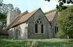
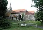
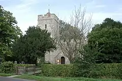
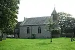
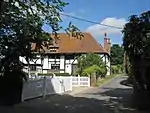
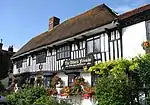
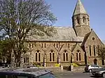
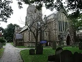
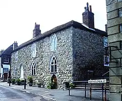
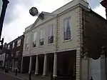
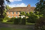
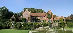
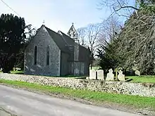
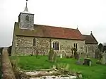
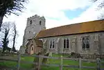
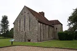
Buildings and monuments

Name Location Type Completed [note 1]Date designated Grid ref.[note 2]
Geo-coordinates
Entry number [note 3]Image
Acrise Place and Acrise Court AcriseHouse16th century27 August 1952TR1932442196
51°08′13″N 1°08′01″E / 51.13701°N 1.133729°E / 51.13701; 1.133729 (Acrise Place and Acrise Court)
1250981
Hoad Farm AcriseFarmhouse1697 dated27 August 1952TR2113643106
51°08′40″N 1°09′37″E / 51.144484°N 1.160147°E / 51.144484; 1.160147 (Hoad Farm)
1251021
Upload Photo
Church of St Augustine Snave, BrenzettParish Church13th century9 June 1959TR0142229934
51°02′00″N 0°52′17″E / 51.03346°N 0.87136°E / 51.03346; 0.87136 (Church of St Augustine)
1061152
Church of St Augustine
Church of St Eanswith BrenzettParish ChurchLate 11th century or 12th century9 June 1959TR0050527730
51°00′50″N 0°51′25″E / 51.013987°N 0.857081°E / 51.013987; 0.857081 (Church of St Eanswith)
1344185
Church of All Saints BurmarshParish Church12th century9 June 1959TR1011832035
51°02′57″N 0°59′47″E / 51.049216°N 0.996425°E / 51.049216; 0.996425 (Church of All Saints)
1061163
Church of All Saints
Church of St Peter and St Paul DymchurchTower18219 June 1959TR1031529737
51°01′43″N 0°59′52″E / 51.028509°N 0.997898°E / 51.028509; 0.997898 (Church of St Peter and St Paul)
1061130
Church of St Peter and St Paul
New Hall, New Hall Cottage and the Expenditors House DymchurchHouseAddition, probably early 19th century9 June 1959TR1028829702
51°01′42″N 0°59′51″E / 51.028204°N 0.997493°E / 51.028204; 0.997493 (New Hall, New Hall Cottage and the Expenditors House)
1061129
Upload Photo
Boyke Manor Ottinge, ElhamFarmhouse17th century29 December 1966TR1674342410
51°08′24″N 1°05′49″E / 51.139913°N 1.097022°E / 51.139913; 1.097022 (Boyke Manor)
1252276
Boyke Manor
Boyke Manor
Elham Manor ElhamContinuous Jetty HouseEarly 16th century or earlier29 December 1966TR1757643935
51°09′12″N 1°06′35″E / 51.15329°N 1.109832°E / 51.15329; 1.109832 (Elham Manor)
1253867
Elham Manor
Elham Manor
King Post ElhamHouse18th century29 December 1966TR1769943898
51°09′10″N 1°06′42″E / 51.152911°N 1.111566°E / 51.152911; 1.111566 (King Post)
1260568
Upload Photo
Parsonage Farmhouse North Elham, ElhamFarmhouse13th century or earlier29 December 1966TR1817844761
51°09′38″N 1°07′08″E / 51.160478°N 1.118927°E / 51.160478; 1.118927 (Parsonage Farmhouse)
1252342
Parsonage Farmhouse
Parsonage Farmhouse
The Abbots Fireside Hotel and Restaurant ElhamHouse19th century27 August 1952TR1763443925
51°09′11″N 1°06′38″E / 51.153179°N 1.110654°E / 51.153179; 1.110654 (The Abbots Fireside Hotel and Restaurant)
1252338
The Abbots Fireside Hotel and Restaurant
Dean Farm ElmstedFarmhouse18th century17 October 1988TR1246446401
51°10′38″N 1°02′18″E / 51.177353°N 1.0383°E / 51.177353; 1.0383 (Dean Farm)
1241760
Upload Photo
Old Leigh Place ElmstedFarmhouse16th century29 December 1966TR1316547144
51°11′02″N 1°02′56″E / 51.183764°N 1.048754°E / 51.183764; 1.048754 (Old Leigh Place)
1241849
Upload Photo
Spong Farm House ElmstedFarmhouseEarly-mid 16th century29 December 1966TR1247245771
51°10′18″N 1°02′17″E / 51.171693°N 1.038042°E / 51.171693; 1.038042 (Spong Farm House)
1260301
Upload Photo
Church of the Holy Trinity Folkestone, FolkestoneChurch1866-6911 March 1975TR2195035598
51°04′36″N 1°10′02″E / 51.07676°N 1.16715°E / 51.07676; 1.16715 (Church of the Holy Trinity)
1344160
Church of the Holy Trinity
Folkestone War Memorial FolkestoneMonumentUnveiled 2 December 192224 June 2010TR2280035755
51°04′40″N 1°10′46″E / 51.077841°N 1.179361°E / 51.077841; 1.179361 (Folkestone War Memorial)
1393854
The Parish Church of St Mary and St Eanswythe Folkestone, FolkestoneParish Church13th century5 December 1949TR2295935863
51°04′43″N 1°10′54″E / 51.078748°N 1.181694°E / 51.078748; 1.181694 (The Parish Church of St Mary and St Eanswythe)
1068556
18 and 20, Church Street Folkestone, FolkestoneHouse18th century5 December 1949TR2293535926
51°04′46″N 1°10′53″E / 51.079323°N 1.181391°E / 51.079323; 1.181391 (18 and 20, Church Street)
1356216
18 and 20, Church Street
Centuries
1 and 2, Bartholomew Street
HytheHouse13th century3 January 1950TR1610934810
51°04′19″N 1°05′00″E / 51.071912°N 1.083425°E / 51.071912; 1.083425 (Centuries
1 and 2, Bartholomew Street
)
1069006
Centuries1 and 2, Bartholomew Street
Centuries
1 and 2, Bartholomew Street
Town Hall HytheGuildhall17943 January 1950TR1618834781
51°04′18″N 1°05′04″E / 51.071622°N 1.084534°E / 51.071622; 1.084534 (Town Hall)
1068981
Dungeness Lighthouse Dungeness, LyddLighthouseDesigned 195726 March 2003TR0929416883
50°54′48″N 0°58′33″E / 50.913451°N 0.975967°E / 50.913451; 0.975967 (Dungeness Lighthouse)
1390640
Lindon Hall LymingeHousec.1668, possibly with earlier core29 December 1966TR1626141233
51°07′46″N 1°05′22″E / 51.129527°N 1.089436°E / 51.129527; 1.089436 (Lindon Hall)
1260204
Lindon Hall
Lindon Hall
Sibton Park LymingeHousec.160227 August 1952TR1587441738
51°08′03″N 1°05′03″E / 51.134208°N 1.084216°E / 51.134208; 1.084216 (Sibton Park)
1242126
Upload Photo
French House Lympne, LympneHousec.193029 December 1966TR1123234709
51°04′22″N 1°00′50″E / 51.07282°N 1.013855°E / 51.07282; 1.013855 (French House)
1344206
Upload Photo
Port Lympne House, Stable Block, Forecourt Walls to East, and Loggia, Patio, Terrace and Shell Fountain to South Port Lympne, LympneHouse191229 December 1966TR1021934985
51°04′32″N 0°59′58″E / 51.07567°N 0.999576°E / 51.07567; 0.999576 (Port Lympne House, Stable Block, Forecourt Walls to East, and Loggia, Patio, Terrace and Shell Fountain to South)
1344207
Port Lympne House, Stable Block, Forecourt Walls to East, and Loggia, Patio, Terrace and Shell Fountain to South
Church of St Peter Monks HortonParish Church13th century29 December 1966TR1234640536
51°07′29″N 1°01′59″E / 51.124732°N 1.033157°E / 51.124732; 1.033157 (Church of St Peter)
1344171
Church of St Peter
Church of St Peter
Kite Manor Monks HortonHousemid to late 16th century27 August 1952TR1156939883
51°07′09″N 1°01′18″E / 51.119156°N 1.021687°E / 51.119156; 1.021687 (Kite Manor)
1061121
Kite Manor
Kite Manor
St John's Priory, including the ruins of the Priory New Romney, New RomneyHouse18th century, possibly older28 August 1951TR0644124829
50°59′09″N 0°56′24″E / 50.985836°N 0.939941°E / 50.985836; 0.939941 (St John's Priory, including the ruins of the Priory)
1025316
3 and 4, West Street New Romney, New RomneyHousec.140028 August 1951TR0625524739
50°59′06″N 0°56′14″E / 50.985095°N 0.937243°E / 50.985095; 0.937243 (3 and 4, West Street)
1025299
Upload Photo
Church of St Nicholas Newington, NewingtonBell Towerlate 18th century or early 19th century29 December 1966TR1826437369
51°05′39″N 1°06′56″E / 51.094074°N 1.115682°E / 51.094074; 1.115682 (Church of St Nicholas)
1061089
Church of St Nicholas
Church of St Peter and St Paul Saltwood, SaltwoodTower187329 December 1966TR1578936007
51°04′58″N 1°04′46″E / 51.082781°N 1.079578°E / 51.082781; 1.079578 (Church of St Peter and St Paul)
1344199
Church of St Peter and St Paul
Spade House Sandgate, SandgateHouse189911 March 1975TR2093535326
51°04′29″N 1°09′09″E / 51.074709°N 1.152518°E / 51.074709; 1.152518 (Spade House)
1061164
Church of St Dunstan SnargateParish Church13th century9 June 1959TQ9906928646
51°01′22″N 0°50′14″E / 51.022712°N 0.837138°E / 51.022712; 0.837138 (Church of St Dunstan)
1061105
Church of St Dunstan
Church of St Mary StowtingParish Church13th century29 December 1966TR1247641845
51°08′11″N 1°02′09″E / 51.136438°N 1.035783°E / 51.136438; 1.035783 (Church of St Mary)
1061070
Church of St Mary
Church of St Mary
St John's Commandery SwingfieldFarmhouse16th century17 October 1988TR2322844015
51°09′07″N 1°11′26″E / 51.151834°N 1.190569°E / 51.151834; 1.190569 (St John's Commandery)
1242361

See also

Notes

  1. The date given is the date used by Historic England as significant for the initial building or that of an important part in the structure's description.
  2. Sometimes known as OSGB36, the grid reference is based on the British national grid reference system used by the Ordnance Survey.
  3. The "List Entry Number" is a unique number assigned to each listed building and scheduled monument by Historic England.

References

  1. "What is a listed building?". Manchester City Council. Retrieved 8 December 2007.
  2. "Planning (Listed Buildings and Conservation Areas) Act 1990 (c. 9)". Ministry of Justice. Retrieved 17 December 2007.
This article is issued from Wikipedia. The text is licensed under Creative Commons - Attribution - Sharealike. Additional terms may apply for the media files.