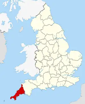
Cornwall shown in England
There are over 20,000 Grade II* listed buildings in England. This article comprises a list of these buildings in the county of Cornwall.
List of buildings
| Name | Location | Type | Completed [note 1] | Date designated | Grid ref.[note 2] Geo-coordinates |
Entry number [note 3] | Image |
|---|---|---|---|---|---|---|---|
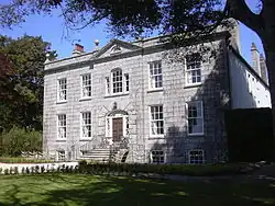
| Abbey House | Padstow | House | Late 15th century | 24 April 1953 | SW9194275499 50°32′32″N 4°56′16″W / 50.542156°N 4.93779°W |
1289740 | 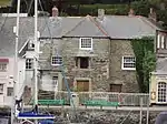 Abbey House |
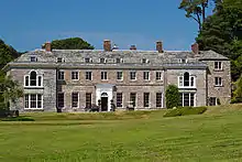
| Acton Castle | Perranuthnoe | Country house | c.1775 | 9 October 1987 | SW5515228445 50°06′20″N 5°25′32″W / 50.105503°N 5.425568°W |
1160515 | |
| Aldercombe Barton | Kilkhampton | Farmhouse | 16th century | 26 September 1951 | SS2699411758 50°52′46″N 4°27′38″W / 50.879349°N 4.46062°W |
1141822 |  Upload Photo |
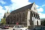
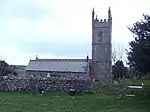
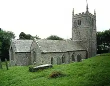
| All Hallows Church of Saint Kea | Kea | Parish church | 1894 | 30 May 1967 | SW8100642653 50°14′36″N 5°04′22″W / 50.243199°N 5.072759°W |
1310700 | 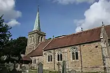 All Hallows Church of Saint Kea |
| Almshouses | Tregoney | Almshouses | 1696 | 30 May 1985 | SW9236044812 50°16′00″N 4°54′54″W / 50.266691°N 4.914927°W |
1141037 |  Almshouses |
| Alverton Manor Hotel | Truro | House | Mid-19th century | 10 December 1984 | SW8316145141 50°15′59″N 5°02′38″W / 50.266338°N 5.044006°W |
1282635 | Upload Photo |
| Anderton and barn adjoining at west | Launcells | Farmhouse | 15th century | 29 September 1961 | SS2773105746 50°49′32″N 4°26′50″W / 50.825557°N 4.447324°W |
1141830 | Upload Photo |
| Antenna No. 1 (Arthur) at Goonhilly Satellite Earth Station | Goonhilly Downs, St. Martin-in-Meneage | Satellite dish | 1960–62 | 26 March 2003 | SW7272321303 50°02′54″N 5°10′34″W / 50.048355°N 5.176007°W |
1350341 | 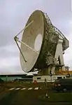 Antenna No. 1 (Arthur) at Goonhilly Satellite Earth Station |
| Arwenack House and Arwenack Manor | Falmouth | Apartment | Mostly rebuilt 1571 | 22 July 1949 | SW8122832310 50°09′01″N 5°03′49″W / 50.150395°N 5.063694°W |
1270061 | |
| Assay Office about 20m south-west of Count House at King Edward Mine | Camborne | Assay office | Late 19th century | 12 September 1989 | SW6631938902 50°12′14″N 5°16′34″W / 50.203895°N 5.276089°W |
1142686 | Upload Photo |
| Bank House | St. Columb Major | House | 1857 | 21 January 1985 | SW9136863635 50°26′07″N 4°56′21″W / 50.435398°N 4.939255°W |
1144073 | Upload Photo |
| Baptist Church and attached schoolroom at rear | Penzance | Schoolroom | Mid-19th century | 29 July 1950 | SW4710630350 50°07′09″N 5°32′21″W / 50.119231°N 5.53913°W |
1143967 | .jpg.webp) Baptist Church and attached schoolroom at rear |
| Bareppa House | Bareppa, Mawnan | House | c.Early 18th century | 17 June 1988 | SW7814729757 50°07′35″N 5°06′19″W / 50.126324°N 5.105269°W |
1309989 | Upload Photo |
| Barn 30m to north of Bokelly | St. Kew | Barn | Possibly 17th century | 6 June 1969 | SX0405077051 50°33′37″N 4°46′05″W / 50.56028°N 4.767939°W |
1129856 | Upload Photo |
| Barn about 25m south-west of Tredown Farmhouse | South Petherwin | Bank barn | Late 18th or early 19th century | 25 February 1991 | SX3026082592 50°37′06″N 4°24′03″W / 50.618271°N 4.400789°W |
1142740 | Upload Photo |
| Barn about 40m south-east of Tremaer | Bude-Stratton | Barn | c.14th-century origins | 9 September 1985 | SS2074107893 50°50′34″N 4°32′51″W / 50.842721°N 4.547519°W |
1229361 | Upload Photo |
| Barn and adjoining buildings | Mylor | Barn etc. | c.Late 18th century | 30 May 1967 | SW7881737991 50°12′02″N 5°06′03″W / 50.200518°N 5.100695°W |
1160345 | Upload Photo |
| Barn and two adjoining engine houses about 10m north of Trewithen Farmhouse | Probus | Horse engine house | c.1800 | 17 October 1984 | SW9144947731 50°17′33″N 4°55′45″W / 50.292587°N 4.929302°W |
1141079 | Upload Photo |
| Barn about 20m south of Kestle Barton Farmhouse and Kestle Cottage | Manaccan | Barn | c.Late 18th century | 22 June 1987 | SW7535225448 50°05′12″N 5°08′30″W / 50.086577°N 5.141777°W |
1328581 |  Barn about 20m south of Kestle Barton Farmhouse and Kestle Cottage |
| Barn with gate piers and adjoining building about 50m east of Golden Manor House | Probus | Barn | 15th–16th century | 10 May 1967 | SW9208946895 50°17′07″N 4°55′12″W / 50.285304°N 4.91987°W |
1310504 | 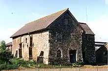 Barn with gate piers and adjoining building about 50m east of Golden Manor House |
| Barrack block, Maker Heights Barracks | Maker-with-Rame | Barracks | 1804–08 | 8 July 1998 | SX4349351396 50°20′30″N 4°12′03″W / 50.341637°N 4.200819°W |
1375582 |  Barrack block, Maker Heights Barracks |
| Basil Manor | St. Clether | House | Early 16th century | 23 November 1988 | SX2045884070 50°37′43″N 4°32′24″W / 50.628613°N 4.539924°W |
1159225 | 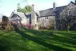 Basil Manor |
| Battens Mill | North Hill | Watermill | Probably late 16th century | 10 May 1989 | SX2720875941 50°33′27″N 4°26′27″W / 50.557618°N 4.440797°W |
1249309 | Upload Photo |
| Beehive Cottage | Veryan | House | c.1820 | 30 May 1967 | SW9154639604 50°13′11″N 4°55′24″W / 50.219627°N 4.923468°W |
1291428 | 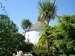 Beehive Cottage |
| Berriowbridge Bridge | Berriowbridge, North Hill | Road bridge | Mid-16th century | 22 November 1960 | SX2731775668 50°33′19″N 4°26′21″W / 50.555197°N 4.439133°W |
1249964 | .jpg.webp) Berriowbridge Bridge |
| Bible Christian Chapel | St. Cleer | Chapel | 1846 | 21 August 1964 | SX2432468210 50°29′14″N 4°28′40″W / 50.487298°N 4.47783°W |
1311103 | Upload Photo |
| Bochym Manor House | Cury | Manor house | Late Medieval | 10 July 1957 | SW6907920798 50°02′33″N 5°13′35″W / 50.042418°N 5.226519°W |
1141746 | 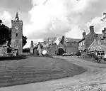 Bochym Manor House |
| Boconnoc House | Boconnoc Park, Boconnoc | Country house | 16th/17th century | 27 August 1952 | SX1463260562 50°24′56″N 4°36′38″W / 50.415603°N 4.610523°W |
1140354 | |
| Bodriggy House, including front garden walls | Hayle | House | c.1718 | 14 January 1988 | SW5656037636 50°11′19″N 5°24′42″W / 50.188595°N 5.411786°W |
1160426 | Upload Photo |
| Boiler House immediately to north-east of pump engine house to Robinsons Shaft at South Crofty Mine | Carn Brea | Boiler house | 1903 | 12 September 1989 | SW6679741256 50°13′31″N 5°16′15″W / 50.22522°N 5.270848°W |
1160761 | 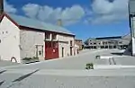 Boiler House immediately to north-east of pump engine house to Robinsons Shaft at South Crofty Mine |
| Bonallack Barton Cottages | Bonallack Barton, Constantine | House | Probably 16th century | 10 July 1957 | SW7185626453 50°05′39″N 5°11′28″W / 50.094269°N 5.191169°W |
1142154 | Upload Photo |
| Bonython Manor House | Cury | House | c.1790 | 10 July 1957 | SW6965421138 50°02′44″N 5°13′07″W / 50.045694°N 5.218706°W |
1141754 | |
| Boskenna | Boskenna, St. Buryan | Country house | 17th century | 15 December 1988 | SW4228623671 50°03′26″N 5°36′07″W / 50.057208°N 5.601915°W |
1137280 | Upload Photo |
| Botallack Manor House | Botallack, St. Just | Manor house | 17th century | 26 April 1950 | SW3672133041 50°08′20″N 5°41′09″W / 50.138868°N 5.685953°W |
1143288 | 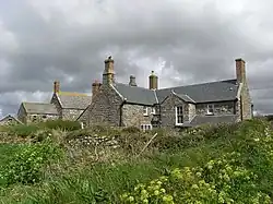 Botallack Manor House |
| Boundary wall to Lanherne Carmelite Convent | St Mawgan, Mawgan-in-Pydar | Boundary wall | Late 17th century | 12 May 1988 | SW8713665895 50°27′15″N 5°00′00″W / 50.454175°N 5.000047°W |
1137593 | Upload Photo |
| Braganza House | St Mawes, St. Just-in-Roseland | House | c.1830 | 30 May 1967 | SW8474033178 50°09′34″N 5°00′54″W / 50.159477°N 5.015097°W |
1136691 | Upload Photo |
| Bridge about 150m east of Chyverton House | Chyverton, Perranzabuloe | Bridge | 18th century | 31 October 1988 | SW7986651133 50°19′08″N 5°05′37″W / 50.318928°N 5.09366°W |
1328680 | Upload Photo |
| Buildings at Wheal St Vincent | Callington | Smelting works | Early to mid-19th century | 22 September 1986 | SX3850969647 50°30′15″N 4°16′43″W / 50.504295°N 4.278664°W |
1140789 | .jpg.webp) Buildings at Wheal St Vincent |
| Burdenwell Manor and cottage adjoining at north-east | Week St. Mary | Farmhouse | Probably 16th century | 29 September 1961 | SX2392997796 50°45′11″N 4°29′51″W / 50.752989°N 4.497441°W |
1137650 | Upload Photo |
| Burrell House | Longlands, Saltash | House | Early 17th century | 17 January 1952 | SX3960258417 50°24′13″N 4°15′30″W / 50.403681°N 4.258451°W |
1140376 | Upload Photo |
| Calciner with attached chimney to south of dressing plant at King Edward Mine | Camborne | Calciner | 1904 | 12 September 1989 | SW6639038878 50°12′13″N 5°16′30″W / 50.203707°N 5.275081°W |
1159243 | 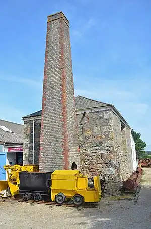 Calciner with attached chimney to south of dressing plant at King Edward Mine |
| Calenick House and garden walls to south and north | Calenick, Kea | House | 1702 | 12 March 1986 | SW8209343178 50°14′54″N 5°03′28″W / 50.248316°N 5.057839°W |
1329027 |  Calenick House and garden walls to south and north |
| Calf house at Lithiack and stable adjacent to north | St. Germans | Calf house | Late 18th–early 19th century | 9 October 1987 | SX3588258420 50°24′10″N 4°18′39″W / 50.402681°N 4.310755°W |
1140518 | Upload Photo |
| Camelot Restaurant | Penzance | House | 18th century | 10 January 1969 | SW4713730283 50°07′07″N 5°32′19″W / 50.118643°N 5.538652°W |
1143144 | Upload Photo |
| Cannon in undergrowth beside the Green Walk of Prideaux Place | Prideaux Place, Padstow | Cannon | c.1700 | 20 May 1988 | SW9129675562 50°32′33″N 4°56′49″W / 50.542491°N 4.946929°W |
1289637 | Upload Photo |
| Carharrack Methodist Church | Carharrack | Methodist chapel | 1815 | 12 September 1989 | SW7305241439 50°13′45″N 5°11′00″W / 50.229297°N 5.183409°W |
1160248 | .jpg.webp) Carharrack Methodist Church |
| Carines Farmhouse with attached garden wall | Cubert | Farmhouse | c.Early 17th century | 30 May 1967 | SW7904959027 50°23′22″N 5°06′35″W / 50.389511°N 5.109751°W |
1141566 | Upload Photo |
| Carnanton House | Mawgan-in-Pydar | House | c.1710 | 25 August 1987 | SW8781864629 50°26′35″N 4°59′23″W / 50.443053°N 4.989737°W |
1327395 | |
| Carpenters shop, workshops and forge at Robinsons Shaft, South Crofty Mine | Carn Brea | Carpenters workshop | 1903–10 | 27 October 1999 | SW6674641230 50°13′30″N 5°16′18″W / 50.224966°N 5.271546°W |
1379233 |  Carpenters shop, workshops and forge at Robinsons Shaft, South Crofty Mine |
| Cartuther Barton and courtyard buildings to north-east | Menheniot | House | Late 17th century | 21 August 1964 | SX2635663156 50°26′33″N 4°26′49″W / 50.442494°N 4.446868°W |
1329407 | Upload Photo |
| Castle Hill House | Launceston | Town house | Early/mid-18th century | 27 February 1950 | SX3308784731 50°38′18″N 4°21′43″W / 50.638307°N 4.361827°W |
1297886 | Upload Photo |
| Castle Horneck | Penzance | House | Late 18th/early 19th century | 7 February 1974 | SW4575330268 50°07′05″N 5°33′29″W / 50.117917°N 5.557964°W |
1143172 | |
| Castle remains at harbour mouth | Fowey | Fortified house | Late 15th century | 13 March 1951 | SX1217751334 50°19′55″N 4°38′26″W / 50.331922°N 4.640431°W |
1327315 | 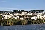 Castle remains at harbour mouth |
| Celtic cross adjacent to the Town Hall | Penryn | Preaching cross | Possibly pre-Conquest | 22 September 1971 | SW7850834397 50°10′05″N 5°06′11″W / 50.168127°N 5.102924°W |
1187644 | .jpg.webp) Celtic cross adjacent to the Town Hall |
| Chantry | St. Ive | House | 1852–54 | 26 November 1985 | SX3101567125 50°28′46″N 4°22′59″W / 50.479518°N 4.383106°W |
1137118 | Upload Photo |
| Chapel immediately to east of Shillingham Farmhouse | Shillingham Manor, Saltash | Ruined chapel | 14th century | 17 January 1952 | SX4073957245 50°23′36″N 4°14′31″W / 50.393459°N 4.241967°W |
1329258 | Upload Photo |
| Chapel Mill | St. Stephen-in-Brannel | China stone mill | Late 19th century | 17 July 1995 | SW9485253102 50°20′31″N 4°53′04″W / 50.342022°N 4.884511°W |
1261837 | Upload Photo |
| Chapel of St Clether | St. Clether | Well chapel | 15th century | 23 November 1988 | SX2022584587 50°37′59″N 4°32′36″W / 50.633186°N 4.543466°W |
1159239 | 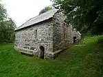 Chapel of St Clether |
| Chapel of St George and St Thomas a Becket | Calstock | Chapel | c.1490 | 23 January 1968 | SX4252468552 50°29′44″N 4°13′18″W / 50.495549°N 4.221629°W |
1140219 | 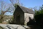 Chapel of St George and St Thomas a Becket |
| Chapel of St Michael | Maker-with-Rame | Chapel | Medieval | 23 January 1968 | SX4181448328 50°18′49″N 4°13′23″W / 50.313617°N 4.223108°W |
1159655 | 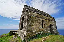 Chapel of St Michael |
| Chapel of St Nectan | St. Winnow | Chapel | c.15th century | 21 August 1966 | SX1283559983 50°24′35″N 4°38′08″W / 50.409831°N 4.6355°W |
1138175 | 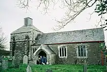 Chapel of St Nectan |
| Chapel at SX426527 | Millbrook | Chapel | Late 13th century | 23 January 1968 | SX4264652738 50°21′12″N 4°12′48″W / 50.353471°N 4.213273°W |
1329133 | Upload Photo |
| Chimney stack about 30m east of pump engine house at Taylor's Shaft of New East Pool Mine | Carn Brea | Engine house | 1922 | 9 April 1975 | SW6744241895 50°13′52″N 5°15′44″W / 50.231211°N 5.262213°W |
1328183 | .jpg.webp) Chimney stack about 30m east of pump engine house at Taylor's Shaft of New East Pool Mine |
| Church House | Poughill, Bude-Stratton | Cross-passage house | Early 16th century or earlier | 9 September 1985 | SS2225707712 50°50′30″N 4°31′33″W / 50.841563°N 4.525921°W |
1278759 | Upload Photo |
| Church of All Saints | Falmouth | Anglican church | 1887–90 | 23 January 1973 | SW8030932441 50°09′04″N 5°04′36″W / 50.151232°N 5.076614°W |
1270048 | |
| Church of King Charles the Martyr; the Church Institute | Falmouth | Church institute | 1662–65 | 22 July 1949 | SW8096532631 50°09′11″N 5°04′03″W / 50.153181°N 5.067555°W |
1270080 | 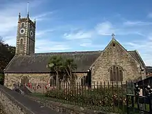 Church of King Charles the Martyr; the Church Institute |
| Church of Saint Anthony | Gerrans | Parish church | 13th century | 30 May 1967 | SW8548532035 50°08′58″N 5°00′15″W / 50.149481°N 5.004038°W |
1141049 | 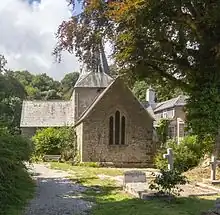 Church of Saint Anthony |
| Church of Saint Budock | Budock Water, Budock | Parish church | 13th century | 10 July 1957 | SW7862232396 50°09′01″N 5°06′01″W / 50.1502°N 5.100167°W |
1141977 | 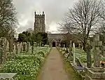 Church of Saint Budock |
| Church of Saint Credan | Sancreed | Parish church | 15th century | 15 December 1988 | SW4202529356 50°06′29″N 5°36′34″W / 50.108123°N 5.609389°W |
1143822 | 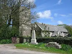 Church of Saint Credan |
| Church of Saint Crewen | Crowan | Parish church | 15th century | 10 July 1957 | SW6458334495 50°09′49″N 5°17′52″W / 50.163638°N 5.297646°W |
1160230 | 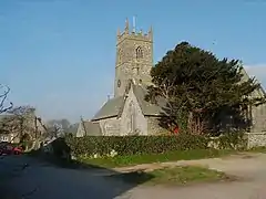 Church of Saint Crewen |
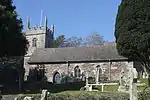
| Church of Saint Feock | Feock | Parish church | 1875–76 | 30 May 1967 | SW8248338430 50°12′21″N 5°02′59″W / 50.20582°N 5.049654°W |
1329009 | 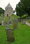 Church of Saint Feock |
| Church of Saint Gothian | Gwithian Churchtown, Gwinear-Gwithian | Parish church | 15th century | 14 January 1988 | SW5863541263 50°13′19″N 5°23′06″W / 50.222007°N 5.385076°W |
1327619 | |
| Church of Saint Laud | Spargo, Mabe | Parish church | 15th century | 10 July 1957 | SW7574432479 50°09′00″N 5°08′26″W / 50.149864°N 5.140438°W |
1328122 | |
| Church of Saint Mawnan | Mawnan | Parish church | 13th century | 10 July 1957 | SW7877427234 50°06′14″N 5°05′42″W / 50.1039°N 5.095048°W |
1161760 | |
| Church of Saint Paul | Ludgvan Churchtown, Ludgvan | Parish church | Norman | 10 June 1954 | SW5052333036 50°08′41″N 5°29′35″W / 50.144789°N 5.49318°W |
1143598 | 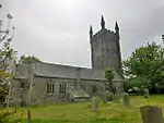 Church of Saint Paul |
| Church of Saint Piran | Perranarworthal | Parish church | 15th century | 30 May 1967 | SW7792638930 50°12′31″N 5°06′49″W / 50.208617°N 5.11371°W |
1141586 | |
| Church of Saint Piran | Perranzabuloe | Parish church | 1804 | 30 May 1967 | SW7704752036 50°19′34″N 5°08′01″W / 50.325977°N 5.133731°W |
1312468 | 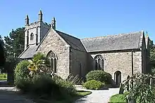 Church of Saint Piran |
| Church of Saint Sennen | Sennen | Parish church | 13th century | 15 December 1988 | SW3570925517 50°04′15″N 5°41′42″W / 50.070891°N 5.694878°W |
1143798 | |
| Church of Saint Stedian | Stithians | Parish church | 15th century | 10 July 1957 | SW7311037131 50°11′26″N 5°10′48″W / 50.190635°N 5.180022°W |
1162143 | 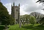 Church of Saint Stedian |
| Church of Saint Towennac | Towednack | Church | 15th century | 10 June 1954 | SW4869738077 50°11′21″N 5°31′19″W / 50.189269°N 5.522016°W |
1137373 | 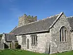 Church of Saint Towennac |
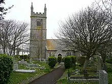
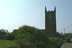
| Church of St Agnes | Churchtown St Agnes, St. Agnes | Parish church | 15th century | 30 May 1967 | SW7202850734 50°18′45″N 5°12′12″W / 50.312366°N 5.203343°W |
1328673 |  Church of St Agnes |
| Church of St Allen (Alleyne) | St Allen | Parish church | 12th century | 30 May 1967 | SW8223850602 50°18′54″N 5°03′36″W / 50.315041°N 5.060084°W |
1141465 | 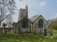 Church of St Allen (Alleyne) |
| Church of St Andrew | Tywardreath, Tywardreath and Par | Church | 14th century | 28 November 1950 | SX0849054314 50°21′27″N 4°41′37″W / 50.357505°N 4.693691°W |
1212463 | 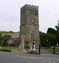 Church of St Andrew |
| Church of St Bartholomew | Warleggan | Parish church | 13th century | 21 August 1964 | SX1563869095 50°29′33″N 4°36′02″W / 50.492579°N 4.600581°W |
1140464 |  Church of St Bartholomew |
| Church of St Blaize | St Blazey, St. Blaise | Church | c.1440 | 28 November 1950 | SX0686354813 50°21′41″N 4°43′00″W / 50.361455°N 4.716793°W |
1289700 |  Church of St Blaize |
| Church of St Briocus | Lezant | Church | Early 13th century | 22 November 1960 | SX3384779087 50°35′16″N 4°20′55″W / 50.587812°N 4.348561°W |
1291277 | .jpg.webp) Church of St Briocus |
| Church of St Catherine | Temple, Blisland | Church | c.Late 12th or early 13th century | 6 June 1969 | SX1461473240 50°31′46″N 4°37′01″W / 50.529492°N 4.617061°W |
1311621 |  Church of St Catherine |
| Church of St Clement (Methodist) | Mousehole, Penzance | Methodist chapel | 1784 | 14 October 1991 | SW4686526179 50°04′54″N 5°32′23″W / 50.081688°N 5.539731°W |
1115115 | 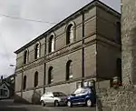 Church of St Clement (Methodist) |
| Church of St Clether | St. Clether | Parish church | 15th century | 23 November 1988 | SX2054884382 50°37′53″N 4°32′20″W / 50.631444°N 4.538804°W |
1328078 | .jpg.webp) Church of St Clether |
| Church of St David | Davidstow | Parish church | Probably 15th century | 17 December 1962 | SX1511287264 50°39′20″N 4°37′01″W / 50.655635°N 4.617023°W |
1158418 | 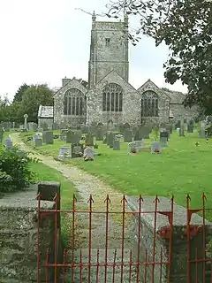 Church of St David |
| Church of St Denis | Otterham | Parish church | Norman origins | 17 December 1962 | SX1683490761 50°41′15″N 4°35′40″W / 50.687594°N 4.594421°W |
1143456 | |
| Church of St Dennis | St Dennis | Church | Probably late 14th–early 15th century | 10 February 1967 | SW9507258306 50°23′20″N 4°53′03″W / 50.38884°N 4.884258°W |
1327433 | 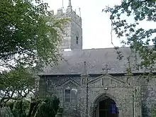 Church of St Dennis |
| Church of St Elwyn | Hayle | Parish church | 1886–88 | 14 January 1988 | SW5591137573 50°11′16″N 5°25′15″W / 50.187762°N 5.42082°W |
1143688 | |
| Church of St Euny | Church Town, Redruth | Church | Late 15th century | 1 December 1951 | SW6912141232 50°13′33″N 5°14′18″W / 50.225916°N 5.238307°W |
1161605 | 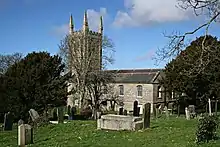 Church of St Euny |
| Church of St Gluvias | Penryn | Parish church | 15th century | 28 January 1949 | SW7873834662 50°10′14″N 5°06′00″W / 50.170593°N 5.099862°W |
1205597 | 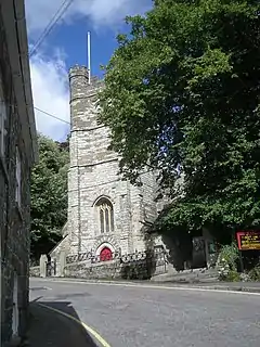 Church of St Gluvias |
| Church of St Gomonda | Roche | Parish church | 14th century | 10 February 1967 | SW9879659796 50°24′13″N 4°49′58″W / 50.40351°N 4.832736°W |
1158829 |  Church of St Gomonda |
| Church of St Goran | Gorran Churchtown, St Goran | Church | 12th century | 10 February 1967 | SW9995042303 50°14′48″N 4°48′26″W / 50.246774°N 4.807238°W |
1144750 |  Church of St Goran |
| Church of St Gregory | Treneglos | Parish church | Norman origins | 22 November 1960 | SX2078688106 50°39′54″N 4°32′14″W / 50.664974°N 4.537245°W |
1310214 | |
| Church of St Gulval | Gulval, Penzance | Church | 1440 | 29 July 1950 | SW4846631754 50°07′57″N 5°31′16″W / 50.132412°N 5.521068°W |
1327829 |  Church of St Gulval |
| Church of St Helena | Helland | Church | 14th century | 6 June 1969 | SX0751471014 50°30′26″N 4°42′57″W / 50.507203°N 4.715972°W |
1327931 | 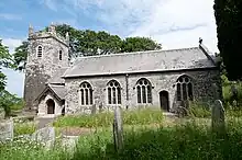 Church of St Helena |
| Church of St Hermes | Churchtown, St. Erme | Anglican church | 15th century | 30 May 1967 | SW8464649866 50°18′34″N 5°01′33″W / 50.309316°N 5.025891°W |
1136778 | |
| Church of St Hermes | St. Ervan | Parish church | 13th century | 6 June 1969 | SW8917670283 50°29′40″N 4°58′26″W / 50.494321°N 4.973824°W |
1212526 | 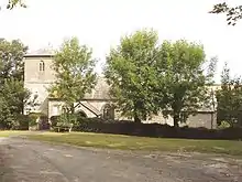 Church of St Hermes |
| Church of St John (Methodist) | St. Austell | Methodist church | 1828 | 28 November 1950 | SX0116452595 50°20′23″N 4°47′44″W / 50.339634°N 4.795648°W |
1211944 | 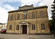 Church of St John (Methodist) |
| Church of St Julitta | Hennett, St. Juliot | Parish church | 15th century | 17 December 1962 | SX1290291221 50°41′26″N 4°39′01″W / 50.690475°N 4.650256°W |
1222833 | |
| Church of St Just | Gorran Haven, St. Goran | Church | 15th century | 10 February 1967 | SX0127041613 50°14′28″N 4°47′18″W / 50.241022°N 4.788385°W |
1144785 | 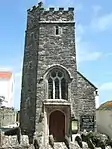 Church of St Just |
| Church of St Keyne | St Keyne | Parish church | 15th century | 21 August 1964 | SX2422960810 50°25′15″N 4°28′32″W / 50.420783°N 4.475693°W |
1140840 | 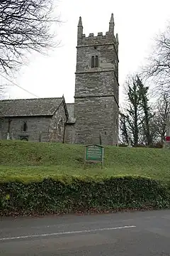 Church of St Keyne |
| Church of St Keyne | Kenwyn, Truro | Parish church | Consecrated 1259 | 29 December 1950 | SW8196845852 50°16′20″N 5°03′40″W / 50.272284°N 5.06113°W |
1205410 | 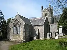 Church of St Keyne |
| Church of St Martin | Lewannick | Church | 15th century | 22 November 1960 | SX2760480710 50°36′02″N 4°26′15″W / 50.600583°N 4.437424°W |
1277508 | .jpg.webp) Church of St Martin |
| Church of St Martin | St. Martin-in-Meneage | Parish church | 15th century | 10 July 1957 | SW7350523640 50°04′11″N 5°09′59″W / 50.06964°N 5.166484°W |
1265918 | 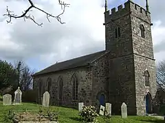 Church of St Martin |
| Church of St Mary | Botusfleming | Parish church | 15th century | 23 January 1968 | SX4045661298 50°25′47″N 4°14′52″W / 50.429803°N 4.247669°W |
1140249 | 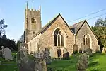 Church of St Mary |
| Church of St Mary | Par, St. Blaise | Anglican church | 1848–49 | 11 March 1974 | SX0581653592 50°21′01″N 4°43′51″W / 50.350142°N 4.730866°W |
1212089 | 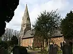 Church of St Mary |
| Church of St Merryn | St. Merryn | Church | Extended 15th century | 6 June 1969 | SW8864174141 50°31′44″N 4°59′01″W / 50.528776°N 4.983541°W |
1212764 | .jpg.webp) Church of St Merryn |
| Church of St Mewan | St. Mewan | Parish church | 12th century | 10 February 1967 | SW9983851849 50°19′57″N 4°48′50″W / 50.332483°N 4.813863°W |
1327442 | .jpg.webp) Church of St Mewan |
| Church of St Michael | Helston | Church | 12th century | 24 March 1950 | SW6580127734 50°06′12″N 5°16′35″W / 50.103415°N 5.276468°W |
1207743 | 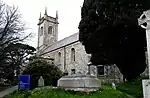 Church of St Michael |
| Church of St Michael | Lawhitton, Lawhitton Rural | Church | 13th century | 22 November 1960 | SX3554782356 50°37′04″N 4°19′34″W / 50.617667°N 4.326015°W |
1219238 | 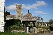 Church of St Michael |
| Church of St Michael | Lesnewth | Parish church | Probably Norman | 17 December 1962 | SX1307690304 50°40′56″N 4°38′50″W / 50.682293°N 4.647331°W |
1327721 | |
| Church of St Michael | Newquay | Church | 1909–11 | 24 October 1951 | SW8112361528 50°24′46″N 5°04′55″W / 50.412746°N 5.082076°W |
1144109 | 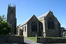 Church of St Michael |
| Church of St Michael | Porthilly, St Minver Lowlands | Church | Early 12th century | 6 June 1969 | SW9368775367 50°32′30″N 4°54′47″W / 50.541588°N 4.913122°W |
1124714 | 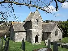 Church of St Michael |
| Church of St Michael | Trewen | Church | 15th century | 22 November 1960 | SX2519683560 50°37′32″N 4°28′22″W / 50.625472°N 4.47276°W |
1263226 | 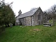 Church of St Michael |
| Church of St Moren | Lamorran, St. Michael Penkevil | Church | 15th century | 30 May 1967 | SW8786041774 50°14′16″N 4°58′35″W / 50.237806°N 4.976279°W |
1328931 | 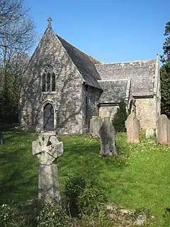 Church of St Moren |
| Belfry of Church of St Moren | Lamorran, St. Michael Penkevil | Bell tower | Possibly 16th–17th century | 27 November 1985 | SW8783841756 50°14′15″N 4°58′36″W / 50.237636°N 4.976577°W |
1141056 | Upload Photo |
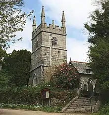
| Church of St Newlyna | Churchtown, St. Newlyn East | Anglican church | Late 12th–mid-13th century | 30 May 1967 | SW8289156349 50°22′01″N 5°03′15″W / 50.366893°N 5.054237°W |
1137190 | 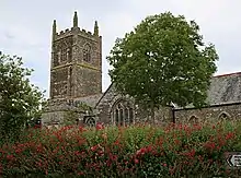 Church of St Newlyna |
| Church of St Nicholas | West Looe, Looe | Parish church | 12th or 13th century | 19 March 1951 | SX2540253201 50°21′10″N 4°27′20″W / 50.352767°N 4.455662°W |
1201132 | 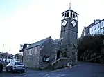 Church of St Nicholas |
| Church of St Nicholas | Tresmeer Churchtown, Tresmeer | Parish church | Late 15th century | 22 November 1960 | SX2335587485 50°39′37″N 4°30′02″W / 50.66018°N 4.500634°W |
1161299 | 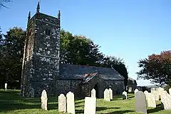 Church of St Nicholas |
| Church of St Peter | Mevagissey | Church | Perhaps 12th century | 28 November 1950 | SX0125745248 50°16′25″N 4°47′26″W / 50.27367°N 4.790475°W |
1210661 | .jpg.webp) Church of St Peter |
| Church of St Petroc | Trevalga | Parish church | Partly rebuilt 13th century | 17 December 1962 | SX0810990032 50°40′42″N 4°43′03″W / 50.678233°N 4.717416°W |
1223574 | .jpg.webp) Church of St Petroc |
| Church of St Philip and St James | Maryfield, Antony | Parish church | 1863–65 | 23 January 1968 | SX4238956125 50°23′02″N 4°13′06″W / 50.383839°N 4.218302°W |
1329073 | 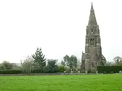 Church of St Philip and St James |
| Church of St Phillack (St Felicitas) | Phillack, Hayle | Parish church | 15th century | 14 January 1988 | SW5653538421 50°11′44″N 5°24′45″W / 50.195632°N 5.412638°W |
1160143 | |
| Church of St Rumon | Ruan Minor, Grade-Ruan | Parish church | 13th century | 10 July 1957 | SW7210015224 49°59′37″N 5°10′52″W / 49.993528°N 5.181085°W |
1141916 | 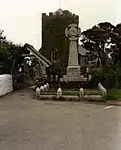 Church of St Rumon |
| Church of St Symphorian | Forrabury, Forrabury and Minster | Parish church | Norman | 17 December 1962 | SX0957390895 50°41′11″N 4°41′50″W / 50.686466°N 4.697164°W |
1143467 | |
| Church of St Terminus | St Erney, Landrake with St. Erney | Parish church | Late 13th century | 23 January 1968 | SX3710259048 50°24′31″N 4°17′38″W / 50.408664°N 4.293875°W |
1158530 | 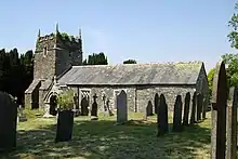 Church of St Terminus |
| Church of St Thomas by Launceston | St Thomas, Launceston | Church | 1482 | 27 February 1950 | SX3279385062 50°38′28″N 4°21′58″W / 50.641197°N 4.36613°W |
1196004 | 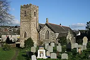 Church of St Thomas by Launceston |
| Church of St Werburgha | Warbstow | Parish church | 15th century | 22 November 1960 | SX2053590344 50°41′06″N 4°32′31″W / 50.685002°N 4.541879°W |
1161531 | |
| Church of the Holy Name | Boyton | Parish church | 14th century | 22 November 1960 | SX3200292047 50°42′13″N 4°22′50″W / 50.703729°N 4.380481°W |
1142944 | .jpg.webp) Church of the Holy Name |
| Churchtown | Botusfleming | Farmhouse | Late 16th/early 17th century | 23 January 1968 | SX4035161284 50°25′47″N 4°14′57″W / 50.429649°N 4.24914°W |
1312100 | Upload Photo |
| Churchyard Cross immediately south-east of Church | Saltash | Cross | 15th century | 22 November 1982 | SX4168958325 50°24′12″N 4°13′45″W / 50.403421°N 4.229068°W |
1329256 | Upload Photo |
| Chyrond | Veryan | House | c.1820 | 30 May 1967 | SW9150839419 50°13′05″N 4°55′26″W / 50.217952°N 4.923898°W |
1219588 | 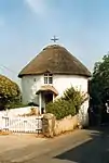 Chyrond |
| Chyverton House | Chyverton, Perranzabuloe | Country house | c.Early–mid-18th century | 28 February 1952 | SW7968551132 50°19′08″N 5°05′46″W / 50.318852°N 5.096198°W |
1141551 | Upload Photo |
| Cliff Cottage and Step Cottage | Gorran Haven, St. Goran | House | c.mid-17th century | 10 February 1988 | SX0129141588 50°14′27″N 4°47′17″W / 50.240804°N 4.788078°W |
1327045 | Upload Photo |
| Clock tower and adjoining building about 15m south-west of Calenick House | Calenick, Kea | Clock tower | c.1750 | 12 March 1986 | SW8207743168 50°14′54″N 5°03′29″W / 50.24822°N 5.058057°W |
1159675 | 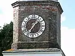 Clock tower and adjoining building about 15m south-west of Calenick House |
| Clock tower and attached steps, Treworgey | Liskeard | Clock tower | 1733 | 22 July 1981 | SX2403366552 50°28′20″N 4°28′52″W / 50.472314°N 4.481148°W |
1206020 | Upload Photo |
| Clocktower with stable yard and office yard adjoining Tregothnan to the north-east | Tregothnan Park, St. Michael Penkevil | Clock tower | 18th century | 27 November 1985 | SW8570141626 50°14′09″N 5°00′23″W / 50.235697°N 5.006428°W |
1141070 | Upload Photo |
| Coach house and stabling about 20m north of the Home Farmhouse and including courtyard wall and gate-piers to front (south-east) | Kea | House | c.Early 19th century | 30 May 1967 | SW8039742241 50°14′21″N 5°04′52″W / 50.239273°N 5.081049°W |
1159480 | Upload Photo |
| Coach house with attached screen walls, gateway and retaining walls attached to south-east of Lanhydrock House | Lanhydrock Park, Lanhydrock | Coach house | 1857 | 15 April 1988 | SX0859063561 50°26′26″N 4°41′49″W / 50.440605°N 4.697001°W |
1143089 | 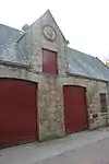 Coach house with attached screen walls, gateway and retaining walls attached to south-east of Lanhydrock House |
| Codda Farmhouse and attached shippon, wall and pigsty | Altarnun | Farmhouse | 17th century or earlier | 23 November 1988 | SX1800378395 50°34′37″N 4°34′19″W / 50.576869°N 4.571816°W |
1142823 | Upload Photo |
| Community Centre to north-west of Church of St Tetha | St. Teath | Church house | c.16th century | 13 January 1988 | SX0637880613 50°35′35″N 4°44′13″W / 50.593053°N 4.736965°W |
1158789 | Upload Photo |
| Compressor house, chimney, whim engine house and electricity substation at Robinsons Shaft, South Crofty Mine | Carn Brea | Whim house | 1908 | 27 October 1999 | SW6674641280 50°13′31″N 5°16′18″W / 50.225415°N 5.271577°W |
1379231 | 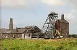 Compressor house, chimney, whim engine house and electricity substation at Robinsons Shaft, South Crofty Mine |
| Coombe Mill | Coombe, Bude | Watermill | 1842 | 29 September 1961 | SS2099711708 50°52′37″N 4°32′45″W / 50.877073°N 4.545753°W |
1141812 | 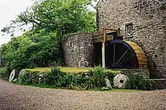 Coombe Mill |
| Cordys Close | Mylor | Chapel | c.Late 18th century | 30 May 1967 | SW7893338245 50°12′10″N 5°05′57″W / 50.202842°N 5.09922°W |
1141659 | Upload Photo |
| Count house and attached smith's shop at King Edward Mine | Camborne | Counting house | Late 19th century | 12 September 1989 | SW6631938929 50°12′15″N 5°16′34″W / 50.204137°N 5.276106°W |
1142685 | Upload Photo |
| Court Barton Farmhouse | Lanreath | Farmhouse | c.1612 | 27 August 1952 | SX1815656795 50°22′58″N 4°33′33″W / 50.382862°N 4.55915°W |
1137024 | Upload Photo |
| Courtyard walls and gateway attached to front of Rialton Manor | Colan | Gate | 15th century | 12 May 1988 | SW8477362221 50°25′13″N 5°01′52″W / 50.420318°N 5.031177°W |
1144179 | Upload Photo |
| Courtyard walls attached to south and east of Medros Farmhouse and Methrose Farmhouse, and font in courtyard | Luxulyan | Walls | Mid-17th century | 28 August 1987 | SX0506156303 50°22′27″N 4°44′34″W / 50.374246°N 4.74287°W |
1311637 | Upload Photo |
| Creekvean and attached entrance bridge and walls to road | Feock | House | 1964–67 | 15 July 1998 | SW8267838668 50°12′29″N 5°02′49″W / 50.208029°N 5.047061°W |
1375676 | 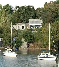 Creekvean and attached entrance bridge and walls to road |
| Croan | Egloshayle | House | 1696 | 6 June 1969 | SX0296271598 50°30′39″N 4°46′49″W / 50.510934°N 4.780398°W |
1159175 | Upload Photo |
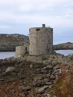
| Cromwell's Castle | Tresco, Isles of Scilly | Gun tower | 1651–52 | 14 December 1992 | SV8818115968 49°57′44″N 6°20′58″W / 49.962245°N 6.349466°W |
1141198 | |
| Cross 1m north of Church of Saint Wenappa | Gwennap | Cross | c.13th century | 3 February 1986 | SW7387740113 50°13′04″N 5°10′16″W / 50.217706°N 5.17107°W |
1136478 | Upload Photo |
| Cross 2.3m to south of south porch of Church of Lanteglos by Fowey | Lanteglos | Cross | c.13th century | 21 August 1964 | SX1447451510 50°20′03″N 4°36′30″W / 50.334231°N 4.608279°W |
1140332 | .jpg.webp) Cross 2.3m to south of south porch of Church of Lanteglos by Fowey |
| Cross adjacent to south-east corner of Church of St Martin | Liskeard | Preaching cross | Possibly pre-Conquest | 22 July 1981 | SX2542664392 50°27′12″N 4°27′38″W / 50.453324°N 4.460529°W |
1203163 | .jpg.webp) Cross adjacent to south-east corner of Church of St Martin |
| Cross about 12m south of south transept of Church of Saint Corentin | Cury | Cross | Medieval | 22 June 1987 | SW6777221262 50°02′46″N 5°14′42″W / 50.046075°N 5.245023°W |
1141758 | 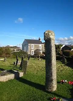 Cross about 12m south of south transept of Church of Saint Corentin |
| Cross about 1 metre south of Church of St Credan | Sancreed | Cross | Pre-Conquest | 15 December 1988 | SW4202329345 50°06′29″N 5°36′34″W / 50.108023°N 5.60941°W |
1311523 | Upload Photo |
| Cross about 2m south of sacristy of Church of Saint Mylor | Mylor Churchtown, Mylor | Cross | Medieval | 30 May 1967 | SW8202635233 50°10′37″N 5°03′15″W / 50.17694°N 5.054215°W |
1310590 | Upload Photo |
| Cross about 10m south of Church of St Credan | Sancreed | Cross | Pre-Conquest | 15 December 1988 | SW4202329336 50°06′29″N 5°36′34″W / 50.107942°N 5.609403°W |
1143823 |  Cross about 10m south of Church of St Credan |
| Cross in the churchyard about 2m east of chancel of Church of St Mawgan | St Mawgan, Mawgan-in-Pydar | Cross | Pre-Conquest or medieval | 12 May 1988 | SW8724565945 50°27′17″N 4°59′55″W / 50.454664°N 4.998543°W |
1144129 | Upload Photo |
| Cross in the churchyard about 3m south of south porch of Church of St Sidwell and St Gulval | Laneast | Cross | Pre-Conquest | 23 November 1988 | SX2279083978 50°37′43″N 4°30′25″W / 50.628501°N 4.506942°W |
1311185 | 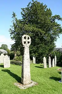 Cross in the churchyard about 3m south of south porch of Church of St Sidwell and St Gulval |
| Cross in the churchyard about 4m south of south porch of Church of St Meubred | Cardinham | Cross | 10th century | 6 June 1969 | SX1230268683 50°29′16″N 4°38′50″W / 50.487818°N 4.647354°W |
1143116 | 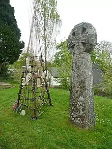 Cross in the churchyard about 4m south of south porch of Church of St Meubred |
| Cross in the churchyard about 5m west of tower of Church of St Nivet | Lanivet | Cross | Probably Pre-Conquest | 6 June 1969 | SX0391864210 50°26′42″N 4°45′47″W / 50.444892°N 4.763056°W |
1143069 | 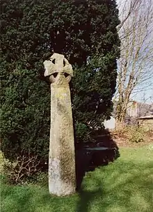 Cross in the churchyard about 5m west of tower of Church of St Nivet |
| Cross near south-east corner of St Michael's Mount | St. Michael's Mount | Cross | Medieval | 9 October 1987 | SW5144029813 50°06′58″N 5°28′42″W / 50.116241°N 5.47827°W |
1327556 | Upload Photo |
| Cross south-east of Pendean House (Pendean House not included) | Liskeard | Preaching cross | Possibly pre-Conquest | 15 November 1993 | SX2487464614 50°27′19″N 4°28′06″W / 50.455154°N 4.468401°W |
1203204 | Upload Photo |
| Cross to south of Church of St Hugo | Quethiock | Cross | Hiberno-Saxon | 23 January 1968 | SX3129764716 50°27′29″N 4°22′41″W / 50.457954°N 4.378049°W |
1329439 | 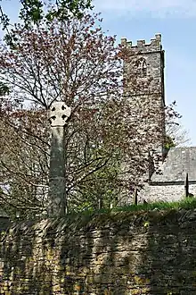 Cross to south of Church of St Hugo |
| Crugsillick | Veryan | Country house | 17th century | 30 May 1967 | SW9034239362 50°13′01″N 4°56′25″W / 50.217028°N 4.940188°W |
1219187 | Upload Photo |
| Cusgarne House | Gwennap | Farmhouse | Probably 17th century | 3 February 1986 | SW7589740799 50°13′29″N 5°08′36″W / 50.224635°N 5.143204°W |
1140915 | Upload Photo |
| Cusgarne Manor Farmhouse and mounting block to rear | Gwennap | Farmhouse | 17th century | 14 February 1985 | SW7542040735 50°13′26″N 5°08′59″W / 50.223879°N 5.149843°W |
1140913 | Upload Photo |
| Custom House and rear courtyard walls | Falmouth | House | 1814 | 23 January 1973 | SW8109532527 50°09′08″N 5°03′56″W / 50.152295°N 5.065678°W |
1270122 |  Custom House and rear courtyard walls |
| Custom House Quay and King Charles Quay, North Quay, quay walls and steps | Falmouth | Quay | 1670 | 10 September 1968 | SW8114232586 50°09′10″N 5°03′54″W / 50.152842°N 5.065055°W |
1269983 |  Custom House Quay and King Charles Quay, North Quay, quay walls and steps |
| Cutcrew Sawmills | St. Germans | Corn mill | Late 18th century | 9 October 1987 | SX3378160123 50°25′03″N 4°20′28″W / 50.417392°N 4.341048°W |
1158656 | .jpg.webp) Cutcrew Sawmills |
| Dairy and Grotto | Prideaux Place, Padstow | Dairy | Early 19th century | 20 May 1988 | SW9133375623 50°32′35″N 4°56′47″W / 50.543052°N 4.946442°W |
1212134 | Upload Photo |
| Dockacre House and attached road frontage walls | Launceston | House | 16th and 17th century | 27 February 1950 | SX3331484628 50°38′15″N 4°21′31″W / 50.637447°N 4.358573°W |
1195976 | Upload Photo |
| Dovecot about 60m north of Antony House | Antony Park, Antony | Dovecote | Early 18th century | 23 January 1968 | SX4178856377 50°23′09″N 4°13′37″W / 50.385942°N 4.226855°W |
1140711 | .jpg.webp) Dovecot about 60m north of Antony House |
| Dovecote about 80m east of Cotehele House | Calstock | Dovecote | Late 16th/early 17th century | 19 October 1987 | SX4233968620 50°29′46″N 4°13′27″W / 50.49611°N 4.224264°W |
1140259 |  Dovecote about 80m east of Cotehele House |
| Dovecote immediately to north-west of Harlyn House | Harlyn House, St. Merryn | Dovecote | Probably 18th century | 20 May 1988 | SW8719475102 50°32′13″N 5°00′16″W / 50.536881°N 5.004477°W |
1212749 | Upload Photo |
| Dovecote, Tintagel Vicarage | Tintagel | Dovecote | 13th century | 17 December 1962 | SX0548488382 50°39′45″N 4°45′13″W / 50.66254°N 4.753657°W |
1143440 | Upload Photo |
| Downs (Roman Catholic Convent, part of St Michael's Hospital) | Hayle | Country house | c.1880 | 14 January 1988 | SW5556036730 50°10′48″N 5°25′31″W / 50.18005°N 5.425186°W |
1160452 | Upload Photo |
| Dressing plant attached to south side of stamps at King Edward Mine | Camborne | Dressing shed | c.1902 | 12 September 1989 | SW6638538892 50°12′14″N 5°16′31″W / 50.203831°N 5.27516°W |
1142687 |  Dressing plant attached to south side of stamps at King Edward Mine |
| Druxton Bridge | Werrington | Road bridge | 16th century | 23 August 1957 | SX3443488336 50°40′16″N 4°20′40″W / 50.671083°N 4.344408°W |
1328037 | 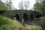 Druxton Bridge |
| Dry house and attached carpenter's shop immediately to east of Count House (etc) at King Edward Mine | Camborne | Carpenters workshop | Late 19th century | 12 September 1989 | SW6634138950 50°12′16″N 5°16′33″W / 50.204335°N 5.275811°W |
1328113 | Upload Photo |
| Dry sand shop and green sand shop | Perran Wharf, Mylor | Iron foundry | c.Early–mid-19th century | 30 May 1967 | SW7761638429 50°12′14″N 5°07′04″W / 50.204001°N 5.117754°W |
1141603 |  Dry sand shop and green sand shop |
| Duke of Cornwall's Light Infantry War Memorial | Bodmin | War memorial | 1924 | 7 January 1994 | SX0738766372 50°27′56″N 4°42′55″W / 50.465463°N 4.7153685°W |
1298217 | .jpg.webp) Duke of Cornwall's Light Infantry War Memorial |
| East Berriow | North Hill | House | Probably early 16th century | 22 November 1960 | SX2740875765 50°33′22″N 4°26′16″W / 50.556095°N 4.437895°W |
1249547 | Upload Photo |
| Ebbingford Manor | Bude, Bude-Stratton | House | Late 16th century | 5 March 1952 | SS2059805999 50°49′32″N 4°32′55″W / 50.825662°N 4.54862°W |
1328546 | Upload Photo |
| Edgcumbe House | Lostwithiel | House | 18th century | 18 October 1949 | SX1035859816 50°24′27″N 4°40′13″W / 50.407536°N 4.670237°W |
1144230 | Upload Photo |
| Eliot Terrace | St. Germans | Row | Mid-17th century | 23 January 1968 | SX3558857840 50°23′51″N 4°18′53″W / 50.397387°N 4.314634°W |
1329181 | Upload Photo |
| Engine sheds, stack and turntable | Par, St. Blaise | Engine shed | 1870s | 11 March 1974 | SX0732753722 50°21′07″N 4°42′35″W / 50.351807°N 4.709719°W |
1289905 | _railway_depot_Geograph-3206818-by-Roger-Templeman.jpg.webp) Engine sheds, stack and turntable |
| Engineers Shop | Perran Wharf, Mylor | Engineering workshop | c.Early–mid-18th century | 30 May 1967 | SW7757338408 50°12′14″N 5°07′06″W / 50.203797°N 5.118343°W |
1141643 | Upload Photo |
| Ennys Farmhouse | St. Hilary | Farmhouse | 17th century | 9 October 1987 | SW5589132693 50°08′38″N 5°25′05″W / 50.143944°N 5.41797°W |
1143739 | Upload Photo |
| Entrance gate piers and gates about 150m west of Trelowarren House | Trelowarren, Mawgan-in-Meneage | Gate piers | 1660 | 22 June 1987 | SW7187823960 50°04′19″N 5°11′22″W / 50.071891°N 5.189374°W |
1159284 |  Entrance gate piers and gates about 150m west of Trelowarren House |
| Entrance to courtyard and flanking walls to north of Radford Farmhouse | Werrington | Gate | Early 17th century | 11 February 1988 | SX3180489008 50°40′35″N 4°22′55″W / 50.676367°N 4.381899°W |
1142849 | Upload Photo |
| Erth Barton | Saltash | House | 17th century | 17 January 1952 | SX3811256334 50°23′04″N 4°16′43″W / 50.384555°N 4.278503°W |
1159153 | Upload Photo |
| Ethy House, including garden walls to north and east | St. Winnow | Country house | 18th century | 27 August 1952 | SX1334857231 50°23′07″N 4°37′37″W / 50.385271°N 4.62692°W |
1311893 | 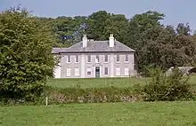 Ethy House, including garden walls to north and east |
| Flanking walls and gateway to the bridge over the moat about 8m east of the Old Rectory | St. Columb Major | Gate | 1851 | 12 May 1988 | SW9119263908 50°26′16″N 4°56′31″W / 50.437788°N 4.941882°W |
1144097 | Upload Photo |
| Footbridge | Perran Wharf, Perranarworthal | Footbridge | c.Early–mid-19th century | 30 May 1967 | SW7755338420 50°12′14″N 5°07′07″W / 50.203897°N 5.11863°W |
1160542 | Upload Photo |
| Footbridge over lane to estate yard and flanking walls forming north end of mock fortifications to north-east of Prideaux Place | Prideaux Place, Padstow | Wall | Early 19th century | 20 May 1988 | SW9140475612 50°32′35″N 4°56′44″W / 50.542979°N 4.945435°W |
1212128 | Upload Photo |
| Former offices and remains of foundry of Harvey and Company | Hayle | Foundry | Late 18th century | 29 April 1983 | SW5582237164 50°11′03″N 5°25′18″W / 50.184054°N 5.421802°W |
1143685 | 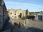 Former offices and remains of foundry of Harvey and Company |
| Former St Lawrence's Hospital | Bodmin | Apartments | 1818 | 8 June 1972 | SX0592066879 50°28′10″N 4°44′11″W / 50.469533°N 4.736277°W |
1195283 | 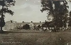 Former St Lawrence's Hospital |
| Fowey Museum | Fowey | Merchants house | 15th or 16th century | 11 March 1974 | SX1259251674 50°20′06″N 4°38′05″W / 50.335108°N 4.634776°W |
1210657 |  Fowey Museum |
| Frenchman's Creek | Fowey | Exchange | 15th century | 11 March 1974 | SX1262251661 50°20′06″N 4°38′04″W / 50.335001°N 4.634348°W |
1210654 | Upload Photo |
| Friends' Meeting House | Marazion | Friends meeting house | c.1688 | 9 October 1987 | SW5184930701 50°07′28″N 5°28′23″W / 50.124384°N 5.473138°W |
1143785 | 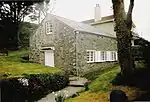 Friends' Meeting House |
| Froxton Farmhouse and Froxton | Whitstone | House | 15th century core | 12 October 1984 | SX2567699806 50°46′18″N 4°28′25″W / 50.771575°N 4.473652°W |
1142424 | Upload Photo |
| Garden feature at south end of south terrace of Prideaux Place | Prideaux Place, Padstow | Wall | 1740 | 20 May 1988 | SW9139075453 50°32′30″N 4°56′44″W / 50.541546°N 4.945544°W |
1212203 | Upload Photo |
| Garden railings and gate piers to Eagle House Hotel | Launceston | Gate | 1764 | 13 September 1972 | SX3305084699 50°38′17″N 4°21′44″W / 50.638009°N 4.362335°W |
1280373 | 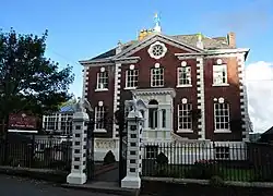 Garden railings and gate piers to Eagle House Hotel |
| Garden temple to south-west of Prideaux Place | Prideaux Place, Padstow | Garden temple | 1738–39 | 20 May 1988 | SW9131075540 50°32′32″N 4°56′48″W / 50.542298°N 4.94672°W |
1212199 | .jpg.webp) Garden temple to south-west of Prideaux Place |
| Garden walls and gate piers attached to right and rear left of Bank House | St Columb Major | Gate | 1857 | 12 May 1988 | SW9135863620 50°26′07″N 4°56′22″W / 50.43526°N 4.939388°W |
1138191 | Upload Photo |
| Garden walls and ramp to north-east of Keveral Barton | St. Martin-by-Looe | Wall | 16th century | 18 December 1985 | SX2976955184 50°22′19″N 4°23′43″W / 50.371864°N 4.39523°W |
1329342 | Upload Photo |
| Garlenick | Grampound with Creed | House | 1812 | 10 February 1967 | SW9443050198 50°18′57″N 4°53′20″W / 50.315792°N 4.888851°W |
1327444 | 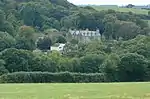 Garlenick |
| Gate piers and courtyard wall adjoining Truthall and Truthall House | Sithney | Gate pier | 17th century | 10 July 1957 | SW6547030200 50°07′32″N 5°16′57″W / 50.125426°N 5.282604°W |
1310274 | Upload Photo |
| Gate piers and flanking walls about 200m north of Bochym Manor House | Cury | Gate pier | Probably c.1699 | 10 July 1957 | SW6906721039 50°02′40″N 5°13′37″W / 50.044577°N 5.226831°W |
1141753 |  Gate piers and flanking walls about 200m north of Bochym Manor House |
| Gate piers and flanking walls at road entrance about 200m WNW of Trewoon | Budock | Gate pier | Late 17th century | 10 July 1957 | SW7598731299 50°08′22″N 5°08′11″W / 50.139359°N 5.136348°W |
1236947 | Upload Photo |
| Gate piers and gates west of Roskruge Barton Farmhouse and adjoining garden walls | St. Anthony-in-Meneage | Gate pier | c.Late 17th century | 22 June 1987 | SW7753823562 50°04′14″N 5°06′37″W / 50.070462°N 5.110169°W |
1328594 | Upload Photo |
| Gate piers about 10m south-east of Trewoon Manor House | Trewoon, Budock | Gate pier | Late 17th century | 10 July 1957 | SW7624831201 50°08′19″N 5°07′58″W / 50.138578°N 5.132643°W |
1142696 | Upload Photo |
| Gate piers at the south-west entrance to Penmellyn | St. Columb Major | Gate pier | c.1855 | 12 May 1988 | SW9140163775 50°26′12″N 4°56′20″W / 50.436668°N 4.938869°W |
1137996 | Upload Photo |
| Gate piers, gates, flanking walls and railings | Budock | Gate pier | Early 18th century | 10 July 1957 | SW7829330063 50°07′45″N 5°06′12″W / 50.129126°N 5.103408°W |
1146499 | Upload Photo |
| Gatehouse and barn about 3m east of Marsland Manor and walls between gatehouse and east front of Marsland Manor | Marsland Manor, Morwenstow | Gatehouse | Late 17th century | 9 September 1985 | SS2170416767 50°55′22″N 4°32′17″W / 50.922739°N 4.538186°W |
1278377 | Upload Photo |
| Gatehouse Cottage | Hugh Town, St. Mary's, Isles of Scilly | House | Late 16th/early 17th century | 12 February 1975 | SV9006510642 49°54′56″N 6°19′08″W / 49.915461°N 6.318993°W |
1218853 | Upload Photo |
| Gate piers and walls to north-west of Penhelae Manor | Penheale, Egloskerry | Gate pier | 19th century | 11 January 1989 | SX2681888043 50°39′58″N 4°27′07″W / 50.666234°N 4.451947°W |
1142959 | Upload Photo |
| Gates, gate piers, walls and railings to front (east) of Treludick | Egloskerry | Gate | 18th century | 11 January 1989 | SX2540388125 50°40′00″N 4°28′19″W / 50.666548°N 4.471989°W |
1159988 | Upload Photo |
| Gates, railings, screen walls and attached garden wall to Marlborough House | Falmouth | Gate | Early 19th century | 23 January 1973 | SW7994931967 50°08′49″N 5°04′53″W / 50.146842°N 5.081372°W |
1270003 | Upload Photo |
| Gear and Kerrow Farmhouse | St. Erth | Farmhouse | Early 18th century | 14 January 1988 | SW5785434402 50°09′36″N 5°23′30″W / 50.160092°N 5.391633°W |
1143635 | Upload Photo |
| Glanmor House | Hayle | House | c.1862 | 14 January 1988 | SW5551036579 50°10′43″N 5°25′33″W / 50.178673°N 5.425788°W |
1327660 | Upload Photo |
| Glynn House | Glynn, Cardinham | House | Mid–late 18th century | 15 June 1951 | SX1134164944 50°27′14″N 4°39′32″W / 50.45392°N 4.658999°W |
1143108 | Upload Photo |
| Golden Manor | Probus | Manor house | c.1520 | 28 February 1952 | SW9204546847 50°17′05″N 4°55′14″W / 50.284857°N 4.92046°W |
1141132 | 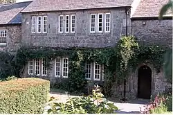 Golden Manor |
| Goonvean China Clay Works: engine house with boiler-house and detached chimney | St. Stephen-in-Brannel | Boiler house | 1910 | 20 December 1988 | SW9496655284 50°21′42″N 4°53′03″W / 50.36166°N 4.884099°W |
1136944 | 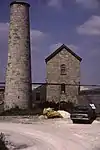 Goonvean China Clay Works: engine house with boiler-house and detached chimney |
| Greystone Farmhouse | Greystone, Lezant | Farmhouse | 15th century | 11 May 1989 | SX3626179958 50°35′47″N 4°18′54″W / 50.59632°N 4.314873°W |
1291535 | Upload Photo |
| Guard house, boundary wall and attached ancillary buildings, Maker Heights Barracks | Maker-with-Rame | Wash house | 1804–08 | 26 January 1987 | SX4352851370 50°20′29″N 4°12′01″W / 50.341412°N 4.200316°W |
1329099 | Upload Photo |
| Guildhall | Market Place, Helston | Guildhall | 1839 | 22 May 1972 | SW6593427471 50°06′04″N 5°16′28″W / 50.101106°N 5.27445°W |
1196492 | |
| Guildhall | Liskeard | County court | 1858 | 22 July 1981 | SX2520364561 50°27′17″N 4°27′49″W / 50.454776°N 4.463746°W |
1206610 | |
| Gun battery NNW of St Michael's Mount | St. Michael's Mount | Battery | 17th century | 9 October 1987 | SW5139829861 50°07′00″N 5°28′44″W / 50.116655°N 5.478888°W |
1143756 | 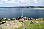 Gun battery NNW of St Michael's Mount |
| Gun battery west of St Michael's Mount | St. Michael's Mount | Battery | 17th century | 9 October 1987 | SW5139829822 50°06′59″N 5°28′44″W / 50.116305°N 5.478862°W |
1327572 | 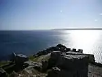 Gun battery west of St Michael's Mount |
| Gwennap Pit | Busveal, St. Day | Mine shaft | 1762 | 12 September 1989 | SW7171741761 50°13′54″N 5°12′08″W / 50.231674°N 5.20229°W |
1309719 |
.jpg.webp)
.jpg.webp)
_Geograph-3173033-by-Edmund-Gooch.jpg.webp)
.jpg.webp)


See also
Notes
- ↑ The date given is the date used by Historic England as significant for the initial building or that of an important part in the structure's description.
- ↑ Sometimes known as OSGB36, the grid reference is based on the British national grid reference system used by the Ordnance Survey.
- ↑ The "List Entry Number" is a unique number assigned to each listed building and scheduled monument by Historic England.
External links
![]() Media related to Grade II* listed buildings in Cornwall at Wikimedia Commons
Media related to Grade II* listed buildings in Cornwall at Wikimedia Commons
This article is issued from Wikipedia. The text is licensed under Creative Commons - Attribution - Sharealike. Additional terms may apply for the media files.