Beyren-lès-Sierck | |
|---|---|
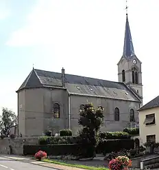 The church in Beyren-lès-Sierck | |
.svg.png.webp) Coat of arms | |
Location of Beyren-lès-Sierck | |
 Beyren-lès-Sierck  Beyren-lès-Sierck | |
| Coordinates: 49°28′19″N 6°17′16″E / 49.4719°N 6.2878°E | |
| Country | France |
| Region | Grand Est |
| Department | Moselle |
| Arrondissement | Thionville |
| Canton | Yutz |
| Intercommunality | Cattenom et environs |
| Government | |
| • Mayor (2020–2026) | Philippe Gaillot[1] |
| Area 1 | 9.28 km2 (3.58 sq mi) |
| Population | 504 |
| • Density | 54/km2 (140/sq mi) |
| Time zone | UTC+01:00 (CET) |
| • Summer (DST) | UTC+02:00 (CEST) |
| INSEE/Postal code | 57076 /57570 |
| Elevation | 154–268 m (505–879 ft) (avg. 162 m or 531 ft) |
| 1 French Land Register data, which excludes lakes, ponds, glaciers > 1 km2 (0.386 sq mi or 247 acres) and river estuaries. | |
Beyren-lès-Sierck (German: Beiern) is a commune in the Moselle department in Grand Est in northeastern France.
The locality of Gandren (German: Gandern) is incorporated in the commune since 1812.
Population
| Year | Pop. | ±% p.a. |
|---|---|---|
| 1968 | 307 | — |
| 1975 | 308 | +0.05% |
| 1982 | 353 | +1.97% |
| 1990 | 430 | +2.50% |
| 1999 | 426 | −0.10% |
| 2009 | 472 | +1.03% |
| 2014 | 537 | +2.61% |
| 2020 | 512 | −0.79% |
| Source: INSEE[3] | ||
See also
References
- ↑ "Répertoire national des élus: les maires". data.gouv.fr, Plateforme ouverte des données publiques françaises (in French). 2 December 2020.
- ↑ "Populations légales 2021". The National Institute of Statistics and Economic Studies. 28 December 2023.
- ↑ Population en historique depuis 1968, INSEE
External links
 Media related to Beyren-lès-Sierck at Wikimedia Commons
This article is issued from Wikipedia. The text is licensed under Creative Commons - Attribution - Sharealike. Additional terms may apply for the media files.