Zenting
Zenting is a municipality in the Freyung-Grafenau district in Bavaria in Germany.
Zenting | |
|---|---|
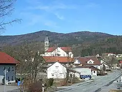 View of Zenting. Behind: the Aschenstein (l) and the Geißlstein | |
 Coat of arms | |
Location of Zenting within Freyung-Grafenau district 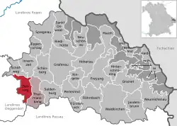 | |
 Zenting  Zenting | |
| Coordinates: 48°48′N 13°16′E | |
| Country | Germany |
| State | Bavaria |
| Admin. region | Niederbayern |
| District | Freyung-Grafenau |
| Municipal assoc. | Thurmansbang |
| Government | |
| • Mayor (2020–26) | Dirk Rohowski[1] (FW) |
| Area | |
| • Total | 21.74 km2 (8.39 sq mi) |
| Elevation | 450 m (1,480 ft) |
| Population (2022-12-31)[2] | |
| • Total | 1,115 |
| • Density | 51/km2 (130/sq mi) |
| Time zone | UTC+01:00 (CET) |
| • Summer (DST) | UTC+02:00 (CEST) |
| Postal codes | 94579 |
| Dialling codes | 09907 |
| Vehicle registration | FRG |
| Website | www.zenting.de |
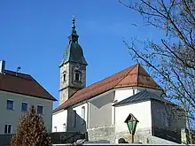
The parish church of Zenting
Place
The municipality is in the Danube Forest (Donau-Wald) in the middle of the Bavarian Forest. The village is near the Austrian and Czech borders. The Brotjacklriegel (1,016 m) and Aschenstein (945 m) mountains are to the north. Zenting is around 35 km NW of Passau, 13 km from Tittling, 18 km SW of Grafenau, 26 km N of Vilshofen an der Donau and 15 km from the A 3 (Iggensbach exit).
References
- Liste der ersten Bürgermeister/Oberbürgermeister in kreisangehörigen Gemeinden, Bayerisches Landesamt für Statistik, 15 July 2021.
- Genesis Online-Datenbank des Bayerischen Landesamtes für Statistik Tabelle 12411-003r Fortschreibung des Bevölkerungsstandes: Gemeinden, Stichtag (Einwohnerzahlen auf Grundlage des Zensus 2011) .
Towns and municipalities in Freyung-Grafenau | ||
|---|---|---|
This article is issued from Wikipedia. The text is licensed under Creative Commons - Attribution - Sharealike. Additional terms may apply for the media files.