Haidmühle
Haidmühle is a municipality in the district of Freyung-Grafenau in Bavaria in Germany.
Haidmühle | |
|---|---|
 Coat of arms | |
Location of Haidmühle within Freyung-Grafenau district 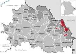 | |
 Haidmühle  Haidmühle | |
| Coordinates: 48°49′36″N 13°46′31″E | |
| Country | Germany |
| State | Bavaria |
| Admin. region | Niederbayern |
| District | Freyung-Grafenau |
| Government | |
| • Mayor (2020–26) | Heinz Scheibenzuber[1] |
| Area | |
| • Total | 21.03 km2 (8.12 sq mi) |
| Elevation | 831 m (2,726 ft) |
| Population (2022-12-31)[2] | |
| • Total | 1,373 |
| • Density | 65/km2 (170/sq mi) |
| Time zone | UTC+01:00 (CET) |
| • Summer (DST) | UTC+02:00 (CEST) |
| Postal codes | 94145 |
| Dialling codes | 08556 |
| Vehicle registration | FRG |
| Website | www.gde-haidmuehle.de |
Geography
Geographical place
The community is in the Donau-Wald on the Kalte Moldau in the Bavarian Forest, on the border with the Czech Republic. Haidmühle is 25 km from Freyung, 24 km from Waldkirchen, and 20 km from the border with Austria.
A few meters away from the village is the border crossing Nové Údolí (Neuthal) to Stožec, which is open to pedestrians and cyclists.
Haidmühle was formerly a railway border station, connected by the Waldkirchen–Haidmühle railway to Waldkirchen and Passau, and by the Číčenice–Haidmühle railway to Volary and Prachatice. The section in the Czech Republic is still in use. Part of the route is a museum train Pošumavská jižní dráha in operation.
Constituent Communities
The municipality contains of the following districts:
- Auersbergsreut
- Bischofsreut
- Frauenberg
- Haberau
- Haidmühle
- Langreut
- Leopoldsreut
- Ludwigsreut
- Marchhäuser
- Raumreut
- Schnellenzipf
- Schwarzthal
- Theresienreut
There are the following districts: Bischofsreut, Philippsreut, Frauenberg.
References
- Liste der ersten Bürgermeister/Oberbürgermeister in kreisangehörigen Gemeinden, Bayerisches Landesamt für Statistik, 15 July 2021.
- Genesis Online-Datenbank des Bayerischen Landesamtes für Statistik Tabelle 12411-003r Fortschreibung des Bevölkerungsstandes: Gemeinden, Stichtag (Einwohnerzahlen auf Grundlage des Zensus 2011) .
Towns and municipalities in Freyung-Grafenau | ||
|---|---|---|