Walla Walla County, Washington
Walla Walla County is a county located in the U.S. state of Washington. As of the 2020 census, its population was 62,584.[1] The county seat and largest city is Walla Walla.[2]
Walla Walla County | |
|---|---|
 Joso Bridge over the Snake River | |
 Location within the U.S. state of Washington | |
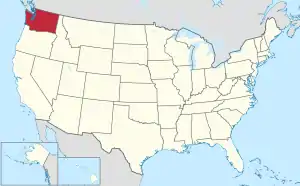 Washington's location within the U.S. | |
| Coordinates: 46°14′N 118°29′W | |
| Country | |
| State | |
| Founded | April 25, 1854 |
| Named for | Walla Walla people |
| Seat | Walla Walla |
| Largest city | Walla Walla |
| Area | |
| • Total | 1,299 sq mi (3,360 km2) |
| • Land | 1,270 sq mi (3,300 km2) |
| • Water | 29 sq mi (80 km2) 2.2% |
| Population (2020) | |
| • Total | 62,584 |
| • Density | 46/sq mi (17.8/km2) |
| Time zone | UTC−8 (Pacific) |
| • Summer (DST) | UTC−7 (PDT) |
| Congressional district | 5th |
| Website | www |
References
- "QuickFacts: Walla Walla County, Washington". United States Census Bureau. Retrieved January 20, 2024.
- "Find a County". National Association of Counties. Retrieved 2011-06-07.
State of Washington | |||||||
|---|---|---|---|---|---|---|---|
Olympia (capital) | |||||||
| Topics |
|  | |||||
| Politics |
| ||||||
| Regions |
| ||||||
| Largest cities |
| ||||||
| Counties |
| ||||||
This article is issued from Wikipedia. The text is licensed under Creative Commons - Attribution - Sharealike. Additional terms may apply for the media files.