Stevens County, Washington
Stevens County is a county in Washington in the United States. It is along the Canada–US border. The county seat is Colville.[1] At the 2020 census, 46,445 people lived there.[2]
Stevens County | |
|---|---|
 Stevens County Courthouse in Colville | |
 Flag | |
 Location within the U.S. state of Washington | |
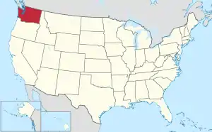 Washington's location within the U.S. | |
| Coordinates: 48°24′N 117°51′W | |
| Country | |
| State | |
| Founded | January 20, 1863 |
| Named for | Isaac Stevens |
| Seat | Colville |
| Largest city | Colville |
| Area | |
| • Total | 2,541 sq mi (6,580 km2) |
| • Land | 2,478 sq mi (6,420 km2) |
| • Water | 63 sq mi (160 km2) 2.5% |
| Population (2020) | |
| • Total | 46,445 |
| • Density | 18/sq mi (7/km2) |
| Time zone | UTC−8 (Pacific) |
| • Summer (DST) | UTC−7 (PDT) |
| Congressional district | 5th |
| Website | www |
History
The county was created on January 20, 1863.[3] It is named after Isaac Stevens, the first governor of Washington Territory.
Geography
The U.S. Census Bureau says that the county has a total area of 2,541 square miles (6,580 km2). Of that 2,478 square miles (6,420 km2) is land and 63 square miles (160 km2) (2.5%) is water.[4]
Bordering counties
- Pend Oreille County – east
- Spokane County – southeast
- Lincoln County – southwest
- Ferry County – west
- Kootenay Boundary Regional District, British Columbia – northeast
- Regional District of Central Kootenay, British Columbia – north
Communities
Cities
- Chewelah
- Colville (county seat)
- Kettle Falls
Towns
- Marcus
- Northport
- Springdale
Census-designated places
- Addy
- Clayton
- Loon Lake
- Valley
Unincorporated communities
- Arden
- Bluecreek
- Cedonia
- Daisy
- Echo
- Evans
- Ford
- Fruitland
- Gifford
- Grays
- Hunters
- Marble
- Nine Mile Falls
- Rice
- Suncrest
- Tumtum (also known as Tum Tum)
- Ward
- Wellpinit
References
- National Association of Counties. "NACo County Explorer". Retrieved January 20, 2024.
- "QuickFacts: Stevens County, Washington". United States Census Bureau. Retrieved January 20, 2024.
- "Milestones for Washington State History — Part 2: 1851 to 1900". HistoryLink.org. March 6, 2003.
- "2010 Census Gazetteer Files". United States Census Bureau. August 22, 2012. Retrieved July 16, 2015.
Wikimedia Commons has media related to Stevens County, Washington.
State of Washington | |||||||
|---|---|---|---|---|---|---|---|
Olympia (capital) | |||||||
| Topics |
|  | |||||
| Politics |
| ||||||
| Regions |
| ||||||
| Largest cities |
| ||||||
| Counties |
| ||||||
This article is issued from Wikipedia. The text is licensed under Creative Commons - Attribution - Sharealike. Additional terms may apply for the media files.