U.S. Route 160
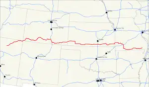
U.S. Route 160 (US 160) is a 1,465 mile (2,358 km) long east–west United States highway in the Midwestern and Western United States. The western endpoint of the route is at US 89, five miles (8 km) west of Tuba City, Arizona. The eastern endpoint is at US 67 and Missouri 158, southwest of Poplar Bluff, Missouri.
U.S. Route 160 | |
|---|---|
 | |
| Route information | |
| Auxiliary route of US 60 | |
| Length | 1,465 mi (2,358 km) |
| Existed | 1930–present |
| Major junctions | |
| West end | |
| |
| East end | |
| Location | |
| Country | United States |
| States | Arizona, New Mexico, Colorado, Kansas, Missouri |
| Highway system | |
| |

Its route was made famous in song in 1975. This is because the road from Wolf Creek Pass to Pagosa Springs, Colorado in C.W. McCall's country music song "Wolf Creek Pass".
Related routes
- U.S. Route 60
- U.S. Route 260
- U.S. Route 360
- U.S. Route 460
References
Other websites
- Endpoints of US 160
- Kansas Highway Maps: Current, Historic, KDOT
| |
Routes in italics are no longer a part of the system. Highlighted routes are considered main routes of the system. |