Simpson County, Mississippi
Simpson County is a county in the U.S. state of Mississippi. As of the 2020 census, 25,949 people lived there.[1] Its county seat is Mendenhall.[2]
Simpson County | |
|---|---|
 Simpson County courthouse in Mendenhall | |
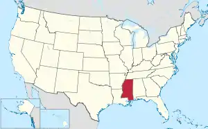
 Location within the U.S. state of Mississippi | |
 Mississippi's location within the U.S. | |
| Coordinates: 31°55′N 89°55′W | |
| Country | |
| State | |
| Founded | 1824 |
| Named for | Josiah Simpson |
| Seat | Mendenhall |
| Largest city | Magee |
| Area | |
| • Total | 590 sq mi (1,500 km2) |
| • Land | 589 sq mi (1,530 km2) |
| • Water | 1.3 sq mi (3 km2) 0.2% |
| Population (2020) | |
| • Total | 25,949 |
| • Density | 44/sq mi (17/km2) |
| Time zone | UTC−6 (Central) |
| • Summer (DST) | UTC−5 (CDT) |
| Congressional district | 3rd |
Geography
According to the U.S. Census Bureau, the county has a total area of 590 square miles (1,500 km2), of which 589 square miles (1,530 km2) is land and 1.3 square miles (3.4 km2) (0.2%) is water.[3]
Bordering counties
- Rankin County (north)
- Smith County (east)
- Covington County (southeast)
- Jefferson Davis County (south)
- Lawrence County (southwest)
- Copiah County (west)
Communities
Cities
Town
Village
Unincorporated communities
- Harrisville
- Merry Hell
- Pinola
- Sanatorium
Ghost town
- Westville
References
- "QuickFacts: Simpson County, Mississippi". United States Census Bureau. Retrieved January 4, 2024.
- "Find a County". National Association of Counties. Retrieved 2011-06-07.
- "2010 Census Gazetteer Files". United States Census Bureau. August 22, 2012. Archived from the original on September 28, 2013. Retrieved November 7, 2014.
Municipalities and communities of Simpson County, Mississippi, United States | ||
|---|---|---|
| Cities | Map of Mississippi highlighting Simpson County | |
| Town | ||
| Village | ||
| Unincorporated communities |
| |
| Ghost town | Westville | |
This article is issued from Wikipedia. The text is licensed under Creative Commons - Attribution - Sharealike. Additional terms may apply for the media files.