Jhapa District
Jhapa District (Nepali: झापा जिल्ला; ![]() Listen ) is a district of Koshi Province in eastern Nepal named after a Rajbanshi |Surjapuri language word "Jhapa" meaning "to cover" (verb). The latest official data, the 2021 Nepal Census, puts the total population of the district at 994,090.[1] The total area of the district is 1,606 square kilometres.
Listen ) is a district of Koshi Province in eastern Nepal named after a Rajbanshi |Surjapuri language word "Jhapa" meaning "to cover" (verb). The latest official data, the 2021 Nepal Census, puts the total population of the district at 994,090.[1] The total area of the district is 1,606 square kilometres.
Jhapa District
झापा जिल्ला | |
|---|---|
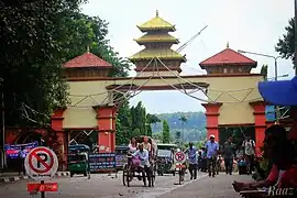 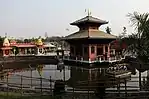 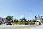  From top left to right Nepal-India Border Gate at Kakarbhitta, Arjundhara Temple, Damak City, Birtamod City | |
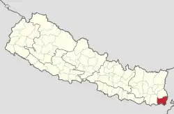 Location of Jhapa District in Nepal | |

Gauri
gunj Gauradaha
Da
mak Kamal
Jhapa District | |
| Country | |
| Province | Koshi Province |
| Headquarters | Bhadrapur |
| Area | |
| • Total | 1,606 km2 (620 sq mi) |
| Highest elevation | 8,848 m (29,029 ft) |
| Lowest elevation | 60 m (200 ft) |
| Population | |
| • Total | 994,090 |
| • Rank | 4th (Nepal) |
| • Density | 620/km2 (1,600/sq mi) |
| • Households | 219,989 |
| Demographics | |
| • Sex ratio | 92,43 ♂ /51.97% ♀ (2011) |
| Human Development Index | |
| • Per Capita Income | 1,226 USD |
| • Poverty rate | 21.82 |
| • Literacy | 75 % |
| • Life Expectancy | 67.29 |
| Main language(s) | Nepali, Rajbanshi, Surjapuri, Limbu, Maithili |
| Website | www.ddcjhapa.gov.np |
The lowlands of Limbuwan (present-day terai lands of Sunsari, Morang and Jhapa) was collectively known as Morang since the time of King Mawrong of 7th century.In the beginning of 1400 AD, Morang Kingdom patriated from Kingdom of Ilam and Kingdom of Mikluk Bodhey (Choubise) and started ruling on its own.[2]
Location
Jhapa is the easternmost district of Nepal and lies in the fertile Terai plains. It is part of the Outer Terai. Jhapa borders with Ilam in the north, Morang in the west, the Indian state of Bihar in the south and the Indian state of West Bengal to the southeast and east. Geographically, it covers an area of 1,606 km2 (620 sq mi) and lies on 87°39’ east to 88°12’ east longitude and 26°20’ north to 26°50’ north latitude.[3]
Related pages
References
- "Preliminary Report of National Population Census 2021". National Census 2021. National Statistical Office. Retrieved 6 December 2022.
- Chemjong, Iman Singh. History and Culture of Kirat People.
- District Transport Masterplan-Jhapa (PDF), retrieved May 5, 2020
Other websites
![]() Media related to Jhapa District at Wikimedia Commons
Media related to Jhapa District at Wikimedia Commons
|  | |