Santa Cruz del Seibo
Santa Cruz del Seibo, or simply El Seibo, is a Dominican city and the head municipality of the El Seibo province, in the eastern part of the country. El Seibo is also written sometimes as El Seybo.
El Seibo | |
|---|---|
Municipality | |
| Santa Cruz del Seibo | |
 Coat of arms | |
 El Seibo | |
| Coordinates: 18°46′12″N 69°2′24″W | |
| Country | |
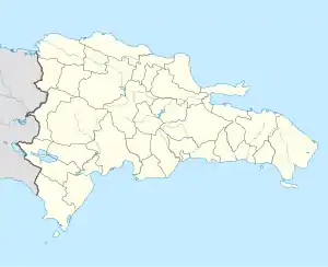
| Province | El Seibo |
| Founded | 1502 |
| Municipality since | 1844 |
| Municipal Districts | Pedro Sánchez, San Francisco-Vicentillo, Santa Lucía |
| Area | |
| • Total | 886.3 km2 (342.2 sq mi) |
| • Urban | 3.57 km2 (1.38 sq mi) |
| Elevation | 117 m (384 ft) |
| Population (2010)[1] | |
| • Total | 46,285 |
| • Density | 52/km2 (140/sq mi) |
| Time zone | UTC-4 (AST) |
| • Summer (DST) | UTC-4 (AST) |
| Distance: | 65 km (40 mi) to San Pedro de Macorís 135 km (84 mi) to Santo Domingo |
It is one of the oldest city of the Hispaniola island, founded during colonial times.
Population
The municipality had, in 2010, a total population of 46,285: 24,787 men and 21,498 women. The urban population was 57.2% of the total population.[1]
History
The town was founded on 1502 by Juan de Esquivel, a Spanish conquistador;[4] the Spanish governor of the Hispaniola at that time was Nicolás de Ovando. The original name of the town was Santa Cruz de Icayagua, also written as Hicayagua.
Geography
The municipality has a total area of 886.3 km2 (342.2 sq mi). The city is at 135 km (84 mi) to the northeast of Santo Domingo, at an elevation of 117 m (384 ft).[3]
Santa Cruz del Seibo is near, on the south side, the Cordillera Oriental (in English: "Eastern mountain range". It is located in the northeastern part of the Llano Costero del Caribe (in English, "Caribbean Coastal Plain"), a large prairie with many important savannas.
The city is near the River Soco, one of the most important river of the eastern region of the Hispaniola island.
The municipality of El Seibo has the municipality of the Miches to the north, the La Altagracia province to the east, the La Romana province to the southeast, the San Pedro de Macorís province to the southwest and the Hato Mayor province to the west.
Climate
El Seibo has a tropical monsoonal climate climate (Köppen climate classification : Am), with a dry season and a heavy monsoon the rest of year, no cold season.[5]
The average amount of rainfall for the year in the city is 1,351.5 mm (53.2 in). Most rains fall during the end of summer. The month with the most precipitation on average is October with 193.5 mm (7.6 in) of rainfall, followed by May with 185.3 mm (7.3 in).
The driest season is winter. The month with the least rainfall on average is February with an average of 50.5 mm (2.0 in) and the second is March with 57.2 mm (2.3 in).
El Seibo is in a warm region; the average temperature for the year is 25.9 °C (78.6 °F). The warmest month, on average, is August with an average temperature of 27.5 °C (81.5 °F). The coolest month on average is January, with an average temperature of 24.2 °C (75.6 °F).
| Climate data for El Seibo (1961–1990) | |||||||||||||
|---|---|---|---|---|---|---|---|---|---|---|---|---|---|
| Month | Jan | Feb | Mar | Apr | May | Jun | Jul | Aug | Sep | Oct | Nov | Dec | Year |
| Average high °C (°F) | 30.1 (86.2) |
30.5 (86.9) |
31.4 (88.5) |
31.9 (89.4) |
32.2 (90.0) |
32.9 (91.2) |
33.4 (92.1) |
33.6 (92.5) |
33.4 (92.1) |
32.8 (91.0) |
31.6 (88.9) |
30.4 (86.7) |
32.0 (89.6) |
| Daily mean °C (°F) | 24.2 (75.6) |
24.3 (75.7) |
24.9 (76.8) |
25.5 (77.9) |
26.2 (79.2) |
27.0 (80.6) |
27.4 (81.3) |
27.5 (81.5) |
27.2 (81.0) |
26.7 (80.1) |
25.6 (78.1) |
24.5 (76.1) |
25.9 (78.7) |
| Average low °C (°F) | 18.4 (65.1) |
18.1 (64.6) |
18.5 (65.3) |
19.2 (66.6) |
20.3 (68.5) |
21.0 (69.8) |
21.5 (70.7) |
21.5 (70.7) |
21.0 (69.8) |
20.7 (69.3) |
19.8 (67.6) |
18.7 (65.7) |
19.9 (67.8) |
| Average rainfall mm (inches) | 57.3 (2.26) |
50.5 (1.99) |
57.2 (2.25) |
107.5 (4.23) |
185.3 (7.30) |
108.3 (4.26) |
74.8 (2.94) |
134.1 (5.28) |
170.0 (6.69) |
193.5 (7.62) |
126.6 (4.98) |
86.4 (3.40) |
1,351.5 (53.2) |
| Source 1: NOAA[6] | |||||||||||||
| Source 2: Climatemps.com[5] | |||||||||||||
Administrative division
The municipality of Comendador has three municipal districts;[1] these are:
| Code | Municipal district | Population (2010) | Area (km2) | Density |
|---|---|---|---|---|
| 080102 | Pedro Sánchez | 4,245 | 117.1 | 36.3 |
| 080103 | San Francisco-Vicentillo | 4,524 | 200.3 | 22.6 |
| 080104 | Santa Lucía | 11,742 | 141.0 | 83.3 |
Economy
Cattle raising is the most important activity in the municipality. Sugar cane is also grown here.
References
- "IX Censo Nacional de Población y Vivienda. Informe Básico" (PDF) (in Spanish). Oficina Nacional de Estadística. June 2012. Retrieved 16 October 2016.
- "Expansión Urbana de las ciudades capitales de R.D. 1988-2010. Informe Básico" (PDF) (in Spanish). Oficina Nacional de Estadística. April 2015. p. 38. Retrieved 9 December 2016.
- De la Fuente, Santiago (1976). Geografía Dominicana (in Spanish). Santo Domingo, Dominican Republic: Editora Colegial Quisqueyana.
- Pouerié Cordero, M.M. (1997). Síntesis de ciudades, pueblos e islas del país (in Spanish). Santo Domingo, Dominican Republic: Impresora Mary.
- "El Seybo Climate & Temperature". Climatemps.com. Retrieved 17 October 2016.
- "El Seybo Climate Normals 1961-1990". National Oceanic and Atmospheric Administration. Retrieved 17 October 2016.
| Provincial capitals of the Dominican Republic | |
|---|---|
| Azua • Baní • Barahona • Bonao • Comendador • Cotuí • Dajabón • El Seibo • Hato Mayor • Higüey • Jimaní • La Romana • La Vega • Mao • Moca • Monte Cristi • Monte Plata • Nagua • Neiba • Pedernales • Puerto Plata • Sabaneta • Salcedo • Samaná • San Cristóbal • San Francisco de Macorís • San José de Ocoa • San Juan de la Maguana • San Pedro de Macorís • Santiago de los Caballeros • Santo Domingo • Santo Domingo Este | |