Randolph County, Arkansas
Randolph County is a county of the U.S. state of Arkansas. As of the 2020 census, the population was 18,571.[2] The county seat is Pocahontas.[3] It was founded on October 29, 1835.
Randolph County | |
|---|---|
 Randolph County courthouse in Pocahontas | |
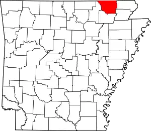 Location within the U.S. state of Arkansas | |
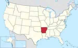 Arkansas's location within the U.S. | |
| Coordinates: 36°20′41″N 91°00′46″W | |
| Country | |
| State | |
| Founded | October 29, 1835 |
| Named for | John Randolph |
| Seat | Pocahontas |
| Largest city | Pocahontas |
| Area | |
| • Total | 656.04 sq mi (1,699.1 km2) |
| • Land | 651.83 sq mi (1,688.2 km2) |
| • Water | 4.21 sq mi (10.9 km2) 0.6% |
| Population | |
| • Total | 18,571 |
| • Density | 28/sq mi (11/km2) |
| Time zone | UTC−6 (Central) |
| • Summer (DST) | UTC−5 (CDT) |
| Website | randolphcounty |
The county is between the Ozark Mountains and Arkansas Delta.
References
- Arkansas State Highway and Transportation Department in cooperation with the U.S. Department of Transportation (2014-10-16). Arkansas County Polygons (SHP file) (Map). Arkansas GIS Office. Retrieved January 1, 2017.
- "QuickFacts: Randolph County, Arkansas". United States Census Bureau. Retrieved August 8, 2023.
- "Find a County". National Association of Counties. Archived from the original on 2011-05-31. Retrieved 2011-06-07.
Municipalities and communities of Randolph County, Arkansas, United States | ||
|---|---|---|
| Cities | Map of Arkansas highlighting Randolph County | |
| Towns | ||
| Townships |
| |
| CDP |
| |
| Other unincorporated communities |
| |
| Ghost town |
| |
Little Rock (capital) | ||
| Topics |
| |
| Regions | ||
| Metros | ||
| Largest cities | ||
| Counties |
| |

This article is issued from Wikipedia. The text is licensed under Creative Commons - Attribution - Sharealike. Additional terms may apply for the media files.