Obertraubling
Obertraubling is a municipality in Bavaria, Upper Palatinate (German: Oberpfalz), in Regensburg.
Obertraubling | |
|---|---|
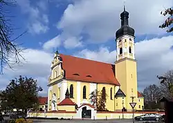 Church of Saint George | |
 Coat of arms | |
Location of Obertraubling within Regensburg district 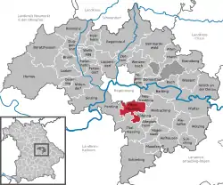 | |
 Obertraubling  Obertraubling | |
| Coordinates: 48°57′57″N 12°10′01″E | |
| Country | Germany |
| State | Bavaria |
| Admin. region | Oberpfalz |
| District | Regensburg |
| Subdivisions | 5 Ortsteile |
| Government | |
| • Mayor (2020–26) | Rudolf Graß[1] (FW) |
| Area | |
| • Total | 24.82 km2 (9.58 sq mi) |
| Elevation | 344 m (1,129 ft) |
| Population (2022-12-31)[2] | |
| • Total | 8,729 |
| • Density | 350/km2 (910/sq mi) |
| Time zone | UTC+01:00 (CET) |
| • Summer (DST) | UTC+02:00 (CEST) |
| Postal codes | 93083 |
| Dialling codes | 09401 |
| Vehicle registration | R |
| Website | www.obertraubling.de |
Geography
Obertraubling is directly on the southend of the City of Regensburg, the capital of the Upper Palatinate.
Community Population divided by subdivisions:
- Einthal (28)
- Embach (44)
- Gebelkofen (568)
- Höhenhof (23)
- Niedertraubling (653)
- Oberhinkofen (920)
- Obertraubling (4,121)
- Piesenkofen (686)
- Scharmassing (197)
- Tenacker (11)
In 1972 the previously independent municipalities Niedertraubling, Gebelkofen and Oberhinkofen joined with Obertraubling and became one municipality.
Twin towns and cities
 Czech Republic, Dobřany
References
- Liste der ersten Bürgermeister/Oberbürgermeister in kreisangehörigen Gemeinden, Bayerisches Landesamt für Statistik, 15 July 2021.
- Genesis Online-Datenbank des Bayerischen Landesamtes für Statistik Tabelle 12411-003r Fortschreibung des Bevölkerungsstandes: Gemeinden, Stichtag (Einwohnerzahlen auf Grundlage des Zensus 2011) .
Other websites
This article is issued from Wikipedia. The text is licensed under Creative Commons - Attribution - Sharealike. Additional terms may apply for the media files.