Norderney
Norderney is one of the East Frisian Islands off the North Sea coast of Germany. It belongs to the municipality of the district of Aurich in Lower Saxony.
Norderney | |
|---|---|
 Aerial view of Norderney from the west | |
 Flag  Coat of arms | |
Location of Norderney within Aurich district  | |
 Norderney 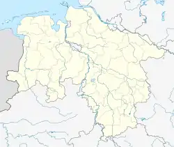 Norderney | |
| Coordinates: 53°42′26″N 07°08′49″E | |
| Country | Germany |
| State | Lower Saxony |
| District | Aurich |
| Subdivisions | 2 Ortsteile Fischerhafen, Nordhelmsiedlung |
| Government | |
| • Mayor (2019–24) | Frank Ulrichs[1] |
| Area | |
| • Total | 26.3 km2 (10.2 sq mi) |
| Elevation | 5 m (16 ft) |
| Population (2022-12-31)[2] | |
| • Total | 5,992 |
| • Density | 230/km2 (590/sq mi) |
| Time zone | UTC+01:00 (CET) |
| • Summer (DST) | UTC+02:00 (CEST) |
| Postal codes | 26548 |
| Dialling codes | 04932 |
| Vehicle registration | AUR, NOR |
| Website | www.norderney.de |

Norderney as seen from space
.JPG.webp)
The Conversationshaus (2010)
Geography
The island has a total area of 26.3 square kilometres (10.2 sq mi) and making it the ninth-largest island in Germany. It has about 6,000 people. On the northern side of the island is a 14-kilometre (8.7 mi) long sandy beach.
The neighbouring island to the east is Baltrum, which is about 800m away. To the west is the island of Juist, about 3 kilometres (1.9 mi) away.
References
Other websites
Wikimedia Commons has media related to Norderney.
- Official site (in German)
- Further information (in German)
- . Encyclopædia Britannica (11th ed.). 1911.
 . Encyclopedia Americana. 1920.
Towns and municipalities in Aurich (district) | ||
|---|---|---|
Coat of arms | ||
This article is issued from Wikipedia. The text is licensed under Creative Commons - Attribution - Sharealike. Additional terms may apply for the media files.