Baltrum
Baltrum (Low German: Baltrum) is a barrier island off the coast of East Frisia (German: Ostfriesland), in Germany, and is a municipality in Aurich, Lower Saxony. It is in-between the chain of the seven inhabited East Frisian Islands. It has a land area of 6.5 square kilometres.
Baltrum | |
|---|---|
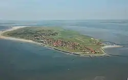 Aerial view of Baltrum from the west | |
 Flag  Coat of arms | |
Location of Baltrum within Aurich district 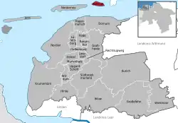 | |
 Baltrum 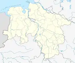 Baltrum | |
| Coordinates: 53°43′44″N 07°22′06″E | |
| Country | Germany |
| State | Lower Saxony |
| District | Aurich |
| Government | |
| • Mayor (2020–25) | Harm Olchers[1] (Ind.) |
| Area | |
| • Total | 6.50 km2 (2.51 sq mi) |
| Elevation | 5 m (16 ft) |
| Population (2022-12-31)[2] | |
| • Total | 599 |
| • Density | 92/km2 (240/sq mi) |
| Time zone | UTC+01:00 (CET) |
| • Summer (DST) | UTC+02:00 (CEST) |
| Postal codes | 26579 |
| Dialling codes | 04939 |
| Vehicle registration | AUR |
| Website | www |
Geography
It is in the middle of the island chain known as the East Frisian Islands (German: Ostfriesische Inseln). There are two villages on the island – Ostdorf (English: Eastern village) and Westdorf (English: Western village) – although they have essentially merged into one.
The island is about 5 kilometres (3.1 mi) long and 1.5 kilometres (0.93 mi) wide. It covers an area of 6.5 square kilometres (2.5 sq mi). The highest point on the island is a central coastal dune with a viewing platform on top called Aussichtsdüne in German and is 19.3 metres (63 ft) above sea-level.[3]
Other websites
 Media related to Baltrum at Wikimedia Commons
- Official website (in German)
Literature
- Richard Pott (1995), Farbatlas Nordseeküste und Nordseeinseln: Ausgewählte Beispiele aus der südlichen Nordsee in geobotanischer Sicht (in German), Stuttgart: Verlag Eugen Ulmer, ISBN 3-8001-3350-4
References
- "Verzeichnis der direkt gewählten Bürgermeister/-innen und Landräte/Landrätinnen". Landesamt für Statistik Niedersachsen. April 2021.
- "LSN-Online Regionaldatenbank, Tabelle A100001G: Fortschreibung des Bevölkerungsstandes, Stand 31. Dezember 2022" (in German). Landesamt für Statistik Niedersachsen.
- "Niedersachsen Karte – Stadtplan 1:25.000 für exakte Planungen" (in German). Behörde für Geoinformation, Landentwicklung und Liegenschaften (GLL) des Bundeslandes Niedersachsen. Archived from the original on 26 March 2009. Retrieved March 25, 2009.
Towns and municipalities in Aurich (district) | ||
|---|---|---|
Coat of arms | ||