Mulvane, Kansas
Mulvane is a city in Sedgwick and Sumner counties in the U.S. state of Kansas. It is a suburb of Wichita. In 2020, 6,286 people lived there.[4]
Mulvane, Kansas | |
|---|---|
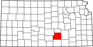
 Location within Sedgwick County and Kansas | |
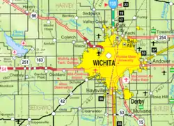
 KDOT map of Sedgwick County (legend) | |
| Coordinates: 37°29′03″N 97°14′35″W[1] | |
| Country | United States |
| State | Kansas |
| Counties | Sedgwick, Sumner |
| Founded | 1870s |
| Platted | 1879 |
| Incorporated | 1883 |
| Named for | Joab Mulvane |
| Area | |
| • Total | 4.47 sq mi (11.58 km2) |
| • Land | 4.46 sq mi (11.56 km2) |
| • Water | 0.01 sq mi (0.02 km2) |
| Elevation | 1,263 ft (385 m) |
| Population | |
| • Total | 6,286 |
| • Density | 1,400/sq mi (540/km2) |
| Time zone | UTC-6 (CST) |
| • Summer (DST) | UTC-5 (CDT) |
| ZIP code | 67110 |
| Area code | 316 |
| FIPS code | 20-49100 |
| GNIS ID | 2395137[1] |
| Website | mulvanekansas.com |
History

Mulvane was planned out in 1879.[5] It is at the junction of five Santa Fe rail lines. It is named after Joab R. Mulvane, a railroad official who was importatnt in bringing the Atchison, Topeka, and Santa Fe Railroad to Mulvane.[6]
Mulvane's Main Street follows part of the Sedgwick and Sumner county lines. The town center is about five miles west of the spot where Sedgwick, Sumner, Butler and Cowley counties meet.
Geography
Mulvane is at 37°28′47″N 97°14′32″W (37.479746, -97.242309).[7] The United States Census Bureau says that the city has a total area of 4.47 square miles (11.58 km2). Of that, 4.46 square miles (11.55 km2) is land and 0.01 square miles (0.03 km2) is water.[2]
People
| Historical population | |||
|---|---|---|---|
| Census | Pop. | %± | |
| 1880 | 215 | — | |
| 1890 | 724 | 236.7% | |
| 1900 | 667 | −7.9% | |
| 1910 | 1,084 | 62.5% | |
| 1920 | 1,239 | 14.3% | |
| 1930 | 1,042 | −15.9% | |
| 1940 | 940 | −9.8% | |
| 1950 | 1,387 | 47.6% | |
| 1960 | 2,981 | 114.9% | |
| 1970 | 3,185 | 6.8% | |
| 1980 | 4,254 | 33.6% | |
| 1990 | 4,674 | 9.9% | |
| 2000 | 5,155 | 10.3% | |
| 2010 | 6,111 | 18.5% | |
| 2020 | 6,286 | 2.9% | |
| U.S. Decennial Census 2010-2020[4] | |||
Mulvane is part of the Wichita, KS Metropolitan Statistical Area.
2020 census
The 2020 census says that there were 6,286 people, 2,338 households, and 1,656 families living in Mulvane. Of the households, 75.7% owned their home and 24.3% rented their home.
The median age was 37.0 years. Of the people, 89.0% were White, 1.0% were Native American, 0.6% were Asian, 0.5% were Black, 0.1% were Pacific Islanders, 0.6% were from some other race, and 8.2% were two or more races. Hispanic or Latino of any race were 4.9% of the people.[3][8]
Education
Mulvane is part of Mulvane USD 263.[10]
Famous people
- Laura M. Cobb, United States Navy nurse during World War II
- Dennis Franchione, college football coach.
References
- U.S. Geological Survey Geographic Names Information System: Mulvane, Kansas
- "2020 U.S. Gazetteer Files". United States Census Bureau. Retrieved December 8, 2023.
- "DP1: PROFILE OF GENERAL POPULATION AND HOUSING CHARACTERISTICS". United States Census Bureau. Retrieved December 8, 2023.
- "QuickFacts: Mulvane city, Kansas". United States Census Bureau. Retrieved December 8, 2023.
- Blackmar, Frank Wilson (1912). Kansas: A Cyclopedia of State History, Volume 2. Standard Publishing Company. p. 332.
- Bentley, Orsemus Hills (1910). History of Wichita and Sedgwick County, Kansas: Past and Present. Windmill Publications. p. 637.
- "US Gazetteer files: 2010, 2000, and 1990". United States Census Bureau. 2011-02-12. Retrieved 2011-04-23.
- "P16: HOUSEHOLD TYPE". United States Census Bureau. Retrieved January 2, 2024.
- "American FactFinder". United States Census Bureau. Retrieved 2012-07-06.
- "Mulvane School District USD 263". USD 263. Retrieved 10 January 2017.
Other websites
- City
- Schools
- USD 263, local school district
- USD 263 School District Boundary Map, KDOT
- Historical
- Larry Richardson - Replica of Golden Gate Bridge at YouTube, from Hatteberg's People on KAKE TV news
- Maps
- Mulvane City Map, KDOT

