Maricopa County, Arizona
Maricopa County (/ˌmærɪˈkoʊpə/ MARR-i-KOH-pə) is a county in the south-central part of the U.S. state of Arizona. As of the 2020 census, its population was 4,420,568,[1] making it the state's most populous county. It is more populous than 23 states.
Maricopa County | |
|---|---|
 The Maricopa County Courthouse and Old Phoenix City Hall, also known as the County-City Administration Building, in 2013 | |
 Flag | |
 Location within the U.S. state of Arizona | |
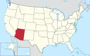 Arizona's location within the U.S. | |
| Coordinates: 33°30′50″N 112°28′33″W | |
| Country | |
| State | |
| Founded | February 14, 1871 |
| Named for | Maricopa people |
| Seat | Phoenix |
| Largest city | Phoenix |
| Area | |
| • Total | 9,224 sq mi (23,890 km2) |
| • Land | 9,200 sq mi (24,000 km2) |
| • Water | 24 sq mi (60 km2) 0.3% |
| Population | |
| • Total | 4,420,568 |
| • Density | 480/sq mi (190/km2) |
| Time zone | UTC−7 (Mountain) |
| Website | www |
The county seat is Phoenix,[2] the state capital and fifth-most populous city in the country.
References
- "QuickFacts: Maricopa County, Arizona". United States Census Bureau. Retrieved August 8, 2023.
- "Find a County". National Association of Counties. Retrieved June 7, 2011.
This article is issued from Wikipedia. The text is licensed under Creative Commons - Attribution - Sharealike. Additional terms may apply for the media files.