Chandler, Arizona
Chandler is a city in Maricopa County, Arizona, United States. It is a suburb of Phoenix, Arizona. As of 2020, the population was 275,987 according to the United States Census Bureau.[3]
Chandler, Arizona | |
|---|---|
City | |
 Aerial view of Chandler | |
 Flag | |
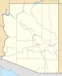
 Location in Maricopa County, Arizona | |
 Chandler Location in Arizona  Chandler Location in the contiguous United States | |
| Coordinates: 33°18′N 111°50′W | |
| Country | United States |
| State | |
| County | Maricopa |
| Founded | May 17, 1912 |
| Incorporated | 1920 |
| Government | |
| • Type | Council-Manager |
| Area | |
| • Total | 65.55 sq mi (169.77 km2) |
| • Land | 65.48 sq mi (169.58 km2) |
| • Water | 0.07 sq mi (0.18 km2) |
| Elevation | 1,211 ft (370 m) |
| Population | |
| • Total | 275,987 |
| • Rank | US: 84th |
| • Density | 4,215.09/sq mi (1,627.45/km2) |
| • Demonym | Chandlerite |
| Time zone | UTC−7 (MST (no DST)) |
| ZIP Codes | 85224–85226, 85246–85249, 85286 |
| Area code | 480 |
| FIPS code | 04-12000 |
| GNIS feature ID | 2409433[2] |
| Website | www |
References
- "2021 U.S. Gazetteer Files: Arizona". United States Census Bureau. Retrieved May 6, 2022.
- U.S. Geological Survey Geographic Names Information System: Chandler, Arizona
- "Chandler city, Arizona: 2020 DEC Redistricting Data (PL 94-171)". U.S. Census Bureau. Retrieved May 6, 2022.
Municipalities and communities of Maricopa County, Arizona, United States | ||
|---|---|---|
| Cities |  | |
| Towns |
| |
| CDPs |
| |
| Populated places |
| |
| Indian reservations |
| |
| Ghost towns/ former populated places |
| |
| Footnotes | ‡This populated place also has portions in an adjacent county or counties | |
This article is issued from Wikipedia. The text is licensed under Creative Commons - Attribution - Sharealike. Additional terms may apply for the media files.