Flevoland
Flevoland is one of the provinces of the Netherlands. Lelystad is its capital, but Almere is its biggest city. About 445,000 people are living in Flevoland (2023).
Flevoland | |
|---|---|
Province | |
.jpg.webp) Oostvaardersplassen (municipality of Lelystad) | |
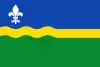 Flag  Coat of arms | |
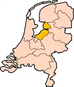 Map: Province of Flevoland in the Netherlands Location | |
 Map | |
| Coordinates: 52°32′N 5°40′E | |
| Country | Netherlands |
| Established | 1986 |
| Seat | Lelystad |
| Area | |
| • Total | 2,412 km2 (931 sq mi) |
| • Land | 1,410 km2 (540 sq mi) |
| • Water | 1,002 km2 (387 sq mi) |
| Highest elevation | 8 m (26 ft) |
| Lowest elevation | −5 m (−16 ft) |
| Population (2023) | |
| • Total | 445,000 |
| • Density | 315/km2 (820/sq mi) |
| Website | www |
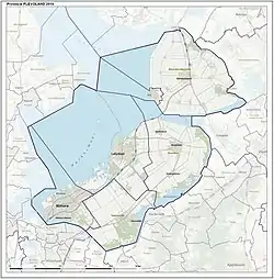
Location of the municipalities of Flevoland.
|
|

Other websites
Municipalities of Flevoland (6) | ||
|---|---|---|
 | ||
| ||
 Map: Provinces of the Netherlands | ||
This article is issued from Wikipedia. The text is licensed under Creative Commons - Attribution - Sharealike. Additional terms may apply for the media files.