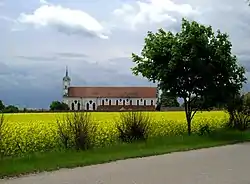
Elchingen
Elchingen is a municipality about 7 km east of Ulm–Neu-Ulm in Neu-Ulm in Bavaria, Germany.
Elchingen | |
|---|---|
 Elchingen Monastery | |
Location of Elchingen within Neu-Ulm district  | |
 Elchingen  Elchingen | |
| Coordinates: 48°27′06″N 10°05′52″E | |
| Country | Germany |
| State | Bavaria |
| Admin. region | Schwaben |
| District | Neu-Ulm |
| Subdivisions | 3 Ortsteile |
| Government | |
| • Mayor (2020–26) | Joachim Eisenkolb[1] (Ind.) |
| Area | |
| • Total | 24.87 km2 (9.60 sq mi) |
| Elevation | 465 m (1,526 ft) |
| Population (2022-12-31)[2] | |
| • Total | 9,793 |
| • Density | 390/km2 (1,000/sq mi) |
| Time zone | UTC+01:00 (CET) |
| • Summer (DST) | UTC+02:00 (CEST) |
| Postal codes | 89275 |
| Dialling codes | 0731, 07308 |
| Vehicle registration | NU |
| Website | elchingen.de |

Elchingen in 1619

Unter-Thalfingen in 1903
Municipality parts:
- Thalfingen: 4 211 residents, 8.83 km²
- Oberelchingen: 3 024 residents, 7.31 km²
- Unterelchingen: 2 863 residents, 8.76 km²
Number of residents

Literature
- Franz Willbold: Napoleons Feldzug um Ulm. Die Schlacht von Elchingen 1805 ISBN 3-7995-8027-1
- Alfred Krauss: 1805 – Der Feldzug von Ulm. Vienna 1912 (Maps from this at napoleon-online.de Archived 2013-03-28 at the Wayback Machine: Battle near Elchingen und Situation at the evening of 14 October)
References
- Liste der ersten Bürgermeister/Oberbürgermeister in kreisangehörigen Gemeinden, Bayerisches Landesamt für Statistik, 15 July 2021.
- Genesis Online-Datenbank des Bayerischen Landesamtes für Statistik Tabelle 12411-003r Fortschreibung des Bevölkerungsstandes: Gemeinden, Stichtag (Einwohnerzahlen auf Grundlage des Zensus 2011) .
Other websites
Wikimedia Commons has media related to Kloster Elchingen.
- Official website
 (in German)
Wikimedia Commons has media related to Elchingen.
This article is issued from Wikipedia. The text is licensed under Creative Commons - Attribution - Sharealike. Additional terms may apply for the media files.