Chetopa, Kansas
Chetopa is a city in Labette County, Kansas, United States. In 2020, 929 people lived there.[3] Chetopa was named after Chief Chetopah, an Osage Indian chief. Later, the community name was shortened.[4]
Chetopa, Kansas | |
|---|---|
 Location within Labette County and Kansas | |
 KDOT map of Labette County (legend) | |
| Coordinates: 37°2′15″N 95°5′31″W[1] | |
| Country | United States |
| State | Kansas |
| County | Labette |
| Incorporated | 1857 |
| Named for | Chief Chetopah |
| Area | |
| • Total | 1.44 sq mi (3.74 km2) |
| • Land | 1.36 sq mi (3.53 km2) |
| • Water | 0.08 sq mi (0.20 km2) |
| Elevation | 824 ft (251 m) |
| Population | |
| • Total | 929 |
| • Density | 650/sq mi (250/km2) |
| Time zone | UTC-6 (CST) |
| • Summer (DST) | UTC-5 (CDT) |
| ZIP code | 67336 |
| Area code | 620 |
| FIPS code | 20-12950 [1] |
| GNIS ID | 469285 [1] |
| Website | chetopa.org |
History
The community started as an Osage village. It was named after its Chief Chetopah, whose name in the Osage language signifies "four lodges".[5]
In 1847 a trading post to exchange goods with the Osage Nation was built here by Larkin McGhee. By the time McGhee came, there were three other Euro-American families and two families with a Euro-American husband and a Cherokee wife at Chetopa. There were also many Osage there.[6]
Chetopa was the where a September 18, 1861 battle between the 6th Kansas Cavalry under the direction of James G. Blunt and pro-slavery raiders led by John Allan Mathews happened. Mathews's wife was an Osage and was culturally identified with the Osages.[7]
The first post office in Chetopa was built in April 1867.[8] In 1880, Postmaster J.M. Cavaness removed the ending “h” in the original spelling to become Chetopa.[9]
Geography
Chetopa is at 37°2′15″N 95°5′31″W (37.037437, -95.092249). The United States Census Bureau says that the city has a total area of 1.44 square miles (3.73 km2). Of that, 1.36 square miles (3.52 km2) is land and 0.08 square miles (0.21 km2) is water.[2]
Climate
Chetopa has hot, humid summers and generally mild to cool winters. The Köppen Climate Classification system says that Chetopa has a humid subtropical climate. It is shortened to "Cfa" on climate maps.[10]
People
| Historical population | |||
|---|---|---|---|
| Census | Pop. | %± | |
| 1870 | 960 | — | |
| 1880 | 1,305 | 35.9% | |
| 1890 | 2,265 | 73.6% | |
| 1900 | 2,019 | −10.9% | |
| 1910 | 1,548 | −23.3% | |
| 1920 | 1,519 | −1.9% | |
| 1930 | 1,344 | −11.5% | |
| 1940 | 1,606 | 19.5% | |
| 1950 | 1,671 | 4.0% | |
| 1960 | 1,538 | −8.0% | |
| 1970 | 1,596 | 3.8% | |
| 1980 | 1,751 | 9.7% | |
| 1990 | 1,357 | −22.5% | |
| 2000 | 1,281 | −5.6% | |
| 2010 | 1,125 | −12.2% | |
| 2020 | 929 | −17.4% | |
| U.S. Decennial Census | |||
2020 census
The 2020 census says there were 929 people, 430 households, and 233 families living in Chetopa. Of the households, 70.0% owned their home and 30.0% rented their home.
The median age was 49.9 years. Of the people, 86.9% were White, 4.2% were Native American, 1.4% were Black, 1.1% were Asian, 0.1% were Pacific Islanders, 0.1% were from some other race, and 6.2% were two or more races. Hispanic or Latino of any race were 0.8% of the people.[3][11]
Related pages
References
- "Chetopa, Kansas". Geographic Names Information System. United States Geological Survey.
- "2020 U.S. Gazetteer Files". United States Census Bureau. Retrieved November 29, 2023.
- "DP1: PROFILE OF GENERAL POPULATION AND HOUSING CHARACTERISTICS". United States Census Bureau. Retrieved November 29, 2023.
- Kansas Place-Names, John Rydjord, University of Oklahoma Press, 1972, p. 435 ISBN 0-8061-0994-7
- Reminiscences of a trader in the Osage Country, James Edwin Finney written down by Joseph B. Thoburn Archived May 23, 2011, at the Wayback Machine
- transcription from the History of Labette County by Nelson Case Archived 2009-07-07 at the Wayback Machine
- Kansas Memory entry on Mathews
- "Kansas Post Offices, 1828-1961". Kansas Historical Society. Retrieved 12 June 2014.
- "Chetopa - Pecan Capitol of Kansas Prepares for Instillation of New Wastewater System" (PDF). Archived from the original (PDF) on 2016-03-04. Retrieved 2015-11-22.
- Climate Summary for Chetopa, Kansas
- "P16: HOUSEHOLD TYPE". United States Census Bureau. Retrieved December 30, 2023.
- "U.S. Census website". United States Census Bureau. Retrieved 2012-07-06.
- "U.S. Census website". United States Census Bureau. Retrieved 2008-01-31.
Other websites
- City
- Schools
- USD 505, local school district
- Maps
- Chetopa City Map, KDOT
Municipalities and communities of Labette County, Kansas, United States | ||
|---|---|---|
| Cities | 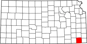 Map of Kansas highlighting Labette County | |
| Unincorporated communities |
| |
| Townships |
| |