Bad Bentheim
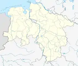
Bad Bentheim (German: [baːt ˈbɛnthaɪm] (![]() listen); Dutch Low Saxon: Beantem) is a town in the southwestern part of Lower Saxony, Germany, in the County of Bentheim on the borders of North Rhine-Westphalia and the Netherlands about 15 km south of Nordhorn and 20 km northeast of Enschede.
listen); Dutch Low Saxon: Beantem) is a town in the southwestern part of Lower Saxony, Germany, in the County of Bentheim on the borders of North Rhine-Westphalia and the Netherlands about 15 km south of Nordhorn and 20 km northeast of Enschede.
Bad Bentheim | |
|---|---|
 Bad Bentheim with its castle | |
 Flag  Coat of arms | |
Location of Bad Bentheim within Grafschaft Bentheim district  | |
 Bad Bentheim  Bad Bentheim | |
| Coordinates: 52°18′11″N 07°09′35″E | |
| Country | Germany |
| State | Lower Saxony |
| District | Grafschaft Bentheim |
| Government | |
| • Mayor (2021–26) | Volker Pannen[1] (SPD) |
| Area | |
| • Total | 100.16 km2 (38.67 sq mi) |
| Elevation | 49 m (161 ft) |
| Population (2022-12-31)[2] | |
| • Total | 16,251 |
| • Density | 160/km2 (420/sq mi) |
| Demonym | Bentheimer |
| Time zone | UTC+01:00 (CET) |
| • Summer (DST) | UTC+02:00 (CEST) |
| Postal codes | 48455 |
| Dialling codes | 05922; 05924 for Gildehaus |
| Vehicle registration | NOH |
| Website | http://www.stadt-badbentheim.de/index/ |

Geography
Extent of the municipal area
The town limit is 49 km, with a north–south reach of 14 km and an east–west reach of 12 km. The area under Bad Bentheim's power, along with all its constituent communities, has a total area of 100.16 km2.
Neighbouring communities
Bad Bentheim, a town shaped by the Evangelical Church, belongs to Lower Saxony's district of Bentheim. It borders on two other towns in Lower Saxony, Schüttorf and Nordhorn as well as on the Catholic towns of Gronau and Ochtrup in North Rhine-Westphalia's Steinfurt and Borken districts respectively. Bad Bentheim is right on the Dutch border, its immediate neighbours on the other side being de Lutte and Losser, both Catholic places in the province of Overijssel (Twente region). Not far away is the Dutch cities of Almelo, Enschede and Hengelo, and on the German side Lingen, Rheine, Münster and Osnabrück.
Constituent communities
The town has the centres of Achterberg, Bardel, Gildehaus, Hagelshoek, Holt und Haar, Sieringhoek, Waldseite and Westenberg.
References
Further reading
- Weiss, Helmuth (2005). Grafschaft Bentheim: Bad Bentheim - Nordhorn - Schüttorf -Neuenhaus -Uelsen - Emlichheim - Wietmarschen. Bremen: Edition Temmen. ISBN 3-86108-941-6. (English-French-Dutch-German)
- Hubert Titz (publisher): Bad Bentheim - Aspekte einer Stadtgeschichte. Schriftenreihe der Volkshochschule des Landkreises Grafschaft Bentheim Bd. 21/Schriftenreihe des Heimatvereins Grafschaft Bentheim Bd. 138, Bad Bentheim 1996.
- Herbert Wagner: Die Gestapo war nicht allein… Politische Sozialkontrolle und Staatsterror im deutsch-niederländischen Grenzgebiet 1929-1945. (Gestapo und Grenzpolizeikommissariat Bentheim), LIT-Verlag, Münster 2004.
Other websites
- Internet presence of the Town of Bad Bentheim (in German and Dutch)
- Bardel Franciscan Monastery Archived 2022-04-19 at the Wayback Machine (in German)
- picture gallery at the Bardel Franciscan Monastery (in German)
- Site of the Prince of Bentheim (in German)
- Site of Bentheim Castle (in German)
- Site of the Sandstone Museum (in German)