Alagnon
The Alagnon is a French river that starts in the Massif Central within the Regional Natural Park of the Volcanoes of Auvergne (French: Parc Naturel Régional des Volcans d'Auvergne) and that flows through the Auvergne-Rhône-Alpes region. It is a left tributary of the Allier.
| Alagnon | |
|---|---|
 | |
  | |
| Location | |
| Country | France |
| Physical characteristics | |
| Source | |
| - location | Massif Central |
| Mouth | |
| - location | Allier |
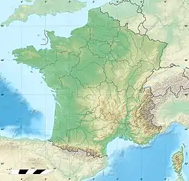
| - coordinates | 45°27′5″N 3°18′14″E |
| Length | 86.7 km (53.9 mi) |
Geography
The Alagnon river has a length of 85.9 km (53.4 mi) and a drainage basin with an area of 1,042 km2 (402 sq mi).[1]
Its average yearly discharge (volume of water which passes through a section of the river per unit of time) is 11.90 m3/s (420 cu ft/s) at Lempdes-sur-Allagnon in the Haute-Loire department.[2]

Average monthly discharge (m3/s) at Lempdes-sur-Allagnon (50 years)[2]
Course
The Alagnon river starts in the Mounts of Cantal (Massif Central), near the Puy Bataillouse mountain, commune of Laveissière, at an altitude of about 1,590 m (5,217 ft), in the Cantal department.[3] First, it flows to the east, near the Super Lioran ski resort, and gets into a gorge and, then, into a valley near Murat. The river flows in general to the northeast and gets into deep gorges in Lempdes-sur-Allagnon.
The Alagnon river flows through the Auvergne-Rhône-Alpes region, 3 departments and 23 communes. Two communes are named after the river: La Chapelle-d'Alagnon and Lempdes-sur-Allagnon. It flows through the following communes, among others:[1]
- Auvergne-Rhône-Alpes region
- Cantal department: Laveissière, Murat, La Chapelle-d'Alagnon, Neussargues-Moissac, Ferrières-Saint-Mary, Molompize, Massiac
- Haute-Loire department: Grenier-Montgon, Torsiac, Lempdes-sur-Allagnon
- Puy-de-Dôme department: Charbonnier-les-Mines, Beaulieu, Auzat-la-Combelle
Finally, it flows into the Allier river in the town of Auzat-la-Combelle, in the place known as Le Saut du Loup, in the Puy-de-Dôme department.[4]
Main tributaries
The main tributaries, over 20 km long, of the Cère river are:[1]
|
Left tributaries:
|
|
Right tributaries:
|
Gallery
 The Alagnon in Torsiac.
 The Alagnon and the Léotoing castle.
 The Alagnon in Molompize.
Related pages
References
- "L'Alagnon (K25-0300)" (in French). SANDRE - Portail national d'accès aux référentiels sur l'eau. Archived from the original on 28 May 2014. Retrieved 25 January 2017.
- "L'Alagnon à Lempdes". Banque Hydro (in French). Ministère de l'Ecologie, du Développement Durable et de l'Energie. Archived from the original on 3 March 2016. Retrieved 25 January 2017.
- "Source de l'Alagnon" (in French). Géoportail. Retrieved 25 January 2017.
- "Embouchure de l'Alagnon" (in French). Géoportail. Retrieved 25 January 2017.