West Kutai Regency
Kabupaten Kutai Barat | |
|---|---|
 Coat of arms | |
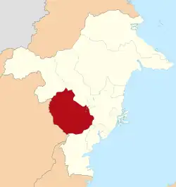 Location within East Kalimantan | |
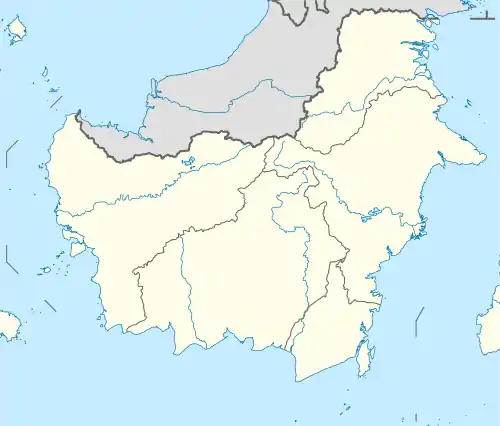 West Kutai Regency Location in Kalimantan and Indonesia 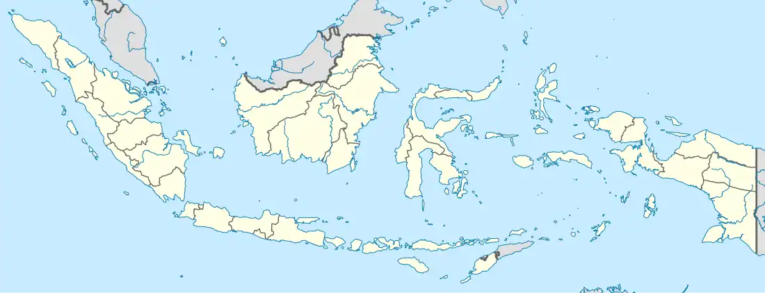 West Kutai Regency West Kutai Regency (Indonesia) | |
| Coordinates: 0°35′39″S 115°30′57″E / 0.5942°S 115.5157°E | |
| Country | Indonesia |
| Region | Kalimantan |
| Province | East Kalimantan |
| Capital | Sendawar |
| Government | |
| • Regent | FX. Yapan |
| • Vice Regent | Edyanto Arkan |
| Area | |
| • Total | 20,384.60 km2 (7,870.54 sq mi) |
| Population (mid 2022 estimate)[1] | |
| • Total | 172,288 |
| • Density | 8.5/km2 (22/sq mi) |
| Time zone | UTC+8 (ICST) |
| Area code | (+62) 545 |
| Website | kutaibaratkab |
West Kutai Regency (Indonesian: Kabupaten Kutai Barat) is a regency (kabupaten) in the Indonesian province of East Kalimantan. It previously covered a much greater area, with a population of 165,091 at the 2010 Census, but in December 2012 the five northernmost districts were split off to form a new Mahakam Ulu Regency; the residual area of 20,384.6 km2 had a population of 140,097 at the 2010 Census,[2] and 165,938 at the 2020 Census;[3] the official estimate as at mid 2022 was 172,288 (comprising 91,327 males and 80,961 females).[1] The town of Sendawar is the administrative capital.
Administrative Districts
Following the removal of the northern five districts in December 2012 to form the new Mahakam Ulu Regency, the residual West Kutai Regency is divided into sixteen districts (kecamatan), tabulated below with their areas and their 2010[2] and 2020[3] Census populations, together with the official estimates as at mid 2022.[1] The table also includes the locations of the district administrative centres, the number of administrative villages (totaling 190 rural kamponmg or desa, and 4 urban kelurahan) in each district, and its postal codes.
| Kode Wilayah | Name of District (kecamatan) | Area in km2 | Pop'n Census 2010 | Pop'n Census 2020 | Pop'n Estimate mid 2022 | Admin centre | No. of villages | Post codes |
|---|---|---|---|---|---|---|---|---|
| 64.07.12 | Bongan | 2,305.3 | 8,997 | 10,499 | 11,557 | Muara Kendang | 16 | 75772 |
| 64.07.11 | Jempang | 744.5 | 11,279 | 11,211 | 12,414 | Tanjung Isuy | 12 | 75773 |
| 64.07.13 | Penyinggahan | 192.1 | 3,904 | 3,815 | 3,845 | Penyinggahan Ilir | 6 | 75763 |
| 64.07.10 | Muara Pahu | 1,110.6 | 8,272 | 8,344 | 8,046 | Tanjung Laor | 12 | 75774 |
| 64.07.17 | Siluq Ngurai | 1,629.1 | 4,292 | 5,880 | 7,331 | Muhur | 16 | 75771 |
| 64.07.09 | Muara Lawa | 436.7 | 6,483 | 7,033 | 7,127 | Muara Lawa | 8 | 75775 |
| 64.07.14 | Bentian Besar | 1,856.1 | 3,093 | 3,213 | 3,342 | Dilang Puti | 9 | 75778 |
| 64.07.08 | Damai | 2,027.5 | 8,476 | 10,549 | 12,483 | Damai Kota | 17 | 75777 |
| 64.07.16 | Nyuatan | 1,343.3 | 5,348 | 6,357 | 6,409 | Dempar | 10 | 75776 & 75777 |
| 64.07.07 | Barong Tongkok | 405.9 | 23,935 | 31,746 | 31,561 | Barong Tongkok | 21 (a) | 75776 |
| 64.07.15 | Linggang Bigung | 2,299.1 | 13,712 | 15,843 | 15,844 | Linggang Bigung | 11 | 75576 |
| 64.07.06 | Melak | 179.2 | 10,596 | 15,041 | 15,333 | Melak Ilir | 6 (b) | 75765 |
| 64.07.20 | Sekolaq Darat | 49.3 | 8,394 | 10,301 | 10,793 | Sekolaq Darat | 8 | 75764 |
| 64.07.18 | Mook Manaar Bulatn | 2,964.6 | 7,478 | 8,409 | 8,424 | Gunung Rampah | 16 | 75765 (c) |
| 64.07.05 | Long Iram (d) | 2,499.5 | 6,407 | 7,184 | 7,074 | Long Iram Kota | 11 | 75766 |
| 64.07.19 | Tering | 341.8 | 9,431 | 10,513 | 10,705 | Tering Lama | 15 | 75760 |
| Totals | 20,384.6 | 140,097 | 165,918 | 172,288 | Sendawar | 194 |
Notes: (a) includes 2 kelurahan - Barong Tongkok and Simpang Raya. (b) includes 2 kelurahan - Melak Ilir and Melak Ulu.
(c) except the four villages of Abit, Muara Jawaq, Rembayan and Tondah (which share a postcode of 75774). (d) includes the riverine island of Pulau Kualan.
References
External links
Regencies and cities of East Kalimantan | ||
|---|---|---|
Capital: Samarinda | ||
| Regencies | ||
| Cities | ||
| Towns and villages | ||