Vinay | |
|---|---|
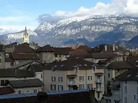 A general view of Vinay | |
 Coat of arms | |
Location of Vinay | |
 Vinay 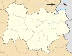 Vinay | |
| Coordinates: 45°12′39″N 5°24′16″E / 45.2108°N 5.4044°E | |
| Country | France |
| Region | Auvergne-Rhône-Alpes |
| Department | Isère |
| Arrondissement | Grenoble |
| Canton | Le Sud Grésivaudan |
| Government | |
| • Mayor (2020–2026) | Philippe Rosaire[1] |
| Area 1 | 16.01 km2 (6.18 sq mi) |
| Population | 4,435 |
| • Density | 280/km2 (720/sq mi) |
| Time zone | UTC+01:00 (CET) |
| • Summer (DST) | UTC+02:00 (CEST) |
| INSEE/Postal code | 38559 /38470 |
| Elevation | 168–580 m (551–1,903 ft) (avg. 262 m or 860 ft) |
| 1 French Land Register data, which excludes lakes, ponds, glaciers > 1 km2 (0.386 sq mi or 247 acres) and river estuaries. | |
Vinay (French pronunciation: [vinɛ]) is a commune in the Isère department in southeastern France.[3]
Vinay is a largely agricultural village. It is commonly known as the walnut capital of Grenoble and boasts over 175,000 trees.
Population
|
| ||||||||||||||||||||||||||||||||||||||||||||||||||||||
| Source: EHESS[4] and INSEE (1968-2017)[5] | |||||||||||||||||||||||||||||||||||||||||||||||||||||||
Twin towns
Vinay is twinned with:
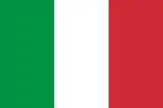 San Possidonio, Italy, since 2013
See also
References
- ↑ "Répertoire national des élus: les maires" (in French). data.gouv.fr, Plateforme ouverte des données publiques françaises. 13 September 2022.
- ↑ "Populations légales 2021". The National Institute of Statistics and Economic Studies. 28 December 2023.
- ↑ INSEE commune file
- ↑ Des villages de Cassini aux communes d'aujourd'hui: Commune data sheet Vinay, EHESS (in French).
- ↑ Population en historique depuis 1968, INSEE
Wikimedia Commons has media related to Vinay (Isère).
This article is issued from Wikipedia. The text is licensed under Creative Commons - Attribution - Sharealike. Additional terms may apply for the media files.