Vasselin | |
|---|---|
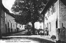 Vasselin at the start of the 20th century | |
 Coat of arms | |
Location of Vasselin | |
 Vasselin 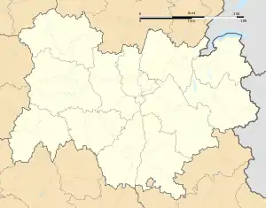 Vasselin | |
| Coordinates: 45°37′54″N 5°27′18″E / 45.6317°N 5.455°E | |
| Country | France |
| Region | Auvergne-Rhône-Alpes |
| Department | Isère |
| Arrondissement | La Tour-du-Pin |
| Canton | Morestel |
| Government | |
| • Mayor (2020–2026) | Jean-Yves Roux[1] |
| Area 1 | 3.85 km2 (1.49 sq mi) |
| Population | 462 |
| • Density | 120/km2 (310/sq mi) |
| Time zone | UTC+01:00 (CET) |
| • Summer (DST) | UTC+02:00 (CEST) |
| INSEE/Postal code | 38525 /38890 |
| Elevation | 221–450 m (725–1,476 ft) (avg. 267 m or 876 ft) |
| 1 French Land Register data, which excludes lakes, ponds, glaciers > 1 km2 (0.386 sq mi or 247 acres) and river estuaries. | |
Vasselin (French pronunciation: [vaslɛ̃]) is a commune in the Isère department in southeastern France.[3]
Population
| Year | Pop. | ±% p.a. |
|---|---|---|
| 1968 | 160 | — |
| 1975 | 171 | +0.95% |
| 1982 | 202 | +2.41% |
| 1990 | 239 | +2.12% |
| 1999 | 300 | +2.56% |
| 2009 | 407 | +3.10% |
| 2014 | 471 | +2.96% |
| 2020 | 461 | −0.36% |
| Source: INSEE[4] | ||
See also
References
- ↑ "Répertoire national des élus: les maires". data.gouv.fr, Plateforme ouverte des données publiques françaises (in French). 9 August 2021.
- ↑ "Populations légales 2021". The National Institute of Statistics and Economic Studies. 28 December 2023.
- ↑ INSEE commune file
- ↑ Population en historique depuis 1968, INSEE
Wikimedia Commons has media related to Vasselin.
This article is issued from Wikipedia. The text is licensed under Creative Commons - Attribution - Sharealike. Additional terms may apply for the media files.