Všeradov | |
|---|---|
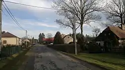 Main road | |
 Flag  Coat of arms | |
 Všeradov Location in the Czech Republic | |
| Coordinates: 49°44′52″N 15°50′14″E / 49.74778°N 15.83722°E | |
| Country | |
| Region | Pardubice |
| District | Chrudim |
| First mentioned | 1487 |
| Area | |
| • Total | 5.09 km2 (1.97 sq mi) |
| Elevation | 572 m (1,877 ft) |
| Population (2023-01-01)[1] | |
| • Total | 148 |
| • Density | 29/km2 (75/sq mi) |
| Time zone | UTC+1 (CET) |
| • Summer (DST) | UTC+2 (CEST) |
| Postal code | 539 01 |
| Website | www |
Všeradov is a municipality and village in Chrudim District in the Pardubice Region of the Czech Republic. It has about 100 inhabitants.
Administrative parts
Villages of Jasné Pole and Milesimov are administrative parts of Všeradov.
References
External links
Wikimedia Commons has media related to Všeradov.
This article is issued from Wikipedia. The text is licensed under Creative Commons - Attribution - Sharealike. Additional terms may apply for the media files.