Horní Bradlo | |
|---|---|
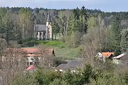 Chapel of the Virgin Mary | |
 Flag  Coat of arms | |
 Horní Bradlo Location in the Czech Republic | |
| Coordinates: 49°48′9″N 15°44′40″E / 49.80250°N 15.74444°E | |
| Country | |
| Region | Pardubice |
| District | Chrudim |
| First mentioned | 1329 |
| Area | |
| • Total | 20.33 km2 (7.85 sq mi) |
| Elevation | 510 m (1,670 ft) |
| Population (2023-01-01)[1] | |
| • Total | 420 |
| • Density | 21/km2 (54/sq mi) |
| Time zone | UTC+1 (CET) |
| • Summer (DST) | UTC+2 (CEST) |
| Postal codes | 538 25, 539 53 |
| Website | www |
Horní Bradlo is a municipality and village in Chrudim District in the Pardubice Region of the Czech Republic. It has about 400 inhabitants.
Administrative parts
Villages of Dolní Bradlo, Javorné, Lipka, Travná, Velká Střítež and Vršov are administrative parts of Horní Bradlo.
References
External links
Wikimedia Commons has media related to Horní Bradlo.
This article is issued from Wikipedia. The text is licensed under Creative Commons - Attribution - Sharealike. Additional terms may apply for the media files.