Tursac | |
|---|---|
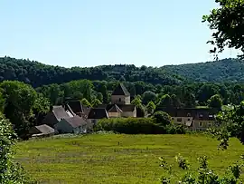 A general view of Tursac | |
 Coat of arms | |
Location of Tursac | |
 Tursac 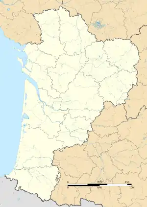 Tursac | |
| Coordinates: 44°58′12″N 1°02′43″E / 44.97°N 1.0453°E | |
| Country | France |
| Region | Nouvelle-Aquitaine |
| Department | Dordogne |
| Arrondissement | Sarlat-la-Canéda |
| Canton | Vallée de l'Homme |
| Government | |
| • Mayor (2020–2026) | Michel Talet[1] |
| Area 1 | 17.71 km2 (6.84 sq mi) |
| Population | 332 |
| • Density | 19/km2 (49/sq mi) |
| Time zone | UTC+01:00 (CET) |
| • Summer (DST) | UTC+02:00 (CEST) |
| INSEE/Postal code | 24559 /24620 |
| Elevation | 56–237 m (184–778 ft) (avg. 79 m or 259 ft) |
| 1 French Land Register data, which excludes lakes, ponds, glaciers > 1 km2 (0.386 sq mi or 247 acres) and river estuaries. | |
Tursac (French pronunciation: [tyʁsak]) is a commune in the Dordogne department in Nouvelle-Aquitaine in southwestern France. Abri de la Madeleine is the site of Magdalenian prehistoric finds.
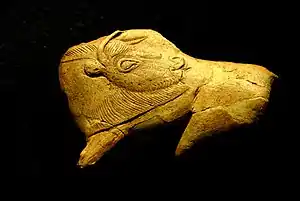
Prehistoric artifact found at La Madeleine in Tursac
Population
| Year | Pop. | ±% |
|---|---|---|
| 1962 | 192 | — |
| 1968 | 217 | +13.0% |
| 1975 | 238 | +9.7% |
| 1982 | 263 | +10.5% |
| 1990 | 316 | +20.2% |
| 1999 | 340 | +7.6% |
| 2008 | 319 | −6.2% |
See also
References
- ↑ "Répertoire national des élus: les maires". data.gouv.fr, Plateforme ouverte des données publiques françaises (in French). 2 December 2020.
- ↑ "Populations légales 2021". The National Institute of Statistics and Economic Studies. 28 December 2023.
Wikimedia Commons has media related to Tursac.
This article is issued from Wikipedia. The text is licensed under Creative Commons - Attribution - Sharealike. Additional terms may apply for the media files.