La Chapelle-Aubareil | |
|---|---|
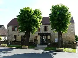 The town hall in La Chapelle-Aubareil | |
Location of La Chapelle-Aubareil | |
 La Chapelle-Aubareil 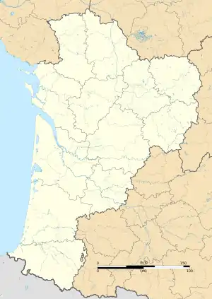 La Chapelle-Aubareil | |
| Coordinates: 45°00′48″N 1°11′00″E / 45.0133°N 1.1833°E | |
| Country | France |
| Region | Nouvelle-Aquitaine |
| Department | Dordogne |
| Arrondissement | Sarlat-la-Canéda |
| Canton | Vallée de l'Homme |
| Government | |
| • Mayor (2020–2026) | Jean-Michel Faure[1] |
| Area 1 | 19.85 km2 (7.66 sq mi) |
| Population | 538 |
| • Density | 27/km2 (70/sq mi) |
| Time zone | UTC+01:00 (CET) |
| • Summer (DST) | UTC+02:00 (CEST) |
| INSEE/Postal code | 24106 /24290 |
| Elevation | 109–288 m (358–945 ft) (avg. 260 m or 850 ft) |
| 1 French Land Register data, which excludes lakes, ponds, glaciers > 1 km2 (0.386 sq mi or 247 acres) and river estuaries. | |
La Chapelle-Aubareil (French pronunciation: [la ʃapɛl obaʁɛj]; Occitan: La Capèla Albarèlh) is a commune in the Dordogne department in Nouvelle-Aquitaine in southwestern France.
Population
| Year | Pop. | ±% |
|---|---|---|
| 1962 | 386 | — |
| 1968 | 333 | −13.7% |
| 1975 | 280 | −15.9% |
| 1982 | 308 | +10.0% |
| 1990 | 330 | +7.1% |
| 1999 | 371 | +12.4% |
| 2008 | 458 | +23.5% |
See also
References
- ↑ "Répertoire national des élus: les maires" (in French). data.gouv.fr, Plateforme ouverte des données publiques françaises. 13 September 2022.
- ↑ "Populations légales 2021". The National Institute of Statistics and Economic Studies. 28 December 2023.
Wikimedia Commons has media related to La Chapelle-Aubareil.
This article is issued from Wikipedia. The text is licensed under Creative Commons - Attribution - Sharealike. Additional terms may apply for the media files.