Tourriers | |
|---|---|
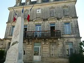 Town hall | |
.svg.png.webp) Coat of arms | |
Location of Tourriers | |
 Tourriers 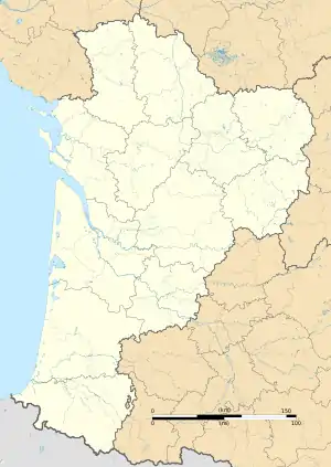 Tourriers | |
| Coordinates: 45°47′54″N 0°11′33″E / 45.7983°N 0.1925°E | |
| Country | France |
| Region | Nouvelle-Aquitaine |
| Department | Charente |
| Arrondissement | Confolens |
| Canton | Boixe-et-Manslois |
| Government | |
| • Mayor (2020–2026) | Laurent Danede[1] |
| Area 1 | 6.77 km2 (2.61 sq mi) |
| Population | 772 |
| • Density | 110/km2 (300/sq mi) |
| Time zone | UTC+01:00 (CET) |
| • Summer (DST) | UTC+02:00 (CEST) |
| INSEE/Postal code | 16383 /16560 |
| Elevation | 89–141 m (292–463 ft) (avg. 108 m or 354 ft) |
| 1 French Land Register data, which excludes lakes, ponds, glaciers > 1 km2 (0.386 sq mi or 247 acres) and river estuaries. | |
Tourriers (French pronunciation: [tuʁje]) is a commune in the Charente department in southwestern France.
Population
| Year | Pop. | ±% p.a. |
|---|---|---|
| 1968 | 467 | — |
| 1975 | 543 | +2.18% |
| 1982 | 584 | +1.05% |
| 1990 | 579 | −0.11% |
| 1999 | 587 | +0.15% |
| 2009 | 742 | +2.37% |
| 2014 | 758 | +0.43% |
| 2020 | 774 | +0.35% |
| Source: INSEE[3] | ||
See also
References
- ↑ "Répertoire national des élus: les maires" (in French). data.gouv.fr, Plateforme ouverte des données publiques françaises. 13 September 2022.
- ↑ "Populations légales 2021". The National Institute of Statistics and Economic Studies. 28 December 2023.
- ↑ Population en historique depuis 1968, INSEE
Wikimedia Commons has media related to Tourriers.
This article is issued from Wikipedia. The text is licensed under Creative Commons - Attribution - Sharealike. Additional terms may apply for the media files.