Cellefrouin | |
|---|---|
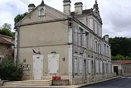 Town hall | |
Location of Cellefrouin | |
 Cellefrouin 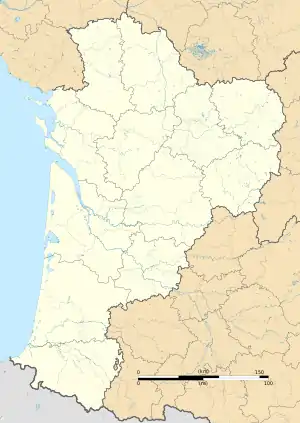 Cellefrouin | |
| Coordinates: 45°53′28″N 0°23′29″E / 45.8910°N 0.3914°E | |
| Country | France |
| Region | Nouvelle-Aquitaine |
| Department | Charente |
| Arrondissement | Confolens |
| Canton | Boixe-et-Manslois |
| Intercommunality | Cœur de Charente |
| Government | |
| • Mayor (2020–2026) | Marie-Annick Perche[1] |
| Area 1 | 40.09 km2 (15.48 sq mi) |
| Population | 573 |
| • Density | 14/km2 (37/sq mi) |
| Time zone | UTC+01:00 (CET) |
| • Summer (DST) | UTC+02:00 (CEST) |
| INSEE/Postal code | 16068 /16260 |
| Elevation | 81–189 m (266–620 ft) (avg. 142 m or 466 ft) |
| 1 French Land Register data, which excludes lakes, ponds, glaciers > 1 km2 (0.386 sq mi or 247 acres) and river estuaries. | |
Cellefrouin (French pronunciation: [sɛlfʁuɛ̃]) is a commune in the Charente department in southwestern France. It is the site of the remains of the canonry of Cellefrouin, founded in 1025 by Arnald of Vitabre, bishop of Périgueux.
Population
| Year | Pop. | ±% p.a. |
|---|---|---|
| 1968 | 730 | — |
| 1975 | 593 | −2.93% |
| 1982 | 580 | −0.32% |
| 1990 | 563 | −0.37% |
| 1999 | 508 | −1.14% |
| 2009 | 551 | +0.82% |
| 2014 | 569 | +0.64% |
| 2020 | 571 | +0.06% |
| Source: INSEE[3] | ||
See also
References
- ↑ "Répertoire national des élus: les maires" (in French). data.gouv.fr, Plateforme ouverte des données publiques françaises. 13 September 2022.
- ↑ "Populations légales 2021". The National Institute of Statistics and Economic Studies. 28 December 2023.
- ↑ Population en historique depuis 1968, INSEE
Wikimedia Commons has media related to Cellefrouin.
This article is issued from Wikipedia. The text is licensed under Creative Commons - Attribution - Sharealike. Additional terms may apply for the media files.