Tournon-Saint-Pierre | |
|---|---|
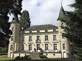 Chateau Les Vallées | |
Location of Tournon-Saint-Pierre | |
 Tournon-Saint-Pierre 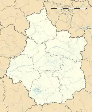 Tournon-Saint-Pierre | |
| Coordinates: 46°44′24″N 0°57′17″E / 46.74°N 0.9547°E | |
| Country | France |
| Region | Centre-Val de Loire |
| Department | Indre-et-Loire |
| Arrondissement | Loches |
| Canton | Descartes |
| Intercommunality | CC Loches Sud Touraine |
| Government | |
| • Mayor (2020–2026) | Nicole Thibault[1] |
| Area 1 | 14.76 km2 (5.70 sq mi) |
| Population | 448 |
| • Density | 30/km2 (79/sq mi) |
| Time zone | UTC+01:00 (CET) |
| • Summer (DST) | UTC+02:00 (CEST) |
| INSEE/Postal code | 37259 /37290 |
| Elevation | 62–136 m (203–446 ft) |
| 1 French Land Register data, which excludes lakes, ponds, glaciers > 1 km2 (0.386 sq mi or 247 acres) and river estuaries. | |
Tournon-Saint-Pierre (French pronunciation: [tuʁnɔ̃ sɛ̃ pjɛʁ]) is a commune in the Indre-et-Loire department in central France.
Population
| Year | Pop. | ±% p.a. |
|---|---|---|
| 1968 | 644 | — |
| 1975 | 608 | −0.82% |
| 1982 | 574 | −0.82% |
| 1990 | 593 | +0.41% |
| 1999 | 514 | −1.58% |
| 2007 | 510 | −0.10% |
| 2012 | 459 | −2.09% |
| 2017 | 459 | +0.00% |
| Source: INSEE[3] | ||
Sights
The Château des Vallées is located in Tournon-Saint-Pierre.
See also
References
- ↑ "Répertoire national des élus: les maires". data.gouv.fr, Plateforme ouverte des données publiques françaises (in French). 9 August 2021.
- ↑ "Populations légales 2021". The National Institute of Statistics and Economic Studies. 28 December 2023.
- ↑ Population en historique depuis 1968, INSEE
External links
Wikimedia Commons has media related to Tournon-Saint-Pierre.
- Official site (in French)
This article is issued from Wikipedia. The text is licensed under Creative Commons - Attribution - Sharealike. Additional terms may apply for the media files.