Reignac-sur-Indre | |
|---|---|
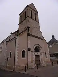 The parish church of Saint-Etienne, in Reignac-sur-Indre | |
.svg.png.webp) Coat of arms | |
Location of Reignac-sur-Indre | |
 Reignac-sur-Indre 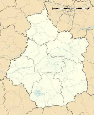 Reignac-sur-Indre | |
| Coordinates: 47°14′00″N 0°55′03″E / 47.2333°N 0.9175°E | |
| Country | France |
| Region | Centre-Val de Loire |
| Department | Indre-et-Loire |
| Arrondissement | Loches |
| Canton | Loches |
| Intercommunality | CC Loches Sud Touraine |
| Government | |
| • Mayor (2020–2026) | Loïc Babary[1] |
| Area 1 | 22.44 km2 (8.66 sq mi) |
| Population | 1,313 |
| • Density | 59/km2 (150/sq mi) |
| Time zone | UTC+01:00 (CET) |
| • Summer (DST) | UTC+02:00 (CEST) |
| INSEE/Postal code | 37192 /37310 |
| Elevation | 60–101 m (197–331 ft) |
| 1 French Land Register data, which excludes lakes, ponds, glaciers > 1 km2 (0.386 sq mi or 247 acres) and river estuaries. | |
Reignac-sur-Indre (French pronunciation: [ʁɛɲak syʁ ɛ̃dʁ] ⓘ, literally Reignac on Indre) is a commune in the Indre-et-Loire department in central France.
Population
| Year | Pop. | ±% p.a. |
|---|---|---|
| 1968 | 645 | — |
| 1975 | 685 | +0.86% |
| 1982 | 842 | +2.99% |
| 1990 | 909 | +0.96% |
| 1999 | 1,068 | +1.81% |
| 2007 | 1,186 | +1.32% |
| 2012 | 1,194 | +0.13% |
| 2017 | 1,238 | +0.73% |
| Source: INSEE[3] | ||
See also
References
- ↑ "Répertoire national des élus: les maires". data.gouv.fr, Plateforme ouverte des données publiques françaises (in French). 2 December 2020.
- ↑ "Populations légales 2021". The National Institute of Statistics and Economic Studies. 28 December 2023.
- ↑ Population en historique depuis 1968, INSEE
Wikimedia Commons has media related to Reignac-sur-Indre.
This article is issued from Wikipedia. The text is licensed under Creative Commons - Attribution - Sharealike. Additional terms may apply for the media files.