Sillery | |
|---|---|
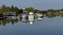 The marina in Sillery | |
.svg.png.webp) Coat of arms | |
Location of Sillery | |
 Sillery  Sillery | |
| Coordinates: 49°11′56″N 4°07′59″E / 49.1989°N 4.1331°E | |
| Country | France |
| Region | Grand Est |
| Department | Marne |
| Arrondissement | Reims |
| Canton | Reims-8 |
| Intercommunality | CU Grand Reims |
| Government | |
| • Mayor (2020–2026) | Thomas Dubois[1] |
| Area 1 | 9.2 km2 (3.6 sq mi) |
| Population | 1,836 |
| • Density | 200/km2 (520/sq mi) |
| Time zone | UTC+01:00 (CET) |
| • Summer (DST) | UTC+02:00 (CEST) |
| INSEE/Postal code | 51536 /51500 |
| 1 French Land Register data, which excludes lakes, ponds, glaciers > 1 km2 (0.386 sq mi or 247 acres) and river estuaries. | |
Sillery (French pronunciation: [sil(ə)ʁi]) is a commune in the north-eastern French department of Marne.
Champagne
The village's vineyards are located in the Montagne de Reims subregion of Champagne, and are classified as Grand Cru (100%) in the Champagne vineyard classification. The vineyards produce mostly Chardonnay grapes; the grapes are used to produce both Champagne and still Coteaux Champenois wine.
See also
- Communes of the Marne department
- Classification of Champagne vineyards
- Fort de la Pompelle, a nearby World War I fortification
References
- ↑ "Répertoire national des élus: les maires". data.gouv.fr, Plateforme ouverte des données publiques françaises (in French). 2 December 2020.
- ↑ "Populations légales 2021". The National Institute of Statistics and Economic Studies. 28 December 2023.
Wikimedia Commons has media related to Sillery.
This article is issued from Wikipedia. The text is licensed under Creative Commons - Attribution - Sharealike. Additional terms may apply for the media files.