Saint-Bonnet-le-Troncy | |
|---|---|
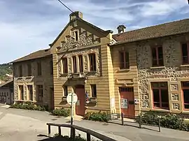 The town hall of Saint-Bonnet-le-Troncy | |
Location of Saint-Bonnet-le-Troncy | |
 Saint-Bonnet-le-Troncy 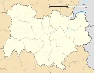 Saint-Bonnet-le-Troncy | |
| Coordinates: 46°05′09″N 4°25′41″E / 46.0858°N 4.4281°E | |
| Country | France |
| Region | Auvergne-Rhône-Alpes |
| Department | Rhône |
| Arrondissement | Villefranche-sur-Saône |
| Canton | Thizy-les-Bourgs |
| Intercommunality | CA de l'Ouest Rhodanien |
| Government | |
| • Mayor (2020–2026) | Pascal Touchard[1] |
| Area 1 | 15.65 km2 (6.04 sq mi) |
| Population | 316 |
| • Density | 20/km2 (52/sq mi) |
| Time zone | UTC+01:00 (CET) |
| • Summer (DST) | UTC+02:00 (CEST) |
| INSEE/Postal code | 69183 /69870 |
| Elevation | 491–905 m (1,611–2,969 ft) (avg. 750 m or 2,460 ft) |
| 1 French Land Register data, which excludes lakes, ponds, glaciers > 1 km2 (0.386 sq mi or 247 acres) and river estuaries. | |
Saint-Bonnet-le-Troncy (French pronunciation: [sɛ̃ bɔnɛ lə tʁɔ̃si]) is a commune in the Rhône department in eastern France.
Demography
| Year | Pop. | ±% p.a. |
|---|---|---|
| 1968 | 364 | — |
| 1975 | 281 | −3.63% |
| 1982 | 268 | −0.67% |
| 1990 | 265 | −0.14% |
| 1999 | 273 | +0.33% |
| 2009 | 312 | +1.34% |
| 2014 | 301 | −0.72% |
| 2020 | 316 | +0.81% |
| Source: INSEE[3] | ||
See also
References
- ↑ "Répertoire national des élus: les maires". data.gouv.fr, Plateforme ouverte des données publiques françaises (in French). 2 December 2020.
- ↑ "Populations légales 2021". The National Institute of Statistics and Economic Studies. 28 December 2023.
- ↑ Population en historique depuis 1968, INSEE
Wikimedia Commons has media related to Saint-Bonnet-le-Troncy.
This article is issued from Wikipedia. The text is licensed under Creative Commons - Attribution - Sharealike. Additional terms may apply for the media files.