Les Chères | |
|---|---|
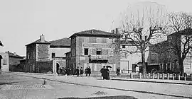 A view within Les Chères, at the beginning of the 20th century | |
.svg.png.webp) Coat of arms | |
Location of Les Chères | |
 Les Chères 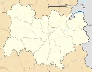 Les Chères | |
| Coordinates: 45°53′25″N 4°44′36″E / 45.8903°N 4.7433°E | |
| Country | France |
| Region | Auvergne-Rhône-Alpes |
| Department | Rhône |
| Arrondissement | Villefranche-sur-Saône |
| Canton | Anse |
| Intercommunality | CC Beaujolais Pierres Dorées |
| Government | |
| • Mayor (2020–2026) | Alix Adamo[1] |
| Area 1 | 5.46 km2 (2.11 sq mi) |
| Population | 1,506 |
| • Density | 280/km2 (710/sq mi) |
| Time zone | UTC+01:00 (CET) |
| • Summer (DST) | UTC+02:00 (CEST) |
| INSEE/Postal code | 69055 /69380 |
| Elevation | 176–212 m (577–696 ft) (avg. 210 m or 690 ft) |
| 1 French Land Register data, which excludes lakes, ponds, glaciers > 1 km2 (0.386 sq mi or 247 acres) and river estuaries. | |
Les Chères (French pronunciation: [le ʃɛʁ]) is a commune in the Rhône department in eastern France.
Demography
| Year | Pop. | ±% p.a. |
|---|---|---|
| 1968 | 617 | — |
| 1975 | 756 | +2.94% |
| 1982 | 814 | +1.06% |
| 1990 | 1,027 | +2.95% |
| 1999 | 1,073 | +0.49% |
| 2009 | 1,349 | +2.32% |
| 2014 | 1,446 | +1.40% |
| 2020 | 1,505 | +0.67% |
| Source: INSEE[3] | ||
See also
References
- ↑ "Répertoire national des élus: les maires" (in French). data.gouv.fr, Plateforme ouverte des données publiques françaises. 13 September 2022.
- ↑ "Populations légales 2021". The National Institute of Statistics and Economic Studies. 28 December 2023.
- ↑ Population en historique depuis 1968, INSEE
Wikimedia Commons has media related to Les Chères.
This article is issued from Wikipedia. The text is licensed under Creative Commons - Attribution - Sharealike. Additional terms may apply for the media files.